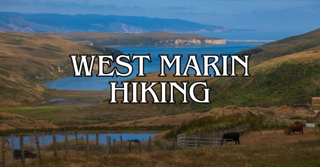
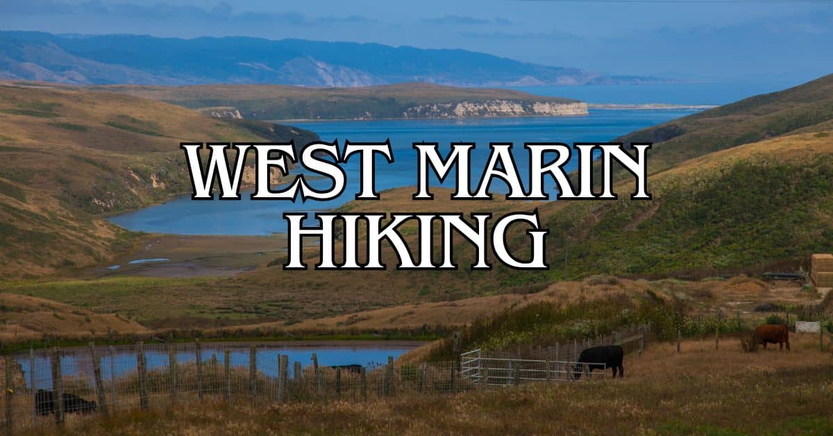
West Marin offers some of the most beautiful hiking trails in California. From coastal paths to mountain ridges, you’ll find a variety of landscapes to explore.
These trails showcase the area’s natural beauty and provide a great way to stay active outdoors.
Get a discount of 15% to 70% on accommodation in Marin County! Look for deals here:
Marin County Hotels, Apartments, B&Bs
The 5 best hiking trails in West Marin include Alamere Falls via Coast Trail, Tomales Point Trail, Bolinas Ridge Trail, Johnstone and Jepson Loop, and Perth Fire Road to Mount Vision. Each trail offers unique views and experiences, from waterfalls to wildlife sightings.
When planning your hike in West Marin, make sure to check trail conditions and bring plenty of water.
The weather can change quickly, so dress in layers.
Remember to respect nature and follow Leave No Trace principles to keep these trails beautiful for future hikers.
1. Alamere Falls Via Coast Trail From Palomarin Trailhead
The Alamere Falls trail offers a stunning coastal hike leading to a rare tidefall waterfall. You’ll experience breathtaking ocean views and diverse coastal landscapes along this popular Point Reyes National Seashore trail.
Difficulty
This hike is rated as moderate to strenuous. The trail has some challenging sections, including steep descents and uneven terrain.
You’ll need good physical fitness and hiking experience. Wear sturdy hiking boots for better traction on the varied surfaces.
The final descent to the falls is particularly steep and can be slippery. Use caution and consider your abilities before attempting this section.
Length And Estimated Time
The round-trip distance is 13.8 miles.
Plan for about 6-7 hours to complete the hike, including time to enjoy the falls and coastal views.
This allows for a comfortable pace and photo stops.
Start early in the day to ensure you have enough daylight to return safely.
The trail can take longer than expected, especially for less experienced hikers.
Key Features
Alamere Falls is the main attraction, a 40-foot waterfall that cascades directly onto the beach. You’ll enjoy:
- Stunning coastal vistas
- Varied landscapes including forests and bluffs
- Bass Lake and Pelican Lake along the way
- Diverse plant and wildlife
The trail offers constant ocean views, making it a photographer’s dream. Keep your camera ready for panoramic shots of the coastline.
Best Times To Visit
Spring and fall offer the best hiking conditions. Waterfalls are fullest in winter and early spring after rains. Summer can be foggy, especially in the mornings.
Weekdays are less crowded than weekends.
If visiting on a weekend, arrive very early to secure parking and enjoy a quieter trail experience.
Avoid hiking during or immediately after heavy rains, as the trail can become muddy and dangerous.
Parking
The Palomarin Trailhead has a small parking lot that fills up quickly, especially on weekends.
Arrive early to secure a spot. The lot is at the end of Mesa Road outside Bolinas.
If the lot is full, limited roadside parking may be available.
Be careful not to block the road or private driveways. Consider carpooling to reduce parking pressure.
Safety Tips
- Carry plenty of water and snacks. There’s no water available on the trail.
- Check tide tables before your hike. High tides can make the beach impassable.
- Stay on marked trails to protect yourself and the environment.
- Be aware of poison oak along the trail.
- Cliff edges can be unstable. Keep a safe distance from the edge.
- Cell phone coverage is limited. Let someone know your hiking plans.
Historical Notes
Alamere Falls is named after the Alamere family, early settlers in the area. The falls are one of only two tidefalls in California, making them a unique geological feature.
Point Reyes National Seashore was established in 1962 to protect the area’s natural and cultural resources. The Coastal Trail, which leads to Alamere Falls, is part of the larger California Coastal Trail system.
Amenities
Facilities at the trailhead are basic:
- Pit toilets
- Trash and recycling bins
- Information kiosk with trail maps
There are no facilities along the trail or at the falls. Pack out all your trash and be prepared with essentials like toilet paper and hand sanitizer.
Usage Information
Dogs are not allowed on this trail. The trail is for hikers only – no bikes or horses are permitted.
The trail can get very busy, especially on weekends and holidays. Practice good trail etiquette:
- Yield to uphill hikers
- Stay on the trail to prevent erosion
- Keep noise levels down to respect wildlife and other hikers
Trail Connections
The Coastal Trail connects to several other trails in Point Reyes National Seashore. You can extend your hike by connecting to:
- Wildcat Camp Trail
- Lake Ranch Trail
- Olema Valley Trail
These connections allow for longer backpacking trips or alternative routes. Check trail maps at the trailhead for more information on connections and distances.
2. Tomales Point Trail
The Tomales Point Trail offers stunning views of Tomales Bay and the Pacific Ocean. You’ll see Tule elk and diverse wildlife as you hike through coastal scrub and grasslands.
Difficulty
This trail is moderate. The terrain is mostly flat, but the length and exposure make it challenging. Sandy sections near the end can be tiring. Bring plenty of water and snacks.
Length And Estimated Time
The trail is 9.5 miles round trip. Plan for 4-6 hours to complete the hike, depending on your pace and stops for photos or wildlife viewing.
Key Features
Spectacular coastal views are the main draw. You’ll see Tomales Bay to the east and the Pacific Ocean to the west. Tule elk herds roam freely in the area. Spring brings colorful wildflowers.
The trail passes by the historic Pierce Point Ranch. At the end, you’ll reach dramatic cliffs overlooking the ocean.
Best Times To Visit
Spring and fall offer the best weather. Spring brings wildflowers and green hillsides. Fall is great for watching elk during rutting season.
Summer can be foggy but is still enjoyable. Winter can be wet and muddy, but offers clear days with amazing views.
Parking
A parking lot is at the trailhead near the old Pierce Point Ranch. It can fill up on weekends and holidays. Arrive early to secure a spot. There are no fees for parking.
Safety Tips
Bring plenty of water. There’s no water available on the trail.
Wear layers. The weather can change quickly.
Stay on the trail. Cliffs are unstable and dangerous.
Watch for poison oak along the trail edges.
Check the weather forecast before you go. Fog can roll in quickly.
Historical Notes
The trail passes by Pierce Point Ranch, which dates back to the 1850s. It was one of the most successful dairy ranches in the area.
Tule elk were reintroduced to the area in 1978. The herd has grown from 10 to over 400 animals.
Amenities
Restrooms are available at the trailhead parking lot.
There’s no water available on the trail. Bring all you need.
A small visitor center at Pierce Point Ranch offers info on the area’s history.
Usage Information
Dogs are not allowed on this trail.
The trail is for hikers only. No bikes or horses are permitted.
Trail Connections
This is an out-and-back trail with no direct connections to other trails.
For a longer hike, you can combine it with a visit to McClures Beach, accessed from a separate trailhead nearby.
3. Bolinas Ridge Trail
The Bolinas Ridge Trail offers breathtaking views of rolling hills and diverse landscapes. It’s a popular hike for both locals and visitors, with options for different skill levels and interests.
Difficulty
The trail is rated moderate. It has some gentle slopes and a few steeper sections. The terrain is mostly well-maintained fire roads and single-track paths. You’ll find some rocky areas and potentially muddy spots after rain.
Length And Estimated Time
The full trail is 11 miles (17.6 km) one-way. Most hikers do shorter out-and-back trips.
For the full length, plan for about 5.5 hours one-way or 11 hours round-trip. Shorter hikes of 2-4 miles are common and take 1-2 hours.
Key Features
Views are the main draw. You’ll see sweeping vistas of the Pacific Ocean, Tomales Bay, and Mount Tamalpais.
The trail passes through diverse ecosystems:
- Open grasslands
- Dense forests
- Oak woodlands
Wildlife sightings are common. Look for deer, hawks, and even bobcats. Wildflowers bloom in spring, adding vibrant colors to the landscape.
Best Times To Visit
Spring and fall offer the most pleasant weather. Spring brings wildflowers and lush green hills. Fall has clear skies and mild temperatures.
Summer can be hot and dry. Bring extra water and sun protection.
Winter has cooler temperatures and potential mud. It’s also when you’ll find the fewest crowds.
Parking
Parking is available at several trailheads:
- Sir Francis Drake Boulevard (northern end)
- Fairfax-Bolinas Road (southern end)
- Samuel P. Taylor State Park (mid-point access)
Spaces can fill up on weekends. Arrive early for the best spots.
Safety Tips
- Carry plenty of water, especially in summer
- Wear sturdy shoes with good traction
- Bring layers for changing weather
- Use sunscreen and a hat
- Watch for poison oak along the trail edges
- Be aware of your surroundings and wildlife
Historical Notes
The trail follows an old stagecoach route. It was used to transport goods between Bolinas and Olema in the late 1800s.
The area has a rich history of logging and dairy farming.
Amenities
Amenities are limited on the trail itself. You’ll find:
- Restrooms at the Samuel P. Taylor State Park trailhead
- No water sources along the trail
- Picnic areas at some trailheads
Pack everything you need for your hike.
Usage Information
The trail is multi-use. You’ll share it with:
- Hikers
- Mountain bikers
- Equestrians
Dogs are allowed on leash. Be respectful of other trail users and follow proper trail etiquette.
Trail Connections
Bolinas Ridge Trail connects to several other popular routes:
- Cross Marin Trail in Samuel P. Taylor State Park
- Olema Valley Trail
- Randall Trail
These connections allow for longer hikes or backpacking trips.
You can create loop options or point-to-point hikes with proper planning.
4. Johnstone And Jepson Loop
The Johnstone and Jepson Loop is a scenic trail in West Marin that offers hikers a mix of forest and coastal views. This loop takes you through diverse landscapes and provides access to several beaches.
Difficulty
The trail is rated as moderate. It has some elevation changes and uneven terrain.
You’ll encounter a few steep sections, but they’re short. Most hikers with average fitness can complete this loop without much trouble.
Wear sturdy shoes with good traction. The trail can be slippery when wet.
Bring water and snacks to keep your energy up.
Length And Estimated Time
The full loop is about 2.6 miles long. It usually takes 1.5 to 2 hours to complete. This includes time for short breaks and enjoying the views.
You can extend your hike by adding side trips to nearby beaches. This will increase your total distance and time.
Key Features
The trail winds through a lush forest of Bishop pines, bay trees, and oaks. You’ll see diverse plant life, including chaparral and coastal scrub.
The loop offers access to several beaches:
- Shell Beach
- Indian Beach
- Pebble Beach
These beaches are great spots for a picnic or to rest. You might see seabirds, seals, or even whales from the shore.
The trail provides stunning views of Tomales Bay and the surrounding hills. On clear days, you can see across to the Point Reyes Peninsula.
Best Times To Visit
Spring and fall are ideal for hiking this trail. The weather is mild and wildflowers bloom in spring.
Summer can be foggy, especially in the mornings. This adds a mystical atmosphere to the forest. The fog usually clears by afternoon.
Winter brings lush greenery and fewer crowds. But the trail can be muddy after rain.
Weekdays are less crowded than weekends. Early mornings offer the best chance for solitude.
Parking
Parking is available at the Heart’s Desire Beach parking lot. This lot can fill up quickly on weekends and holidays.
Arrive early to secure a spot, especially in summer. There’s no overnight parking allowed.
If the main lot is full, you might find parking along Pierce Point Road. But be careful not to block traffic or park in no-parking zones.
Safety Tips
- Stay on marked trails to protect yourself and the environment.
- Watch your step on steep or rocky sections.
- Bring layers as the weather can change quickly.
- Carry a map and compass or GPS device.
- Tell someone your hiking plans before you go.
- Be aware of poison oak along the trail edges.
- Check for ticks after your hike.
- Don’t approach or feed wildlife.
Historical Notes
The area has a rich Native American history. The Coast Miwok people lived here for thousands of years.
In the 1800s, the land was used for ranching and logging. The park was established in 1960 to protect the natural and cultural resources.
The trail names honor two important figures:
- Willis Linn Jepson, a famous California botanist
- John Johnstone, an early settler in the area
Amenities
There are no restrooms directly on the loop trail. But you can find facilities at nearby Heart’s Desire Beach.
Bring your own water as there are no water sources on the trail. Pack out all trash as there are no garbage cans along the route.
The nearby Bear Valley Visitor Center offers maps, exhibits, and ranger-led programs. It’s a great place to start your visit to the park.
Usage Information
The trail is open to hikers only. No bikes or horses are allowed.
Dogs are not permitted on this trail or any trails in Tomales Bay State Park.
The trail is usually busy on weekends. You’ll likely encounter other hikers, especially near the beaches.
Practice good trail etiquette:
- Yield to uphill hikers
- Keep noise levels down
- Stay on the trail to prevent erosion
Trail Connections
The Johnstone and Jepson Loop connects to other trails in Tomales Bay State Park.
You can extend your hike by taking the Johnstone Trail south to Shell Beach. This adds about 5.4 miles round trip to your hike.
The nearby Indian Beach Trail offers a short, accessible option for those wanting an easier walk.
For a longer adventure, you can connect to the Bolinas Ridge Trail. This trail offers views of both Tomales Bay and the Pacific Ocean.
5. Perth Fire Road – Mount Vision – Inverness Ridge
The Perth Fire Road – Mount Vision – Inverness Ridge trail offers a challenging hike with stunning views of the Point Reyes National Seashore. This loop trail takes you through diverse landscapes and provides a unique hiking experience.
Difficulty
The Perth Fire Road trail is rated as moderately challenging. You’ll encounter some steep sections and switchbacks as you climb to the summit of Mount Vision.
The trail surface varies, including paved and dirt sections. Be prepared for a good workout, especially on the uphill portions.
Length And Estimated Time
The trail is a 5.2-mile loop. Most hikers complete it in about 2 hours and 41 minutes.
Your actual time may vary based on your fitness level and how often you stop to enjoy the views or take photos.
Key Features
Perth Fire Road offers diverse scenery and unique geological features. The trail’s granite base rock gives it a Sierra-like feel, uncommon in Marin County.
As you climb, you’ll be rewarded with panoramic views of Tomales Bay, the Pacific Ocean, and surrounding hills.
Keep an eye out for local wildlife. The area is known for its bird populations, making it a popular spot for birdwatching.
Best Times To Visit
The trail is open year-round and can be enjoyed in any season. Spring brings wildflowers, while fall offers milder temperatures.
Summer can be foggy, especially in the mornings, but this can create a mystical atmosphere.
Early mornings or weekdays are best for avoiding crowds. If you’re looking for solitude, plan your hike during off-peak hours.
Parking
Parking is available near the trailhead in Inverness. Space can be limited, especially on weekends and holidays.
Arrive early to secure a spot. Be sure to check local parking regulations and any fees that may apply.
Safety Tips
- Bring plenty of water, as there are no water sources along the trail.
- Wear sturdy hiking boots with good traction for the varied terrain.
- Use sunscreen and wear a hat, as parts of the trail have limited shade.
- Check the weather forecast before you go, as conditions can change quickly.
- Carry a map or download a trail map to your phone, as some sections can be confusing.
Historical Notes
The Perth Fire Road gets its name from its original purpose as an access route for fire management. It has since been repurposed as a recreational trail, showcasing the area’s natural beauty while maintaining its practical origins.
Amenities
There are limited amenities on the trail itself. No restrooms or water fountains are available along the route.
The nearby town of Inverness offers some services, so plan accordingly before starting your hike.
Usage Information
The trail is popular for both hiking and birding. Mountain biking is also allowed, so be prepared to share the trail.
Dogs are not permitted on this trail due to its location within the Point Reyes National Seashore.
Trail Connections
From the summit of Mount Vision, you can connect to other trails in the Point Reyes National Seashore network.
The Inverness Ridge Trail offers an option to extend your hike if you’re looking for a longer adventure.
Wolf Ridge is nearby and provides another hiking opportunity with different views and terrain. Consider combining these trails for a full day of exploration in the area.
West Marin Local Regulations And Trail Etiquette
When hiking in West Marin, it’s important to follow local rules and show respect for nature.
Stay on marked trails to protect plants and wildlife. Don’t pick flowers or disturb animals.
Keep your dog on a leash if allowed. Some trails, like the Tomales Point Trail, don’t allow pets.
Always clean up after your dog.
Pack out all trash, including food scraps. This helps keep the area clean and prevents wildlife from getting used to human food.
Be quiet and courteous to other hikers. Let faster hikers pass you. When going downhill, yield to uphill hikers.
Park only in designated areas. Some popular trails like Alamere Falls have limited parking.
Respect private property. Many trails in West Marin cross through ranches. Stay on the trail and don’t disturb livestock.
Check trail conditions before you go. Some trails close seasonally or after heavy rain.
The Bolinas Ridge Trail can get muddy in wet weather.
Learn about the area’s history. Many trails in West Marin have rich pasts tied to Native American heritage and early California ranching.
Getting To West Marin
West Marin is a beautiful area with many ways to reach it.
You can drive, take public transit, or use a mix of both. Each option has its pros and cons.
By Car
Driving to West Marin gives you the most freedom.
From San Francisco, cross the Golden Gate Bridge and take Highway 101 north. Exit onto Sir Francis Drake Boulevard for places like Point Reyes. For Stinson Beach, take Highway 1.
The drive is scenic but can be winding.
Plan for about 1-2 hours from San Francisco, depending on your exact destination. Traffic can be heavy on weekends and holidays.
Keep an eye out for cyclists, as the roads are popular for biking.
Fill up your gas tank before entering West Marin, as stations are limited.
Public Transportation
Public transit to West Marin is limited but available.
The Marin Transit West Marin Stagecoach serves several areas. Route 61 goes to Point Reyes Station and Inverness. Route 68 serves Stinson Beach and Bolinas.
Buses run daily but less often on weekends. Check schedules in advance.
The trip takes longer than driving but is more eco-friendly.
From San Francisco, take a Golden Gate Transit bus to San Rafael. Then transfer to a West Marin Stagecoach. Bring exact change or a Clipper card for fares.
Parking Information
Parking in West Marin can be tricky, especially at popular spots like Stinson Beach.
Arrive early on weekends to secure a spot. Some areas have pay parking, so bring cash or a credit card.
For hiking, trailhead parking lots can fill up fast.
The Tomales Point Trail has a decent-sized lot, but it’s still best to arrive early.
Street parking is available in towns like Point Reyes Station. Be sure to follow posted signs and time limits. Some areas have permit-only parking for residents.
Consider carpooling to reduce parking pressure.
If a lot is full, don’t create your own spot. Instead, try a different trail or come back another time.
Preparing For Your Hike
Getting ready for a hike in West Marin takes some planning. You’ll need the right gear, an eye on the weather, and a good idea of your fitness level.
Let’s look at what you need to know before hitting the trails.
Essential Gear
Packing the right gear is key for a safe and fun hike. Here’s what you should bring:
- Comfortable hiking boots or shoes
- Layered clothing (it can get foggy and cool)
- Plenty of water (at least 1 liter per 2 hours of hiking)
- Snacks or a packed lunch
- Sunscreen and a hat
- First aid kit
- Map and compass (or GPS device)
- Flashlight or headlamp
Don’t forget a backpack to carry everything. A lightweight, comfortable pack will make your hike much more enjoyable.
Weather Considerations
West Marin’s weather can change quickly. Here’s what to keep in mind:
- Check the forecast before you go
- Expect fog, especially in the morning
- Bring layers you can add or remove
- Pack a light rain jacket, just in case
- Be ready for wind on coastal trails
The Tomales Point Trail can be extra foggy. Plan for limited visibility and cooler temps there.
Fitness Levels
Hiking in West Marin can be a great workout. Here’s how to match trails to your fitness:
- Beginners: Start with shorter, flatter trails
- Intermediate: Try longer trails with some elevation gain
- Advanced: Take on challenging hikes like Alamere Falls
Build up your stamina before tackling tougher trails.
Start with easier hikes and work your way up. Remember, it’s okay to turn back if a trail is too hard.
Listen to your body and take breaks when needed.
Bring more water and snacks than you think you’ll need. This will help you keep your energy up throughout the hike.
Wildlife And Plant Life In West Marin
West Marin is home to a rich variety of wildlife and plant species. You can spot many animals and plants on the area’s hiking trails.
Tule elk are a notable sight in West Marin. These majestic creatures roam freely in Point Reyes National Seashore. You might see them grazing in meadows or resting near water sources.
Coastal areas like Muir Beach offer chances to see marine life. Keep an eye out for seals, sea lions, and various seabirds along the shoreline.
Elephant seals are another exciting sight. You can often spot them at certain beaches in Point Reyes National Seashore during their breeding season.
Coyotes are common in West Marin. You might hear their howls or catch a glimpse of them in open grasslands or forested areas.
Plant life in West Marin is diverse. You’ll find:
- Coastal redwoods in Muir Woods
- Wildflowers blooming in spring at Abbotts Lagoon
- Various shrubs and grasses in coastal areas
Remember to respect wildlife and plants during your hikes.
Stay on marked trails and observe animals from a safe distance. This helps protect West Marin’s natural beauty for future visitors.
Photography Tips For West Marin
West Marin offers stunning photo opportunities for hikers. Here are some tips to capture its beauty:
Gear:
- Bring a lightweight camera or smartphone
- Pack a wide-angle lens for landscapes
- Use a tripod for steady sunset shots
Lighting:
- Golden hour (just after sunrise or before sunset) creates warm, soft light
- Overcast days are great for waterfalls and forests
Composition:
- Use the rule of thirds to frame spectacular views
- Include foreground elements like flowers or rocks for depth
- Look for natural leading lines on trails
Subjects:
- Capture coastal vistas on the Tomales Point Trail
- Photograph Alamere Falls on the Coast Trail
- Snap wildflowers on Bolinas Ridge in spring
Timing:
- Arrive early to beat crowds and catch morning mist
- Stay late for a chance at a dramatic sunset over the Pacific
Be mindful:
- Respect wildlife and keep a safe distance
- Stay on marked trails to protect habitats
- Ask permission before photographing people
Family-Friendly Options For Hiking West Marin
West Marin offers several hiking trails perfect for families with kids. These paths are easier and shorter, making them great for little legs.
The Bay Trail at Hamilton is a top pick for families. It’s flat and has nice views. You can walk or bike here with kids of all ages.
Another good choice is the Abbotts Lagoon trail. This 3.4-mile round trip hike has lots to see. You’ll pass wildflowers, marshes, and sand dunes. The trail ends with ocean views.
For a shorter walk, try the Tomales Point Trail. The first part is easy and flat. You might see elk and other wildlife.
Here are some tips for hiking with kids in West Marin:
- Bring plenty of water and snacks
- Wear sunscreen and hats
- Start early to avoid crowds
- Let kids set the pace
- Take frequent breaks
- Point out plants and animals along the way
Accessibility Information
West Marin’s hiking trails offer different levels of accessibility. Here’s what you need to know:
Wheelchair-friendly trails:
- Abbotts Lagoon Trail: The first 0.8 miles are wheelchair accessible
- Millerton Point Trail: A 1.2-mile loop with firm, level surfaces
Limited mobility options:
- Tomales Point Trail: The first mile is relatively flat and wide
- Bear Valley Trail: The initial 2 miles are well-maintained and mostly level
Trail difficulty:
- Easy: Millerton Point, Bear Valley (first section)
- Moderate: Abbotts Lagoon, Tomales Point
- Challenging: Alamere Falls, Bolinas Ridge
Parking:
- ADA-compliant spaces available at most trailheads
- Arrive early on weekends to secure spots
Facilities:
- Restrooms: Available at major trailheads
- Picnic areas: Present at Bear Valley and Tomales Point
Local Resources
West Marin offers many helpful resources for hikers. From visitor centers to emergency services, you’ll find support for your outdoor adventures. Here’s what you need to know:
Visitor Centers
The Bear Valley Visitor Center is a great starting point for your West Marin hiking trip. It’s open daily and provides:
• Trail maps and guides
• Park ranger advice
• Exhibits on local wildlife and ecology
• Restrooms and water fountains
The Point Reyes Lighthouse Visitor Center is another useful stop. It offers:
• Information on coastal trails
• Historical displays
• Whale watching tips (seasonal)
Both centers sell hiking gear and souvenirs. Stop by to get local insights and last-minute supplies.
Emergency Contacts
Safety is key when hiking. Keep these numbers handy:
• Park Emergency: 911
• Point Reyes National Seashore 24-hour Emergency: (415) 464-5170
• Marin County Sheriff: (415) 479-2311
Make sure your phone is charged before hitting the Tomales Point Trail. Cell service can be spotty in remote areas.
Useful Websites And Apps
Prepare for your hike with these digital tools:
• AllTrails: Find detailed trail info and user reviews for routes like the Alamere Falls trail.
• National Park Service website: Check trail conditions and closures.
• iNaturalist: Identify plants and animals you spot on the Bolinas Ridge Trail.
• Weather apps: Check local forecasts to plan your hike.
Download these before you go, as internet access may be limited in some areas of West Marin.
Get a discount of 15% to 70% on accommodation in Marin County! Look for deals here:
Marin County Hotels, Apartments, B&Bs
5 Best Hiking Trails in Angel Island State Park – Terrain, Difficulty, Accessibility, and Trail Features
5 Best Hiking Trails in Baltimore Canyon Preserve – Terrain, Difficulty, Accessibility, and Trail Features
5 Best Hiking Trails in Belvedere and Tiburon – Terrain, Difficulty, Accessibility, and Trail Features
5 Best Hiking Trails in Blithedale Summit Preserve – Terrain, Difficulty, Accessibility, and Trail Features
5 Best Hiking Trails in Cascade Canyon Preserve – Terrain, Difficulty, Accessibility, and Trail Features
5 Best Hiking Trails in China Camp State Park – Terrain, Difficulty, Accessibility, and Trail Features
5 Best Hiking Trails in Fairfax – Terrain, Difficulty, Accessibility, and Trail Features
5 Best Hiking Trails in Golden Gate National Recreation Area – Terrain, Difficulty, Accessibility, and Trail Features
5 Best Hiking Trails in Indian Tree Open Space Preserve – Terrain, Difficulty, Accessibility, and Trail Features
5 Best Hiking Trails in Kentfield, Greenbrae, and Ross – Terrain, Difficulty, Accessibility, and Trail Features
5 Best Hiking Trails in Larkspur and Corte Madera – Terrain, Difficulty, Accessibility, and Trail Features
5 Best Hiking Trails in Loma Alta Preserve – Terrain, Difficulty, Accessibility, and Trail Features
5 Best Hiking Trails in Marin Headlands – Terrain, Difficulty, Accessibility, and Trail Features
5 Best Hiking Trails in Mill Valley – Terrain, Difficulty, Accessibility, and Trail Features
5 Best Hiking Trails in Mount Burdell Preserve – Terrain, Difficulty, Accessibility, and Trail Features
5 Best Hiking Trails in Mount Tamalpais State Park – Terrain, Difficulty, Accessibility, and Trail Features
5 Best Hiking Trails in Muir Woods National Monument – Terrain, Difficulty, Accessibility, and Trail Features
5 Best Hiking Trails in Novato – Terrain, Difficulty, Accessibility, and Trail Features
5 Best Hiking Trails in Olompali State Historical Park – Terrain, Difficulty, Accessibility, and Trail Features
5 Best Hiking Trails in Point Reyes National Seashore – Terrain, Difficulty, Accessibility, and Trail Features
5 Best Hiking Trails in Samuel P. Taylor State Park – Terrain, Difficulty, Accessibility, and Trail Features
5 Best Hiking Trails in San Anselmo – Terrain, Difficulty, Accessibility, and Trail Features
5 Best Hiking Trails in San Rafael – Terrain, Difficulty, Accessibility, and Trail Features
5 Best Hiking Trails in Sausalito and Marin City – Terrain, Difficulty, Accessibility, and Trail Features
5 Best Hiking Trails in West Marin – Terrain, Difficulty, Accessibility, and Trail Features


