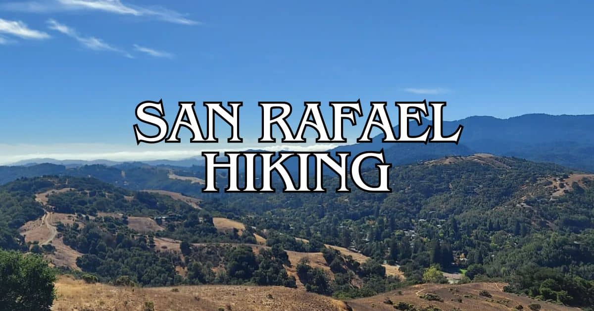
San Anselmo, a charming town in Marin County, California, offers amazing hiking trails for nature lovers. Just a short drive from San Francisco, this area boasts beautiful scenery and outdoor activities.
The town has five great hiking trails that range from easy walks to tough climbs.
Get a discount of 15% to 70% on accommodation in Marin County! Look for deals here:
Marin County Hotels, Apartments, B&Bs
These trails give you views of rolling hills, forests, and even Mount Tamalpais. You can spot local wildlife and enjoy fresh air on these paths.
Each trail has its own special features, from quiet forest walks to steep climbs with big views.
Whether you’re a beginner or an expert hiker, San Anselmo’s trails have something for you. Get ready to explore the natural beauty of this part of California on foot.
1. Sorich/Tomahawwk Trail To Sorich Park Trail Loop
The Sorich/Tomahawwk Trail to Sorich Park Trail Loop offers a mix of challenges and rewards. You’ll find steep climbs, ridge-top views, and a peaceful descent through varied terrain.
Difficulty
This trail is rated as moderately challenging. The initial climb is steep and narrow, which may test your endurance.
After that, the terrain levels out along a ridgeline fire road. The descent back to the parking area is gradual and easier to navigate.
Length And Estimated Time
The loop is about 2.1 miles long. Most hikers complete it in around 1 hour and 5 minutes.
Your pace may vary based on fitness level and how often you stop to enjoy the views or take photos.
Key Features
The trail boasts stunning panoramic views of the surrounding hills and valleys. In spring, you’ll see colorful wildflowers dotting the landscape.
The path winds through lush green hills, offering a mix of open spaces and shaded areas.
Look out for native plants and wildlife along the way. The diverse ecosystem supports a variety of bird species, making it a great spot for birdwatching.
Best Times To Visit
Spring is ideal for wildflower viewing. The hills are at their greenest from late winter to early spring.
Summer can be hot, so start early in the day. Fall offers mild temperatures and clear skies.
Avoid rainy days as the trail can become muddy and slippery.
Early mornings or late afternoons provide the best lighting for photography and cooler temperatures for hiking.
Parking
Parking is available at the end of San Francisco Boulevard. The lot is small, so arrive early on weekends or holidays to secure a spot.
There’s no fee for parking, but space is limited.
If the lot is full, you may find street parking nearby. Be respectful of residential areas and follow all posted signs.
Safety Tips
- Wear sturdy hiking shoes with good traction.
- Bring plenty of water, especially on hot days.
- Apply sunscreen and wear a hat, as parts of the trail have limited shade.
- Watch your footing on the steep and narrow sections.
- Be aware of poison oak along the trail edges.
- Check for ticks after your hike, particularly in spring and summer.
Historical Notes
Sorich Ranch Park, where this trail is located, was once part of a working ranch. The land was donated to the Town of San Anselmo in 1973 by the Sorich family. The park serves as a reminder of the area’s agricultural heritage.
The name “Tomahawwk” is unique to this trail and adds a bit of local character. Its origin isn’t well-documented, but it adds to the trail’s charm.
Amenities
There are no restrooms or water fountains on the trail. The closest facilities are in nearby San Anselmo.
A few benches along the route provide spots to rest and enjoy the views.
No trash cans are available on the trail, so be prepared to pack out all your waste. This helps keep the area clean and protects local wildlife.
Usage Information
The trail is popular for hiking and running. Dogs are allowed but must be kept on leash.
Mountain biking is not permitted on this particular loop. The narrow, steep sections make it unsuitable for bikes.
Trail Connections
This loop connects to other trails in Sorich Ranch Park. You can extend your hike by exploring these additional paths.
The Memorial Ridge Trail and Worn Springs Fire Road are nearby options for longer hikes.
Consider combining this loop with other trails in the area for a full day of hiking. Always check trail maps and your fitness level before attempting longer routes.
2. Worn Springs Fire Road To Yolanda Trail Loop
The Worn Springs Fire Road to Yolanda Trail Loop is a scenic hike near San Anselmo. It offers lush greenery, creek views, and a mix of sun and shade.
Difficulty
This trail is rated as moderately challenging. You’ll encounter some elevation changes and uneven terrain.
The path is well-maintained, but can be slippery after rain.
Wear sturdy hiking shoes with good traction. Bring trekking poles if you need extra balance on steeper sections.
Length And Estimated Time
The loop is 4.9 miles long. Most hikers complete it in about 2.5 to 3 hours.
Your pace may vary based on fitness level and how often you stop to enjoy the views.
Allow extra time if you plan to take photos or have a picnic along the way.
Key Features
The trail winds through a verdant forest with mossy trees and ferns. You’ll hike alongside Larkspur Creek for parts of the journey.
Look out for:
- Dense canopy of oak and bay trees
- Seasonal wildflowers in spring
- Small waterfalls after rainfall
- Creek crossings on wooden bridges
- Views of nearby hills and valleys
The mix of fire road and narrow trail adds variety to your hike.
Best Times To Visit
Spring is ideal for wildflowers and flowing creeks. Fall offers cooler temperatures and changing leaf colors.
Summer can be hot, so start early in the day. Winter brings lush greenery but can be muddy.
Weekdays are less crowded. If hiking on weekends, arrive early for a quieter experience.
Parking
The trailhead has a small parking lot that fills up quickly on weekends. Arrive early to secure a spot.
If the lot is full, limited street parking may be available nearby. Be respectful of residents and obey all parking signs.
Consider carpooling or using ride-share services to reduce parking demand.
Safety Tips
- Carry plenty of water, especially on hot days
- Watch for poison oak along the trail edges
- Be aware of mountain bikers sharing the trail
- Check weather forecasts before your hike
- Tell someone your hiking plans
- Bring a basic first aid kit
- Keep dogs on leash and clean up after them
- Stay on marked trails to avoid getting lost
Historical Notes
The fire road was originally built for wildfire management. It now serves as a popular recreational trail.
The area has a rich history of logging and watershed protection. Look for old-growth redwood stumps as you hike.
Amenities
There are no restrooms or water fountains on the trail. Use facilities before you start your hike.
Pack out all trash. Bring hand sanitizer for hygiene on the trail.
The nearest visitor center is at Sky Oaks Ranger Station, about 3 miles away.
Usage Information
The trail is popular for hiking, trail running, and mountain biking. Be prepared to share the path with others.
Dogs are allowed on leash. Bring waste bags and carry out pet waste.
The trail can be muddy after rain. Check conditions before you go.
Trail Connections
From this loop, you can connect to other trails in the area:
- Yolanda Trail extends further into the watershed
- Worn Springs Fire Road continues to other parts of the preserve
- Nearby trails lead to Phoenix Lake and Mount Tamalpais
Consider combining this loop with other trails for a longer adventure. Always check maps and your fitness level before extending your hike.
3. Bald Hill From Phoenix Lake
Bald Hill from Phoenix Lake is a popular hiking trail near San Anselmo. This trail offers stunning views, diverse terrain, and a good workout for hikers of various skill levels.
Difficulty
The trail is rated as moderately challenging. It has some steep sections and uneven terrain.
You’ll need a decent fitness level to enjoy this hike comfortably. Proper footwear is a must due to the gravel and potentially slippery parts of the trail.
Length And Estimated Time
The trail is about 4.1 miles long as an out-and-back route. Most hikers complete it in around 2 hours and 16 minutes.
Your pace may vary based on fitness level and how often you stop to rest or take in the views.
Key Features
Bald Hill offers panoramic views of the surrounding area. You’ll see:
- Mount Tamalpais
- San Francisco Bay
- Rolling hills of Marin County
The trail winds through oak woodlands and open grasslands. Spring brings colorful wildflowers.
Wildlife sightings might include deer, birds, and small mammals.
Best Times To Visit
The trail is open year-round. March through October are ideal months to visit.
Spring offers lush greenery and wildflowers. Fall provides cooler temperatures and clear skies.
Avoid rainy days as the trail can get muddy and slippery.
Early mornings or late afternoons are great for cooler temperatures and better lighting for photos.
Parking
Parking is available at Phoenix Lake. The lot can fill up quickly on weekends and holidays. Arrive early to secure a spot.
Overflow parking may be available on nearby streets, but check local signs for restrictions.
Safety Tips
- Bring plenty of water, especially on hot days
- Wear sturdy hiking shoes with good traction
- Use sunscreen and wear a hat – parts of the trail have little shade
- Watch for poison oak along the trail edges
- Be aware of your surroundings and wildlife
Historical Notes
Bald Hill has been a popular hiking spot for decades. The area was once used for grazing cattle. Today, it’s part of the Marin County Open Space District, preserving the natural beauty for future generations.
Amenities
Amenities are limited on the trail itself. At the Phoenix Lake trailhead, you’ll find:
- Restrooms
- Water fountains
- Information kiosks
There are no facilities at the top of Bald Hill, so plan accordingly.
Usage Information
The trail is multi-use, popular for:
- Hiking
- Mountain biking
- Trail running
- Bird watching
Dogs are allowed on leash. Be prepared to share the trail with others, especially on weekends. Yield to uphill traffic and be courteous to fellow trail users.
Trail Connections
Bald Hill connects to several other trails in the area:
- Yolanda Trail
- Worn Springs Fire Road
- Phoenix Lake Loop Trail
These connections allow for longer hikes or alternative routes. Check a trail map at the trailhead for more options and to plan your route.
4. Memorial Ridge, Cemetery, Ridgewood And Tomahawk Trail
This 3.3-mile loop trail near San Anselmo offers a mix of scenic views, historical sites, and natural beauty. You’ll find a moderately challenging hike with diverse terrain and minimal crowds.
Difficulty
The trail is rated as moderately challenging. It has some steep sections and uneven terrain. You’ll need a good level of fitness to tackle this hike.
Wear sturdy hiking boots for better traction on rocky parts. Bring water and snacks to keep your energy up during the trek.
Length And Estimated Time
The loop is 3.3 miles long. Most hikers complete it in about 1 hour and 35 minutes.
Your pace may vary based on fitness level and how often you stop to enjoy the views. Plan for extra time if you want to explore the cemetery or take photos.
Key Features
The trail offers a mix of open ridges and wooded areas. You’ll see:
- Panoramic views of Marin County
- Historic Mt. Tamalpais Cemetery
- Native California oak woodlands
- Diverse wildflowers in spring
The changing scenery keeps the hike interesting throughout. Bring a camera to capture the stunning vistas.
Best Times To Visit
The trail is open year-round. Each season has its charms:
- Spring: Wildflowers bloom and temperatures are mild
- Summer: Clear days offer the best views, but it can get hot
- Fall: Cooler temps and changing colors on deciduous trees
- Winter: Green hills after rain, but trails can be muddy
Early morning or late afternoon visits help you avoid the hottest parts of the day. Weekdays are less crowded than weekends.
Parking
Parking is limited near the trailhead. Arrive early on weekends to secure a spot. Options include:
- Street parking on San Francisco Boulevard
- Small lot at Sorich Ranch Park (if starting from that end)
Be respectful of local residents when parking on residential streets. Don’t block driveways or park in no-parking zones.
Safety Tips
- Carry plenty of water, especially on hot days
- Watch for poison oak along the trail edges
- Be aware of wildlife, including coyotes and rattlesnakes
- Tell someone your hiking plans before you go
- Bring a fully charged phone for emergencies
- Stay on marked trails to avoid getting lost
Historical Notes
The Memorial Ridge Trail was conceived in 2002 by Brian Crawford, a local volunteer. It connects several existing trails and passes through the historic Mt. Tamalpais Cemetery.
The cemetery, established in 1879, is the final resting place for many early Marin County settlers. Take time to explore the old gravestones and enjoy the peaceful atmosphere.
Amenities
This is a natural trail with few amenities. Plan accordingly:
- No restrooms along the trail
- No water fountains available
- Bring your own water and snacks
- Pack out all trash
The nearby Sorich Ranch Park has a restroom if needed before or after your hike.
Usage Information
The trail is popular for hiking and running. Here’s what you need to know:
- Dogs are allowed on leash
- No bikes or horses permitted
- Trail can be narrow in spots – yield to uphill hikers
- Be prepared to share the trail with other users
Remember to be courteous to other hikers and keep noise levels down to preserve the peaceful atmosphere.
Trail Connections
This loop connects several trails in the area:
- Memorial Ridge Trail
- Cemetery Trail
- Ridgewood Trail
- Tomahawk Trail
You can extend your hike by connecting to:
- Sorich Ranch Park trails
- Terra Linda/Sleepy Hollow Divide trails
These connections allow for longer hikes or alternate routes back to your starting point.
5. Mount Tam Via Collier Trail
Mount Tam via Collier Trail offers a challenging and scenic hike near San Anselmo. This trail provides stunning views, diverse landscapes, and a rewarding experience for hikers.
Difficulty
The Mount Tam via Collier Trail is considered challenging. It has steep sections and rough terrain. You’ll need good fitness and hiking experience. Proper footwear and hiking poles can help.
The trail has some exposed areas. Be ready for sun and wind. Bring plenty of water and snacks. Take breaks as needed.
Length And Estimated Time
The trail is 11.8 miles long. It’s a loop, so you’ll end up back where you started. Most hikers take about 6 hours and 22 minutes to finish.
Plan for a full day hike. Start early to have enough time. Allow extra time if you want to rest or take photos.
Key Features
Mount Tam via Collier Trail offers diverse scenery. You’ll see:
- Lush forests
- Open grasslands
- Rocky outcrops
- Panoramic views of the Bay Area
The trail climbs to high points with sweeping vistas. You might spot local wildlife like birds and deer.
Best Times To Visit
Spring and fall are ideal for this hike. Wildflowers bloom in spring. Fall brings cooler temperatures and clear skies.
Summer can be hot and dry. Winter may have muddy trails. Check weather forecasts before you go.
Weekdays are less crowded. Early mornings offer cooler temperatures and better chances to see wildlife.
Parking
There’s a parking fee at Mount Tamalpais Watershed. You can buy passes online or at the trailhead. Arrive early on weekends as parking fills up fast.
The main parking area has limited spaces. Have a backup plan if it’s full. Carpool if possible to reduce parking pressure.
Safety Tips
- Carry plenty of water. There’s limited shade on parts of the trail.
- Use sun protection. Bring sunscreen, a hat, and sunglasses.
- Watch for poison oak along the trail edges.
- Be aware of wildlife. Don’t approach or feed animals.
- Tell someone your hiking plans before you go.
- Bring a map or download the trail map to your phone.
- Check trail conditions before starting your hike.
Historical Notes
Mount Tamalpais has been a popular hiking destination for over a century. The Miwok people lived in this area for thousands of years before European settlement.
The trail system was expanded in the early 1900s. Many trails, including parts of the Collier Trail, were built by the Civilian Conservation Corps in the 1930s.
Amenities
There are few amenities directly on the trail. You’ll find:
- Restrooms at the trailhead
- Water fountains at some points (but don’t rely on these)
- Picnic areas near the parking lot
Bring everything you need for the hike. There are no shops or facilities along the trail itself.
Usage Information
The trail is open to hikers only. No bikes or horses are allowed. Dogs are not permitted on this trail.
The trail can get busy on weekends and holidays. You’ll still find quiet spots for solitude.
Practice Leave No Trace principles. Pack out all trash. Stay on marked trails to protect plant life.
Trail Connections
Mount Tam via Collier Trail connects to other paths in the area. You can link to:
- Cataract Trail
- Matt Davis Trail
- Steep Ravine Trail
San Anselmo Local Regulations And Trail Etiquette
When hiking in San Anselmo, it’s important to follow local rules and be respectful of nature and other trail users. Here are some key guidelines to keep in mind:
Stay on designated trails: This helps protect plants and prevents erosion.
Don’t create new paths or take shortcuts.
Leash your dogs: Keep pets on a leash and clean up after them. This applies to popular trails like the Sorich/Tomahawwk Trail.
Yield to others: Hikers going uphill have the right of way. Bikers should yield to hikers on shared trails.
Pack it in, pack it out: Take all your trash with you, including food scraps. Leave no trace of your visit.
Respect wildlife: Observe animals from a distance and don’t feed them. This is especially important on trails like Bald Hill.
No fires or smoking: Fire danger is high in this area. Smoking and open flames are not allowed on trails.
Stay quiet: Keep noise levels down to respect wildlife and other hikers. This is particularly important on peaceful routes like the Worn Springs Fire Road.
Be prepared: Bring water, snacks, and appropriate gear. Check weather conditions before you go.
Getting To San Anselmo
San Anselmo is easy to reach by car or public transit. You’ll find plenty of parking options in town for your hiking adventure.
By Car
You can drive to San Anselmo via several main roads.
From San Francisco, take Highway 101 north and exit at Sir Francis Drake Boulevard. Head west for about 5 miles to reach San Anselmo.
If coming from the East Bay, cross the Richmond-San Rafael Bridge and follow I-580 west to Highway 101 north.
The drive from San Francisco takes about 30 minutes without traffic. From Oakland, expect a 45-minute trip.
Always check traffic reports before setting out, as Bay Area roads can get busy.
Keep an eye out for cyclists, as San Anselmo is popular for road biking. Drive carefully on the winding roads near town.
Public Transportation
You have a few public transit options to reach San Anselmo.
Golden Gate Transit runs bus service from San Francisco and other parts of Marin County. Take Route 27 from San Francisco to San Anselmo. The trip takes about an hour.
From the East Bay, take BART to El Cerrito del Norte station. Then catch the Golden Gate Transit Route 40 bus to San Rafael Transit Center. Transfer to Route 23 to reach San Anselmo.
Marin Transit also offers local bus service within Marin County. Routes 22, 23, and 68 serve San Anselmo.
Parking Information
San Anselmo has both street parking and public lots. Most street parking is free but time-limited. Check posted signs for restrictions.
The main public parking lot is at Creek Park on Center Boulevard. It offers 3-hour free parking.
For all-day parking, use the lot at 535 San Anselmo Avenue.
When hiking, some trailheads have small parking areas. The Sorich Park Trail has a dedicated lot.
For other trails, you may need to park on nearby streets. Always park legally and be mindful of residents.
Preparing For Your Hike
Getting ready for a hike in San Anselmo takes some planning. You’ll need the right gear, weather know-how, and fitness level for the trails.
Essential Gear
When hiking in San Anselmo, pack these items:
- Sturdy hiking boots or trail runners
- Breathable, moisture-wicking clothes
- Sun protection (hat, sunscreen, sunglasses)
- Water bottle or hydration pack
- Snacks and energy bars
- First aid kit
- Map and compass (or GPS device)
- Headlamp or flashlight
- Multi-tool or knife
- Emergency whistle
Don’t forget a backpack to carry everything. Choose one that fits well and has enough space for your gear.
For longer hikes on trails like the Mount Tam via Collier Trail, bring extra water and food.
Weather Considerations
San Anselmo’s weather can change quickly. Check the forecast before you go. Here’s what to expect:
- Summer: Hot and dry. Bring extra water and sun protection.
- Fall: Mild temperatures. Perfect for hiking.
- Winter: Cool and wet. Pack rain gear and warm layers.
- Spring: Unpredictable. Be ready for both sun and rain.
Fog can roll in fast on trails near the coast. Bring a light jacket even on warm days.
For hikes like Bald Hill from Phoenix Lake, watch for slippery conditions after rain.
Fitness Levels
San Anselmo trails suit different fitness levels. Pick a trail that matches your ability:
- Beginners: Try the Sorich/Tomahawwk Trail to Sorich Park Trail Loop. It’s short and has gentle slopes.
- Intermediate: The Worn Springs Fire Road to Yolanda Trail Loop offers a good workout with some steep sections.
- Advanced: Take on Mount Tam via Collier Trail for a challenging climb and stunning views.
Start with easier trails if you’re new to hiking. Build up your stamina before trying harder routes.
Always listen to your body and turn back if you feel tired or unwell.
Wildlife And Plant Life In San Anselmo
San Anselmo’s hiking trails offer a diverse array of wildlife and plant life. You’ll find a rich ecosystem teeming with native species as you explore the area.
Common animals you might spot include black-tailed deer, coyotes, and raccoons. Keep an eye out for birds like hawks, woodpeckers, and owls soaring above or perched in trees.
The plant life is equally varied.
Oak woodlands dominate many trails, with coast live oaks and California bay laurels providing shade.
In spring, you’ll see colorful wildflowers dotting the landscape.
Poison oak is common in the area. Learn to identify its “leaves of three” to avoid skin irritation.
Stick to marked trails to protect sensitive plant habitats.
During your hike, you might encounter:
- Mammals: Squirrels, rabbits, foxes
- Reptiles: Western fence lizards, gopher snakes
- Plants: Manzanita, madrone, California poppies
Remember to observe wildlife from a distance and never feed animals. This helps maintain the natural balance of San Anselmo’s ecosystems.
Photography Tips For San Anselmo
San Anselmo offers beautiful scenery for photographers. Here are some tips to capture the best shots:
- Golden Hour: Take photos during early morning or late afternoon for soft, warm lighting.
- Gear: Bring a wide-angle lens for landscape shots and a macro lens for close-ups of plants and wildlife.
- Mount Tamalpais provides stunning views. Hike up for sunrise or sunset photos.
- Tripod: Use one for steady shots, especially in low light conditions.
- Seasonal Beauty:
- Spring: Capture wildflowers in bloom
- Fall: Focus on colorful foliage
- Winter: Look for misty mornings
- Water Features: Use slow shutter speeds to create silky effects on streams and waterfalls.
- Wildlife: Bring a telephoto lens for birds and animals. Be patient and quiet.
- Composition: Use the rule of thirds to frame your shots. Include foreground elements for depth.
- Local Spots: Phoenix Lake offers great reflections. Try different angles.
- Weather: Overcast days can be perfect for even lighting in forest shots.
Family-Friendly Options For Hiking San Anselmo
San Anselmo offers great hiking options for families with kids. These trails are easy to moderate, making them perfect for little legs.
The Sorich/Tomahawk Trail to Sorich Park Trail Loop is a top pick for families. This short loop is about 1 mile long.
It has nice views and is not too steep.
Another good choice is the Worn Springs Fire Road. This trail connects to the Yolanda Trail Loop.
The path is wide and mostly flat, great for strollers or young kids.
For a bit more challenge, try the Bald Hill trail. It’s steeper but offers amazing views at the top.
Pack a picnic to enjoy while taking in the scenery.
When hiking with kids, bring plenty of water and snacks. Start early to avoid the heat.
Wear good shoes and sun protection.
Remember to stay on marked trails and respect wildlife. Teaching kids about nature can make the hike more fun and educational.
San Anselmo’s family-friendly trails let you enjoy nature close to home.
They’re perfect for short outings or longer adventures, depending on your family’s energy level.
Accessibility Information
Hiking trails in San Anselmo have different levels of accessibility. Here’s what you need to know:
Trail Difficulty:
- Sorich/Tomahawwk Trail to Sorich Park Trail Loop: Moderate
- Worn Springs Fire Road to Yolanda Trail Loop: Moderate
- Bald Hill from Phoenix Lake: Hard
- Memorial Ridge, Cemetary, Ridgewood and Tomahawk Trail: Moderate
- Mount Tam via Collier Trail: Hard
Terrain: Trails vary from well-maintained fire roads to narrow, steep paths. Some have uneven surfaces and rocky sections.
Facilities: Most trailheads have parking areas. Restrooms are available at some locations, like Sorich Park.
Accessibility Features:
- Wide, flat sections on fire roads are more wheelchair-friendly
- Some trails have benches for resting
- Clear signage at most trailheads and major junctions
Tips for Accessible Hiking:
- Check trail conditions before you go
- Bring a hiking buddy for safety
- Use trekking poles for extra stability
- Wear sturdy shoes with good traction
Local Resources
San Anselmo offers helpful resources for hikers. You’ll find visitor centers, emergency contacts, and useful websites to plan your trips safely.
Visitor Centers
The Marin County Visitor Center is a great place to start your hiking adventure.
It’s located in San Rafael, about 10 minutes from San Anselmo. Here you can get maps, trail guides, and local advice.
Staff can tell you about trail conditions and wildlife sightings. They also offer free ranger-led hikes on weekends.
The center has displays about local plants and animals. You can learn about the area’s history and ecology before hitting the trails.
Emergency Contacts
Keep these numbers handy when hiking in San Anselmo:
- Emergency: 911
- Marin County Sheriff: (415) 473-7250
- Marin County Fire: (415) 473-6717
- Marin County Search and Rescue: (415) 473-7283
Park rangers patrol popular trails. If you need help, look for their vehicles or contact the visitor center.
Always tell someone where you’re going and when you’ll be back. Cell service can be spotty in some areas, so bring a charged phone and backup battery.
Useful Websites And Apps
AllTrails is a top resource for San Anselmo hikers. It offers detailed info on popular routes like the Sorich/Tomahawk Trail Loop and Worn Springs Fire Road.
The Marin County Parks website has updates on trail closures and conditions. You can also find info on park hours and rules.
Weather apps like Weather Underground give accurate local forecasts. This is key for planning safe hikes, especially in winter.
For transportation, use the Marin Transit app to find bus routes to trailheads. Some popular spots like Mount Tam have limited parking, so public transit can be helpful.
Get a discount of 15% to 70% on accommodation in Marin County! Look for deals here:
Marin County Hotels, Apartments, B&Bs
5 Best Hiking Trails in Angel Island State Park – Terrain, Difficulty, Accessibility, and Trail Features
5 Best Hiking Trails in Baltimore Canyon Preserve – Terrain, Difficulty, Accessibility, and Trail Features
5 Best Hiking Trails in Belvedere and Tiburon – Terrain, Difficulty, Accessibility, and Trail Features
5 Best Hiking Trails in Blithedale Summit Preserve – Terrain, Difficulty, Accessibility, and Trail Features
5 Best Hiking Trails in Cascade Canyon Preserve – Terrain, Difficulty, Accessibility, and Trail Features
5 Best Hiking Trails in China Camp State Park – Terrain, Difficulty, Accessibility, and Trail Features
5 Best Hiking Trails in Fairfax – Terrain, Difficulty, Accessibility, and Trail Features
5 Best Hiking Trails in Golden Gate National Recreation Area – Terrain, Difficulty, Accessibility, and Trail Features
5 Best Hiking Trails in Indian Tree Open Space Preserve – Terrain, Difficulty, Accessibility, and Trail Features
5 Best Hiking Trails in Kentfield, Greenbrae, and Ross – Terrain, Difficulty, Accessibility, and Trail Features
5 Best Hiking Trails in Larkspur and Corte Madera – Terrain, Difficulty, Accessibility, and Trail Features
5 Best Hiking Trails in Loma Alta Preserve – Terrain, Difficulty, Accessibility, and Trail Features
5 Best Hiking Trails in Marin Headlands – Terrain, Difficulty, Accessibility, and Trail Features
5 Best Hiking Trails in Mill Valley – Terrain, Difficulty, Accessibility, and Trail Features
5 Best Hiking Trails in Mount Burdell Preserve – Terrain, Difficulty, Accessibility, and Trail Features
5 Best Hiking Trails in Mount Tamalpais State Park – Terrain, Difficulty, Accessibility, and Trail Features
5 Best Hiking Trails in Muir Woods National Monument – Terrain, Difficulty, Accessibility, and Trail Features
5 Best Hiking Trails in Novato – Terrain, Difficulty, Accessibility, and Trail Features
5 Best Hiking Trails in Olompali State Historical Park – Terrain, Difficulty, Accessibility, and Trail Features
5 Best Hiking Trails in Point Reyes National Seashore – Terrain, Difficulty, Accessibility, and Trail Features
5 Best Hiking Trails in Samuel P. Taylor State Park – Terrain, Difficulty, Accessibility, and Trail Features
5 Best Hiking Trails in San Anselmo – Terrain, Difficulty, Accessibility, and Trail Features
5 Best Hiking Trails in San Rafael – Terrain, Difficulty, Accessibility, and Trail Features
5 Best Hiking Trails in Sausalito and Marin City – Terrain, Difficulty, Accessibility, and Trail Features
5 Best Hiking Trails in West Marin – Terrain, Difficulty, Accessibility, and Trail Features


