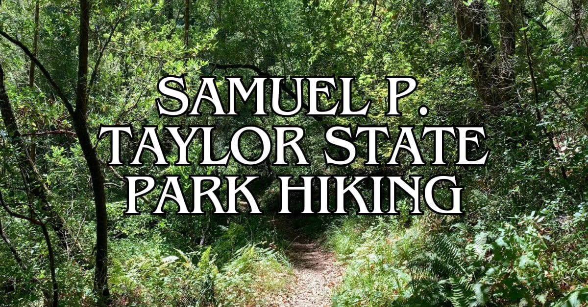
Samuel P. Taylor State Park is a hidden gem in Marin County, California. It’s a great spot for hikers who want to enjoy redwood forests and beautiful views. The park has many trails for different skill levels.
The five best hiking trails in Samuel P. Taylor State Park offer a mix of easy walks and tough climbs. You can find shady paths under tall trees and steep trails that lead to amazing views. Each trail has its own special features to discover.
Get a discount of 15% to 70% on accommodation in Marin County! Look for deals here:
Marin County Hotels, Apartments, B&Bs
When you visit, you’ll see why this park is so loved. From peaceful creeks to sunny hilltops, there’s something for everyone.
Get ready to explore the best that Samuel P. Taylor State Park has to offer on foot.
1. Pioneer Tree Trail
The Pioneer Tree Trail offers a pleasant loop through Samuel P. Taylor State Park’s oldest trees. This trail showcases the park’s natural beauty and historical significance.
Difficulty
The Pioneer Tree Trail is easy to moderate.
Its gentle terrain makes it suitable for hikers of all skill levels. You’ll find a few small hills, but nothing too challenging.
The trail surface is mostly dirt and well-maintained. Some sections have exposed roots, so watch your step.
Wear sturdy shoes for comfort and safety.
Length And Estimated Time
The trail is about 2.7 miles long.
It typically takes 1-2 hours to complete, depending on your pace and how often you stop.
Allow extra time if you want to take photos or enjoy the scenery.
The loop design lets you choose your own adventure. You can do a shorter hike if needed.
Key Features
Old-growth redwoods are the main attraction. You’ll see some of the park’s oldest and largest trees. The Pioneer Tree, a massive redwood, is the trail’s centerpiece.
The trail winds through a lush forest. You’ll cross small streams and see diverse plant life. Look out for ferns, moss, and wildflowers in spring.
Wildlife sightings are common. Keep an eye out for deer, birds, and small mammals.
The peaceful forest setting offers a break from the busy world.
Best Times To Visit
Spring and fall are ideal for hiking this trail. The weather is mild, and the forest is at its most vibrant. Wildflowers bloom in spring, adding color to the green landscape.
Summer can be warm, but the redwood canopy provides shade. Winter brings cooler temperatures and possible rain. The trail can be muddy after rainfall.
Weekday mornings are usually quieter. You’ll have more of the trail to yourself. Weekends can be busier, especially during summer.
Parking
Parking is available at the day-use area near the park entrance. The lot is paved and has space for about 30 cars. It fills up quickly on weekends and holidays.
Arrive early to secure a spot, especially during peak seasons. If the main lot is full, there’s overflow parking along the park road.
A small fee is required for day use. Annual passes are available if you plan to visit often.
Safety Tips
Stay on marked trails to protect yourself and the environment.
Bring water and snacks, even for this short hike. The forest can be cool, so dress in layers.
Tell someone your plans before you go. Cell service is limited in the park. Carry a map and know your route.
Watch for poison oak along the trail edges. Learn to identify it before your hike.
Be aware of wildlife and keep a safe distance.
Historical Notes
The Pioneer Tree Trail showcases the park’s logging history. Samuel P. Taylor, the park’s namesake, started a paper mill here in the 1850s.
Look for old-growth redwoods that survived logging. These giants tell the story of the forest’s past. The Pioneer Tree itself is thought to be over 500 years old.
Interpretive signs along the trail share more about the area’s history. Take time to read them and connect with the park’s rich background.
Amenities
Restrooms are available at the day-use area near the trailhead.
There’s also a picnic area with tables and grills. It’s a great spot for a post-hike meal.
The park has a visitor center with exhibits and information. It’s worth a stop before or after your hike.
Water fountains are available to refill your bottles.
There are no amenities along the trail itself. Plan accordingly and carry what you need.
Usage Information
The trail is open to hikers only. Bikes and horses are not allowed on this particular path.
Dogs are not permitted on the Pioneer Tree Trail to protect the ecosystem.
The trail can get busy on weekends and holidays. Go early or on weekdays for a quieter experience. Always yield to uphill hikers and groups.
Practice Leave No Trace principles. Pack out all trash and stay on the trail to minimize impact.
Trail Connections
The Pioneer Tree Trail connects to other paths in the park. You can extend your hike by linking to the Barnabe Fire Road or the Cross Marin Trail.
For a longer adventure, consider combining this trail with the nearby Bill’s Trail to Mount Barnabe Peak Loop. This adds more mileage and elevation gain.
The Cross Marin Trail offers a flatter option if you want to explore more of the park. It follows an old railroad grade along Lagunitas Creek.
2. Bill’s Trail To Mount Barnabe Peak Loop
Bill’s Trail to Mount Barnabe Peak Loop offers a challenging hike with stunning views. This trail takes you through diverse landscapes and up to the summit of Mount Barnabe.
Difficulty
This trail is rated as moderate to difficult.
The steep climb to Barnabe Peak can be tough for some hikers. You’ll gain about 1,341 feet in elevation.
The trail has many switchbacks. These make the climb easier but still require good fitness. Wear sturdy hiking boots for better traction.
Length And Estimated Time
The loop is 6 miles long. Most hikers finish in 3-4 hours.
Plan for extra time if you want to enjoy the views or take breaks. The trail is well-marked, making it easy to follow.
Key Features
Bill’s Trail offers a mix of shaded forest and open grasslands. You’ll cross several bridges over small streams.
The highlight is the panoramic view from Barnabe Peak. On clear days, you can see the Pacific Ocean and San Francisco Bay.
Look out for diverse plant life, including redwoods and madrones. Wildflowers bloom in spring, adding color to the trail.
Best Times To Visit
Spring and fall are ideal for this hike. Temperatures are mild and the scenery is at its best.
In spring, wildflowers cover the hillsides. Fall brings golden grasses and clearer skies for better views.
Summer can be hot on exposed sections. Winter may have muddy trails after rain. Check the weather forecast before you go.
Parking
Parking is available at the Samuel P. Taylor State Park main lot. There’s a fee to park here.
Arrive early on weekends as the lot can fill up quickly. Overflow parking is sometimes available along the road.
Always lock your car and don’t leave valuables visible.
Safety Tips
Bring plenty of water, especially on hot days. There’s little shade on some parts of the trail.
Watch for poison oak along the trail edges. Wear long pants to avoid contact.
Be prepared for sudden weather changes. Fog can roll in quickly, reducing visibility.
Stay on the marked trail to avoid getting lost. Let someone know your hiking plans before you start.
Historical Notes
Bill’s Trail is named after Bill Grippi, a long-time park employee. He helped design and build many of the park’s trails.
Mount Barnabe got its name from Samuel P. Taylor’s favorite mule. Taylor was a pioneer who started the first paper mill on the West Coast in this area.
The fire lookout tower on Barnabe Peak was built in the 1930s. It still helps spot wildfires today.
Amenities
There are restrooms and water fountains at the trailhead parking lot. No facilities are available on the trail itself.
The park’s visitor center is near the parking area. Here you can get maps and trail information.
Picnic tables are available near the trailhead. They’re perfect for a post-hike meal.
Usage Information
Dogs are not allowed on this trail. Keep pets at home for this hike.
The trail is open to hikers only. No bikes or horses are permitted.
The trail can get busy on weekends. Start early for a quieter experience.
Trail Connections
From Barnabe Peak, you can connect to the Barnabe Fire Road. This leads to other parts of the park.
The Cross Marin Trail intersects with Bill’s Trail near the start. It offers an easy, flat option if you want a shorter walk.
For a longer hike, you can combine Bill’s Trail with the Gravesite Trail. This makes a challenging full-day adventure.
3. Cross Marin Trail
The Cross Marin Trail offers a peaceful, shaded path through Samuel P. Taylor State Park. This scenic route follows an old railroad grade, providing an easy walk or bike ride along Lagunitas Creek.
Difficulty
The Cross Marin Trail is rated as easy.
Its flat, wide path makes it suitable for hikers of all skill levels. The trail’s gentle grade and smooth surface allow for a comfortable walk or leisurely bike ride.
Length And Estimated Time
The trail spans 3.9 miles out-and-back.
You can expect to complete the hike in about 1 hour and 15 minutes at a moderate pace. The flat terrain allows for quicker progress compared to more challenging trails in the park.
Key Features
The trail runs alongside Lagunitas Creek, offering pleasant water views. Tall redwoods provide shade and a serene atmosphere. You’ll find several picnic spots and benches along the way.
Wildlife sightings are common. Keep an eye out for birds, deer, and if you’re lucky, you might spot a coho salmon in the creek during spawning season.
Best Times To Visit
The Cross Marin Trail is enjoyable year-round due to its shaded nature.
Spring brings lush greenery and wildflowers. Summer offers cool refuge under the redwoods.
Fall showcases changing colors. Winter can be serene but watch for muddy patches after rain.
Early mornings or late afternoons are ideal for avoiding crowds and enjoying cooler temperatures.
Parking
Parking is available at the Leo T. Cronin Fish Viewing Area.
This lot is free but limited to 1-hour stays. For longer visits, use the main park entrance parking areas.
On weekends and holidays, arrive early to secure a spot.
Safety Tips
- Stay on the marked trail to protect the environment and avoid getting lost.
- Bring water, even though the trail is short and shaded.
- Watch for bikes, as this is a multi-use trail.
- Be aware of poison oak along the trail edges.
- Check for ticks after your hike, especially in spring and early summer.
Historical Notes
The Cross Marin Trail follows the former Northwestern Pacific Railroad route.
This railway once connected Marin County to Sonoma County, transporting lumber and passengers. The trail’s flat grade is a remnant of its railroad past.
Amenities
You’ll find:
- Portable toilets at the Leo T. Cronin Fish Viewing Area
- Restrooms at Irving Group Picnic Area, about 1 mile into the hike
- Picnic tables scattered along the trail
- Informational signs about local flora and fauna
Usage Information
The Cross Marin Trail is multi-use, open to:
- Hikers
- Bikers
- Horseback riders
- Leashed dogs
Be courteous to other trail users. Yield to horses and uphill traffic. Keep right and pass on the left when biking.
Trail Connections
The Cross Marin Trail connects to several other paths in Samuel P. Taylor State Park:
- It joins the Barnabe Peak Loop for a more challenging hike
- You can access the Pioneer Tree Trail for a redwood forest experience
- The trail extends beyond the park boundaries, offering longer route options
Consider combining this trail with others for a full day of exploring the park’s diverse landscapes.
4. Bolinas Ridge Loop
The Bolinas Ridge Loop offers a mix of scenic views and diverse landscapes. This trail takes you through redwood groves, open grasslands, and along a ridge with panoramic vistas.
Difficulty
The Bolinas Ridge Loop is rated as moderate. It has some steep sections and uneven terrain.
The trail can be challenging for beginners but is manageable for most hikers with average fitness levels.
Proper footwear is essential due to the varied terrain. Hiking boots or sturdy walking shoes with good traction are recommended.
Length And Estimated Time
The loop is about 10.5 miles long. Most hikers complete it in 4-6 hours.
Plan for a full day hike, allowing time for breaks and enjoying the views.
Factors like fitness level and time spent taking photos or resting will affect your total hiking time. It’s wise to start early in the day to ensure you finish before dark.
Key Features
The trail offers a mix of landscapes and stunning views:
- Open grasslands with grazing cattle
- Dense redwood and bay laurel forests
- Panoramic views of Tomales Bay and the Pacific Ocean
- Historic markers and informational boards
The diverse ecosystems you’ll pass through make this hike unique. You’ll see coastal redwoods, meadows full of wildflowers in spring, and possibly spot local wildlife.
Best Times To Visit
Spring and fall are ideal for hiking the Bolinas Ridge Loop.
In spring, wildflowers bloom in the meadows. Fall brings crisp air and clear skies, perfect for long-distance views.
Summer can be hot on exposed ridge sections. Winter may have muddy trails and occasional trail closures due to rain.
Always check weather forecasts before your hike. Fog can roll in quickly, affecting visibility and temperature.
Parking
Parking is available at the Samuel P. Taylor State Park campground.
The lot can fill up on weekends and holidays, so arrive early.
There’s a day-use fee for parking. Bring cash or a credit card for the self-pay station.
Consider carpooling to reduce parking pressure and environmental impact.
Safety Tips
- Carry plenty of water. There are limited water sources on the trail.
- Wear sunscreen and a hat. Many sections are exposed with little shade.
- Be aware of poison oak along the trail edges.
- Watch for mountain bikers, especially on blind corners.
- Carry a map and compass. Cell service can be spotty in some areas.
- Be prepared for sudden weather changes. Bring layers, including a waterproof jacket.
Historical Notes
The trail passes through areas with a rich history. You’ll see remnants of old logging operations and ranching activities.
Samuel P. Taylor State Park, where the trail starts, was once home to a paper mill in the 1800s. Look for informational signs along the trail that explain the area’s history.
The ridge itself has been used for grazing cattle for over a century, a practice that continues today.
Amenities
- Restrooms are available at the Samuel P. Taylor State Park campground.
- There are picnic areas near the trailhead.
- No water fountains along the trail. Fill up at the campground before starting.
- The park has a small visitor center with maps and information.
Bring all necessary supplies with you. There are no stores or facilities once you’re on the trail.
Usage Information
The Bolinas Ridge Loop is a multi-use trail:
- Hikers, mountain bikers, and equestrians share the trail.
- Dogs are allowed on leash in some sections but prohibited in others. Check current park rules.
- The trail can get busy on weekends. For a quieter experience, try hiking on weekdays.
Be courteous to other trail users. Yield to horses and uphill travelers.
Trail Connections
The Bolinas Ridge Loop connects to several other trails:
- Cross Marin Trail: A paved path along Sir Francis Drake Boulevard
- Shafter Grade: Leads to more backcountry trails
- Barnabe Peak Trail: Offers a challenging side trip with great views
These connections allow for longer hikes or backpacking trips. Always check trail conditions and get proper permits for overnight stays.
5. Kent Lake Via San Geronimo Ridge And Peters Dam Road
The Kent Lake via San Geronimo Ridge and Peters Dam Road trail offers a scenic journey through diverse landscapes. You’ll enjoy views of Kent Lake, dense forests, and open grasslands in the San Geronimo Valley.
Difficulty
This trail is rated as moderately challenging. It has some steep sections and uneven terrain.
You’ll need a decent fitness level to complete the hike comfortably. Sturdy hiking shoes are recommended due to rocky areas along the path.
Length And Estimated Time
The trail forms a 3.6-mile loop. Most hikers complete it in about 1 hour and 55 minutes.
Your pace may vary based on fitness level and how often you stop to enjoy the views or take photos.
Key Features
Kent Lake is the main attraction of this hike. You’ll get great views of the lake from several points along the trail.
The path winds through a mix of environments:
- Dense forests with towering trees
- Open grasslands on San Geronimo Ridge
- Rocky outcrops offering panoramic vistas
- Wildflower meadows (seasonal)
Look out for local wildlife like deer, birds, and small mammals.
Best Times To Visit
Spring and fall are ideal seasons for this hike.
In spring, you’ll see wildflowers and lush greenery. Fall brings cooler temperatures and beautiful foliage colors.
Summer can be hot, so start early if hiking then. Winter hikes are possible but may be muddy after rain. Always check weather forecasts before you go.
Parking
Parking is available at the Leo T. Cronin Fish Viewing Area.
This small lot is the trailhead for several hikes in the area. It can fill up on weekends, so arrive early to secure a spot. There are portable toilets near the parking area.
Safety Tips
- Carry plenty of water, especially on hot days
- Wear sunscreen and a hat for sun protection
- Stay on marked trails to avoid poison oak
- Be aware of your surroundings – mountain lions are rare but present in the area
- Tell someone your hiking plans before you go
- Bring a basic first aid kit
Historical Notes
The San Geronimo Valley has a rich history.
Native American tribes, including the Coast Miwok, lived in this area for thousands of years.
In the 1800s, the valley became part of Mexican land grants. Later, it was used for logging and ranching.
Kent Lake was created in 1953 when Peters Dam was built. The lake serves as a water supply for Marin County.
Amenities
- Portable toilets at the trailhead
- No drinking water available on the trail – bring your own
- Benches at some viewpoints for resting
- No visitor center at this trailhead
Pack out all trash as there are no garbage cans along the trail.
Usage Information
This trail is popular for hiking and trail running.
Mountain biking is not allowed on this specific route. Dogs are not permitted on the trail to protect the watershed area.
The trail is usually quiet, especially on weekdays. You may encounter more hikers on weekends and holidays.
Trail Connections
From this trail, you can connect to other paths in the area:
- South Creek Trail offers an easier, flatter option
- San Geronimo Ridge Road extends further for longer hikes
- Peters Dam Road provides access to other parts of the watershed
These connections allow you to create longer routes or explore more of the Mount Tamalpais Watershed area.
Samuel P. Taylor State Park Local Regulations And Trail Etiquette
Samuel P. Taylor State Park has rules to keep everyone safe and protect nature. You need to follow these when you visit.
Dogs are welcome in the park, but they must be on a leash. Keep your furry friends close on trails and in picnic areas.
Camping is allowed only in designated spots. The Camp Taylor area has sites for tents and RVs. You can also stay in the Madrone cabins for a cozy night in the woods.
Fires are only allowed in fire pits at campsites and picnic areas. Always check current fire rules, as they may change based on weather.
Stay on marked trails to protect plants and prevent erosion. This includes popular paths like the Pioneer Tree Trail and Devil’s Gulch Trail.
Bikes are allowed on fire roads and some trails. The Cross Marin Trail is great for cycling.
Be quiet and respectful of others. Many people come to enjoy nature’s peace.
Pack out all trash. Leave no trace of your visit to keep the park clean for everyone.
Watch for poison oak on trails. It’s common in the area, so learn to spot it.
Respect wildlife by keeping your distance. Don’t feed animals or disturb their homes.
Getting To Samuel P. Taylor State Park
Samuel P. Taylor State Park is easy to reach. You have several options for getting there, including driving or taking public transit. Here’s what you need to know about traveling to this beautiful park in West Marin.
By Car
Driving is the most flexible way to reach Samuel P. Taylor State Park. The park is about 30 miles northwest of San Francisco. Take Highway 101 north to the Sir Francis Drake Boulevard exit in Larkspur.
Follow Sir Francis Drake Boulevard west for about 20 miles. You’ll pass through several small towns. The park entrance will be on your right, clearly marked with signs.
The drive takes about an hour from San Francisco, depending on traffic. It’s a scenic route that winds through forests and hills.
Public Transportation
If you don’t have a car, you can still get to Samuel P. Taylor State Park using public transit. Take the Golden Gate Transit bus route 68 from San Francisco to San Rafael Transit Center.
From there, transfer to Marin Transit route 68 towards Inverness. Get off at the Samuel P. Taylor State Park stop. The total trip takes about 2 hours.
Buses run daily, but service is limited on weekends. Check the schedule in advance and plan your trip carefully.
Parking Information
Samuel P. Taylor State Park has several parking areas. The main lot is near the entrance and picnic area. It can fill up quickly on busy weekends.
There’s additional parking along Sir Francis Drake Boulevard. Be sure to park fully off the road to avoid getting a ticket.
If you’re planning to hike the Pioneer Tree Trail, there’s a small lot at the trailhead. For the Cross Marin Trail, you can park at the Camp Taylor area.
A day use fee is required for parking. You can pay at the entrance kiosk or use the self-pay station if it’s unmanned.
Preparing For Your Hike
Getting ready for a hike in Samuel P. Taylor State Park takes planning. Pack the right gear, check the weather, and know your fitness level. These steps will help you enjoy your time on the trails safely.
Essential Gear
Bring these items for a safe and enjoyable hike:
- Sturdy hiking boots or shoes
- Backpack
- Water bottles or hydration system
- Snacks and lunch for longer hikes
- First aid kit
- Sunscreen and hat
- Insect repellent
- Map and compass (or GPS device)
- Flashlight or headlamp
- Whistle for emergencies
- Layers of clothing
Don’t forget a camera to capture the beautiful redwood forests and scenic views. Pack extra socks to keep your feet dry and comfy. A multi-tool can be handy for small repairs.
Weather Considerations
Samuel P. Taylor State Park’s weather can change quickly. Check the forecast before you go.
In summer, expect warm days and cool nights. Bring layers you can add or remove. Fog often rolls in, so pack a light jacket.
Winter brings rain. Waterproof gear is a must. Trails can get muddy and slippery. Wear shoes with good traction.
Spring and fall offer mild temps. These seasons are great for hiking. But still bring layers for changing conditions.
Always carry rain gear, just in case. The weather in the park can surprise you.
Fitness Levels
The park has trails for all fitness levels. Know your limits before choosing a hike.
For beginners, try the Pioneer Tree Trail. It’s an easy 2.1-mile loop with little elevation gain.
Moderate hikers might enjoy the Cross Marin Trail. It’s mostly flat and follows Lagunitas Creek.
For a challenge, tackle the Bill’s Trail to Mount Barnabe Peak Loop. This 6-mile trail has steep sections.
Start with shorter hikes if you’re new to hiking. Build up your stamina before trying longer trails.
Drink plenty of water and take breaks as needed. Listen to your body and turn back if you feel tired.
Wildlife And Plant Life In Samuel P. Taylor State Park
Samuel P. Taylor State Park is home to a rich variety of wildlife and plants. You’ll find a diverse ecosystem as you explore the park’s trails.
The park’s forests are dominated by towering coast redwoods. These ancient trees provide habitat for many animals. Douglas fir and bay laurel trees are also common in the park.
As you hike, keep an eye out for:
- Mammals: Black-tailed deer, raccoons, squirrels
- Birds: Woodpeckers, owls, hawks
- Reptiles: Garter snakes, lizards
The park’s streams, like Devil’s Gulch, support a variety of aquatic life. You might spot fish or salamanders in the clear waters.
Wildflowers bloom in spring, adding color to the forest floor. Look for trillium, wild iris, and California poppies.
Near Stairstep Falls, you’ll find lush ferns and mosses thriving in the moist environment. The wooded countryside offers a mix of open meadows and dense forests.
Remember to respect wildlife by observing from a distance. Don’t feed animals or disturb plants. Stay on marked trails to protect the delicate ecosystem.
Photography Tips For Samuel P. Taylor State Park
Samuel P. Taylor State Park offers many photo-worthy scenes. Here are some tips to help you capture its beauty:
- Bring the right gear:
- Wide-angle lens for landscapes
- Macro lens for wildflowers and small details
- Tripod for steady shots in low light
- Best times to shoot:
- Early morning for soft light and misty scenes
- Golden hour before sunset for warm colors
- Overcast days for even lighting in the redwoods
- Viewpoints to consider:
- Barnabe Peak for panoramic vistas
- Creekside for water and forest shots
- Meadows for wildflower close-ups
- Protect your gear:
- Use a rain cover in misty conditions
- Bring a lens cloth to wipe off moisture
- Capture the details:
- Focus on tree bark textures
- Look for interesting fungi and plants
- Frame shots with overhanging branches
- Be respectful:
- Stay on marked trails
- Don’t disturb wildlife or plants
- Ask permission before photographing people
Family-Friendly Options For Hiking Samuel P. Taylor State Park
Samuel P. Taylor State Park offers great trails for families with kids.
You’ll find easy walks and fun adventures for all ages.
The Pioneer Tree Trail is perfect for families.
It’s a short 2.1-mile loop with only 190 feet of elevation gain. Kids love seeing the big redwood trees along the way.
For a longer hike, try the Cross Marin Trail.
It’s flat and wide, making it easy for strollers or young bikers. You can enjoy views of Lagunitas Creek as you walk.
The park has nice picnic areas too.
You can take a break and have lunch surrounded by nature. Restrooms are available near the main parking areas.
Keep an eye out for wildlife on your hike.
You might see deer, birds, or even fish in the creek. Bring binoculars for a closer look.
Remember to stay on marked trails and don’t climb on fallen trees.
This helps protect the park’s plants and animals. Bring water and snacks for your family hike.
Wear good shoes and dress in layers.
The weather can change quickly in the park. Don’t forget sunscreen and hats to protect from the sun.
Before you go, check the park’s website for current trail conditions.
Some trails might be closed after rainy weather.
Accessibility Information
Samuel P. Taylor State Park offers some accessible options for visitors with mobility challenges.
The park has made efforts to include everyone in its natural beauty.
Handicapped-accessible parking, bathrooms, and showers are available at the Creekside and Orchard Hill campground loops. This makes overnight stays more comfortable for all visitors.
The Cross Marin Trail is a good option for those seeking an easier path.
It’s mostly flat and paved, making it suitable for wheelchairs and strollers.
You’ll find picnic areas with accessible tables near the campgrounds.
These spots let you enjoy outdoor meals with ease.
For the most up-to-date accessibility info, it’s best to contact the park directly before your visit.
They can provide details on current trail conditions and available accommodations.
Remember to bring any necessary equipment or mobility aids.
The park’s terrain can be challenging in some areas, so plan accordingly for a safe and enjoyable experience.
Local Resources
Samuel P. Taylor State Park offers helpful resources for hikers.
You’ll find visitor centers, emergency contacts, and useful websites to plan your trip.
Visitor Centers
The main visitor center is located near the park entrance. It’s open daily from 9 AM to 5 PM. Here you can:
- Get trail maps and park brochures
- Talk to rangers about current conditions
- Learn about local wildlife and plants
- Buy souvenirs and snacks
A smaller information kiosk is near the campground.
It has basic info and is open on weekends during busy seasons.
Emergency Contacts
Keep these numbers handy when hiking:
- Park Rangers: 415-488-9897 (non-emergency)
- 911 for true emergencies
- Marin County Sheriff: 415-473-7233
Cell service can be spotty in the park.
Tell someone your plans before heading out. Consider bringing a satellite messenger for remote areas.
Useful Websites And Apps
Plan your visit with these resources:
- AllTrails for detailed trail info and user reviews
- California State Parks website for official updates
- Marin Transit for bus routes to the park
- Weather apps to check forecasts
- iNaturalist to identify plants and animals
Download offline maps before your trip.
The Cross Marin Trail is great for beginners.
For a challenge, try the Bill’s Trail to Mount Barnabe Peak Loop.
Get a discount of 15% to 70% on accommodation in Marin County! Look for deals here:
Marin County Hotels, Apartments, B&Bs
5 Best Hiking Trails in Angel Island State Park – Terrain, Difficulty, Accessibility, and Trail Features
5 Best Hiking Trails in Baltimore Canyon Preserve – Terrain, Difficulty, Accessibility, and Trail Features
5 Best Hiking Trails in Belvedere and Tiburon – Terrain, Difficulty, Accessibility, and Trail Features
5 Best Hiking Trails in Blithedale Summit Preserve – Terrain, Difficulty, Accessibility, and Trail Features
5 Best Hiking Trails in Cascade Canyon Preserve – Terrain, Difficulty, Accessibility, and Trail Features
5 Best Hiking Trails in China Camp State Park – Terrain, Difficulty, Accessibility, and Trail Features
5 Best Hiking Trails in Fairfax – Terrain, Difficulty, Accessibility, and Trail Features
5 Best Hiking Trails in Golden Gate National Recreation Area – Terrain, Difficulty, Accessibility, and Trail Features
5 Best Hiking Trails in Indian Tree Open Space Preserve – Terrain, Difficulty, Accessibility, and Trail Features
5 Best Hiking Trails in Kentfield, Greenbrae, and Ross – Terrain, Difficulty, Accessibility, and Trail Features
5 Best Hiking Trails in Larkspur and Corte Madera – Terrain, Difficulty, Accessibility, and Trail Features
5 Best Hiking Trails in Loma Alta Preserve – Terrain, Difficulty, Accessibility, and Trail Features
5 Best Hiking Trails in Marin Headlands – Terrain, Difficulty, Accessibility, and Trail Features
5 Best Hiking Trails in Mill Valley – Terrain, Difficulty, Accessibility, and Trail Features
5 Best Hiking Trails in Mount Burdell Preserve – Terrain, Difficulty, Accessibility, and Trail Features
5 Best Hiking Trails in Mount Tamalpais State Park – Terrain, Difficulty, Accessibility, and Trail Features
5 Best Hiking Trails in Muir Woods National Monument – Terrain, Difficulty, Accessibility, and Trail Features
5 Best Hiking Trails in Novato – Terrain, Difficulty, Accessibility, and Trail Features
5 Best Hiking Trails in Olompali State Historical Park – Terrain, Difficulty, Accessibility, and Trail Features
5 Best Hiking Trails in Point Reyes National Seashore – Terrain, Difficulty, Accessibility, and Trail Features
5 Best Hiking Trails in Samuel P. Taylor State Park – Terrain, Difficulty, Accessibility, and Trail Features
5 Best Hiking Trails in San Anselmo – Terrain, Difficulty, Accessibility, and Trail Features
5 Best Hiking Trails in San Rafael – Terrain, Difficulty, Accessibility, and Trail Features
5 Best Hiking Trails in Sausalito and Marin City – Terrain, Difficulty, Accessibility, and Trail Features
5 Best Hiking Trails in West Marin – Terrain, Difficulty, Accessibility, and Trail Features


