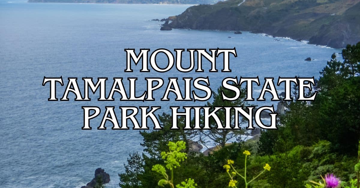
Mount Tamalpais State Park is a hidden gem in Marin County, California. This beautiful park offers stunning views of the Bay Area and diverse landscapes.
From lush redwood forests to golden grasslands, Mount Tam has something for every nature lover.
Get a discount of 15% to 70% on accommodation in Marin County! Look for deals here:
Marin County Hotels, Apartments, B&Bs
The park boasts over 50 miles of hiking trails, ranging from easy walks to challenging climbs.
Whether you’re a beginner or an experienced hiker, you’ll find a trail that suits your skill level. Some trails even offer glimpses of the Golden Gate Bridge and San Francisco Bay on clear days.
Mount Tam is known for its unique ecosystem. The park’s fog-influenced climate supports a wide variety of plant and animal life.
As you hike, you might spot wildflowers, oak trees, and even wildlife like deer or birds.
With so much to see and explore, Mount Tamalpais State Park is a must-visit destination for outdoor enthusiasts.
1. Steep Ravine, Dipsea And Matt Davis Loop From Pantoll Campground
The Steep Ravine, Dipsea and Matt Davis Loop offers a diverse hiking experience with redwood forests, ocean views, and challenging terrain. This popular trail combines three iconic paths in Mount Tamalpais State Park.
Difficulty
This loop is rated as moderately challenging.
The trail features steep sections, particularly along Steep Ravine.
You’ll encounter stairs, ladders, and some rocky terrain. The climb can be strenuous, but the views make it worthwhile.
Proper footwear is essential. Hiking boots with good traction will help you navigate the varied terrain.
Length And Estimated Time
The loop is approximately 7.5 miles long. Most hikers complete it in 3-4 hours.
Your pace may vary depending on fitness level and how often you stop to enjoy the scenery.
Allow extra time if you plan to take photos or have a picnic along the way.
Key Features
The trail offers a mix of landscapes and stunning vistas. You’ll pass through:
- Towering redwood groves
- Fern-lined canyons
- Open grasslands with coastal views
- A series of waterfalls (seasonal)
The Matt Davis Trail provides sweeping views of Stinson Beach and the Pacific Ocean. Steep Ravine features a 10-foot ladder you’ll climb alongside a waterfall.
Wildlife sightings are common. Keep an eye out for deer, rabbits, and various bird species.
Best Times To Visit
Spring and fall offer the most comfortable hiking conditions. Wildflowers bloom in spring, while fall brings clear skies and crisp air.
Summer can be foggy, especially in the mornings. The fog often clears by afternoon, revealing spectacular views.
Winter brings lush greenery and flowing streams, but trails can be muddy and slippery.
Parking
Parking is available at Pantoll Campground. The lot fills up quickly on weekends and holidays.
Arrive early to secure a spot. If the lot is full, limited roadside parking is available along Panoramic Highway.
A parking fee is required. Bring cash or a credit card for the self-pay station.
Safety Tips
- Carry plenty of water. There are no reliable water sources on the trail.
- Wear layers. Weather can change quickly, especially near the coast.
- Use sun protection. Parts of the trail are exposed.
- Watch your footing on steep and potentially slippery sections.
- Poison oak is common. Learn to identify and avoid it.
- Cell phone coverage can be spotty. Download a trail map before you start.
Historical Notes
The Dipsea Trail is home to the annual Dipsea Race, America’s oldest trail running event. It began in 1905 and continues to challenge runners today.
Steep Ravine was once part of a private ranch. The trail and surrounding land were acquired by California State Parks in 1960.
The Matt Davis Trail is named after a local trail builder who helped establish many paths in the area during the early 20th century.
Amenities
Pantoll Campground offers:
- Restrooms
- Picnic tables
- A ranger station with trail maps and information
There are no facilities along the trail itself. Plan accordingly and pack out all trash.
Usage Information
The trail is popular among hikers and trail runners. Mountain biking is not allowed on this loop.
Dogs are not permitted on the Steep Ravine portion of the trail. They are allowed on leash on the Dipsea and Matt Davis sections.
The trail can get crowded on weekends. Start early for a quieter experience.
Trail Connections
This loop connects to several other trails in Mount Tamalpais State Park:
- The Dipsea Trail continues to Muir Woods National Monument.
- The Matt Davis Trail leads to Stinson Beach.
- At Pantoll, you can access the Old Mine Trail and other routes exploring Mt. Tam.
Consider extending your hike if time and energy allow. The park offers numerous options for longer adventures.
2. Dipsea Trail, Steep Ravine Trail, And Matt Davis Loop
This scenic loop combines three iconic trails in Mount Tamalpais State Park. You’ll experience diverse landscapes, from redwood forests to coastal views, making it a must-do hike for nature lovers.
Difficulty
The Dipsea Trail, Steep Ravine Trail, and Matt Davis Loop is rated as moderate to hard. You’ll face steep climbs and descents, especially on the Steep Ravine Trail. The Matt Davis Trail has many switchbacks, which can be challenging for some hikers.
Prepare for a workout, but know that the views and diverse scenery make it worth the effort.
Length And Estimated Time
The loop is about 7 miles long. You can expect to spend 3-5 hours completing the hike, depending on your pace and how often you stop to enjoy the views.
Plan for extra time if you want to take breaks or capture photos of the stunning landscapes.
Key Features
- Ocean views from the Dipsea Trail
- Lush redwood forest along Steep Ravine Trail
- A wooden ladder on Steep Ravine Trail
- Panoramic coastal vistas from Matt Davis Trail
- Webb Creek and small waterfalls (seasonal)
You’ll climb through a mix of ecosystems, from shady redwood groves to sun-drenched coastal scrub.
Best Times To Visit
Spring and fall offer the most comfortable hiking conditions. Wildflowers bloom in spring, while fall brings clear skies and mild temperatures.
Summer can be foggy, especially in the mornings. Winter hikes are possible but can be muddy and slippery after rain.
Parking
Park at the Pantoll Ranger Station or Stinson Beach. Pantoll has limited spots but offers easy access to the loop. Stinson Beach has more parking but adds distance to your hike.
Arrive early on weekends and holidays to secure a spot. Consider carpooling during peak times.
Safety Tips
- Bring plenty of water and snacks
- Wear sturdy hiking shoes with good traction
- Check the weather forecast before you go
- Be prepared for sudden changes in temperature and fog
- Carry a map or download a trail app for navigation
- Tell someone your hiking plans before you start
Stay alert on steep sections and near cliff edges, especially in wet conditions.
Historical Notes
The Dipsea Trail is home to the famous Dipsea Race, the oldest trail race in America. It started in 1905 and continues to challenge runners annually.
The Matt Davis Trail was built in the 1920s by Matt Davis, a local settler and trail builder.
Amenities
- Restrooms at Pantoll Ranger Station and Stinson Beach
- Water fountain along the Dipsea Trail
- Picnic areas at Pantoll and Stinson Beach
- Visitor information center at Pantoll Ranger Station
Bring your own water and snacks for the trail, as there are no facilities between the start and end points.
Usage Information
- Dogs are not allowed on the Steep Ravine Trail
- Bikes are prohibited on most of the loop
- The trail is popular on weekends, so start early for a quieter experience
- Some sections are shared with mountain bikers, so stay alert
Be respectful of other trail users and yield to uphill hikers.
Trail Connections
This loop connects to several other trails in Mount Tamalpais State Park. You can extend your hike by adding:
- Muir Woods National Monument via the Dipsea Trail
- Pantoll to East Peak for summit views
- Coastal Trail for more ocean vistas
Consider these options if you want a longer adventure or to explore more of the park.
3. Dipsea To Steep Ravine Loop From Pantoll Campground
The Dipsea to Steep Ravine Loop from Pantoll Campground offers a stunning mix of coastal views and lush forest scenery. This trail takes you through some of Mount Tamalpais State Park’s most beautiful areas.
Difficulty
This loop is rated as moderately challenging.
The trail has some steep sections and uneven terrain. You’ll encounter stairs, roots, and rocks along the way.
Hiking boots with good traction are recommended. The trail can be slippery when wet, so take extra care after rain.
Length And Estimated Time
The loop is 3.7 miles long. Most hikers complete it in about 2 hours and 5 minutes.
Your hiking speed may vary based on fitness level and how often you stop for breaks or photos.
Plan for extra time if you want to enjoy the views or explore side trails.
Key Features
The trail offers a diverse range of scenery:
- Panoramic ocean views
- Redwood groves
- Fern-lined paths
- Webb Creek with small waterfalls
- Wooden ladders in the Steep Ravine section
You’ll start at Pantoll Station and descend through the forest. The Steep Ravine Trail follows Webb Creek, offering a cool, shaded hike. The Dipsea Trail portion provides sweeping coastal views.
Best Times To Visit
Spring and fall are ideal for this hike.
Wildflowers bloom in spring, while fall brings crisp air and clear skies.
Summer can be foggy, especially in the mornings.
Winter offers lush greenery but can be rainy and muddy.
Check the weather forecast before you go.
Expect temperatures around 64°F with mostly cloudy conditions on November 5, 2024.
Parking
Parking is available at the Pantoll Ranger Station.
The lot can fill up quickly on weekends and holidays. Arrive early to secure a spot.
If the main lot is full, there’s overflow parking along Panoramic Highway.
Always park legally and be mindful of no-parking zones.
Safety Tips
- Carry plenty of water, especially on warm days
- Wear layers as temperatures can vary in different parts of the trail
- Use sunscreen and a hat for exposed sections
- Watch your footing on steep and potentially slippery areas
- Bring a map or download the trail route to your phone
- Let someone know your hiking plans before you start
Historical Notes
The Dipsea Trail is famous for hosting the Dipsea Race, America’s oldest trail race. It started in 1905 and continues annually.
Steep Ravine was once home to cabins built in the 1940s.
Today, a few renovated cabins are available for overnight stays through the state park system.
Amenities
Pantoll Ranger Station offers:
- Restrooms
- Water fountains
- Trail maps
- First aid station
There are no facilities along the trail itself. Plan accordingly and carry what you need.
Usage Information
- Dogs are not allowed on this trail
- The trail is popular for hiking and running
- Mountain bikes are not permitted on the Steep Ravine portion
- You may encounter other hikers, especially on weekends
Trail Connections
This loop connects to several other trails:
- Matt Davis Trail
- Old Mine Trail
- Heather Cutoff Trail
You can extend your hike by combining these trails. The Steep Ravine, Dipsea and Matt Davis Loop offers a longer option if you want to explore more.
4. Fern Creek, Lost, And Canopy Trail Loop
The Fern Creek, Lost, and Canopy Trail Loop offers a stunning journey through diverse landscapes in Mount Tamalpais State Park. You’ll experience lush fern-covered slopes, towering redwoods, and panoramic views of the surrounding area.
Difficulty
This loop trail is rated as moderate.
You’ll encounter some steep sections and uneven terrain. The trail includes both uphill and downhill portions, requiring a good level of fitness.
Proper hiking shoes are a must for navigating rocky areas and potentially slippery surfaces.
Length And Estimated Time
The loop spans approximately 5 miles.
Most hikers complete the trail in 2-3 hours.
Your pace may vary based on fitness level and how often you stop to enjoy the views or take photos.
It’s wise to allow extra time if you’re new to hiking or want to fully explore the area.
Key Features
You’ll be treated to a variety of natural wonders on this trail:
- Towering redwood groves
- Lush fern-covered hillsides
- Scenic creek crossings
- Panoramic views of the surrounding hills
- Diverse flora and fauna
The trail winds through Muir Woods National Monument and Mount Tamalpais State Park, offering a mix of ecosystems.
Keep an eye out for wildflowers in spring and colorful foliage in fall.
Best Times To Visit
The trail is accessible year-round, but each season offers a unique experience:
- Spring: Wildflowers bloom and creeks flow strongly
- Summer: Warm weather, but fog can roll in
- Fall: Pleasant temperatures and fall colors
- Winter: Lush green landscapes, but potential for muddy trails
Weekdays and early mornings are less crowded.
The weather is typically mild year-round, with temperatures ranging from the 50s to 70s Fahrenheit.
Parking
Parking can be challenging, especially on weekends and holidays. Options include:
- Muir Woods main parking lot (fees apply)
- Overflow parking areas along Muir Woods Road
- Pantoll Ranger Station parking (if starting from there)
Arrive early to secure a spot.
Consider using the shuttle service during peak seasons to avoid parking hassles.
Safety Tips
- Carry plenty of water and snacks
- Wear sturdy hiking boots with good traction
- Bring layers for changing weather conditions
- Stay on marked trails to protect vegetation and prevent erosion
- Be aware of poison oak along the trail
- Watch for exposed roots and rocks on the trail
- Check for ticks after your hike
Historical Notes
The area has a rich history:
- Muir Woods was established as a National Monument in 1908
- The land was donated by William and Elizabeth Kent to protect the redwoods
- Native American tribes, including the Coast Miwok, inhabited the area for thousands of years
The trail passes through some of the oldest and most impressive redwood groves in the region.
Amenities
- Restrooms available at Muir Woods Visitor Center
- Water fountains at trailhead
- Gift shop and cafe at Muir Woods
- No amenities along the trail itself, so come prepared
Usage Information
- Dogs are not allowed on the trail
- Bicycles are prohibited
- The trail is for hiking only
- Stay on designated paths to protect sensitive ecosystems
- Practice Leave No Trace principles
Trail Connections
This loop connects with several other trails:
- Panoramic Trail
- Dipsea Trail
- Ben Johnson Trail
You can extend your hike by linking to these trails.
The nearby Dipsea Trail to Steep Ravine Trail Loop offers another challenging option for experienced hikers.
5. Dipsea To Steep Ravine Loop From Stinson Beach
The Dipsea to Steep Ravine Loop from Stinson Beach offers a stunning coastal hike with diverse landscapes. You’ll experience ocean views, lush forests, and challenging terrain on this popular trail.
Difficulty
This loop is rated as moderately challenging.
You’ll face steep climbs and descents, especially on the Steep Ravine section. The trail has some rocky and uneven surfaces, so good hiking boots are a must.
Beginners might find it tough, but with proper preparation, it’s doable.
Experienced hikers will enjoy the varied terrain and scenery.
Length And Estimated Time
The loop is about 6.2 miles long.
Most hikers complete it in 3 to 4 hours.
Your pace may vary based on fitness level and how often you stop for breaks or photos.
Plan for extra time if you want to fully enjoy the views or explore side trails.
Key Features
Ocean vistas are a highlight of this hike.
You’ll get amazing views of the Pacific from several points along the trail.
The Steep Ravine section offers a shady redwood forest with a rushing creek.
Look out for small waterfalls and lush ferns lining the path.
Near the top, you’ll find open grasslands with panoramic views of the surrounding hills and coastline.
A wooden ladder adds a fun challenge to the Steep Ravine portion.
Best Times To Visit
Spring is ideal for this hike.
Wildflowers bloom and the creeks flow strongly.
Fall offers mild weather and clear skies, perfect for long-distance views.
Summer can be foggy, especially in the morning, but this can create a mystical atmosphere in the forest.
Avoid rainy days, as the trail can become slippery and potentially dangerous.
Parking
Parking is available at Stinson Beach.
The lot can fill up quickly on weekends and holidays, so arrive early.
There’s a small fee for parking.
If the main lot is full, you might find street parking in town, but be sure to follow local parking rules.
Safety Tips
- Bring plenty of water, as there are limited water sources on the trail
- Wear layers. The weather can change quickly, and you’ll experience both sunny and shaded areas
- Watch your footing on steep and uneven sections, especially after rain
- Poison oak is common in the area. Stay on the trail and learn to identify this plant
- Cell service can be spotty. Let someone know your hiking plans before you start
Historical Notes
The Dipsea Trail is famous for hosting the Dipsea Race, one of the oldest trail races in America. It started in 1905 and still runs annually.
Native American tribes, including the Coast Miwok, lived in this area for thousands of years before European settlers arrived.
The Steep Ravine Trail follows an old logging road, hinting at the area’s history of timber harvesting.
Amenities
Restrooms and water fountains are available at Stinson Beach before you start the hike.
There are no facilities along the trail itself, so plan accordingly.
The Pantoll Ranger Station, near the midpoint of the loop, has restrooms and water.
Usage Information
- Dogs are not allowed on this trail
- The trail is popular with both hikers and trail runners
- Mountain bikes are not permitted on the Steep Ravine portion of the trail
- Be prepared to share the trail, especially on weekends. Yield to uphill hikers
Trail Connections
This loop connects with several other trails in Mount Tamalpais State Park.
You can extend your hike by taking the Matt Davis Trail for a longer loop.
The Dipsea Trail continues beyond this loop, eventually reaching Muir Woods National Monument.
For a shorter option, you can turn back at Pantoll Ranger Station for an out-and-back hike.
Mount Tamalpais State Park Local Regulations And Trail Etiquette
When hiking in Mount Tamalpais State Park, it’s important to follow local rules and trail etiquette. This helps protect the environment and ensures everyone has a great experience.
Park Hours: The park is open from 7 am to sunset daily.
Plan your hikes accordingly.
Entrance Fees: There are parking fees at some trailheads.
Bring cash or a credit card.
Trail Rules:
• Stay on marked trails
• Don’t take shortcuts or create new paths
• Yield to uphill hikers
• Keep noise levels down
Wildlife: Don’t feed or approach animals.
Keep a safe distance and observe from afar.
Fire Safety: Campfires are only allowed in designated fire rings.
Check current fire restrictions before your visit.
Leave No Trace: Pack out all trash, including food scraps.
Leave natural objects where you find them.
Pets: Dogs are allowed on leash in some areas.
Check trail signs for specific rules.
Biking: Some trails are shared with mountain bikers.
Stay alert and give bikes space to pass.
Group Size: Large groups may need a permit.
Check with park rangers if hiking with more than 25 people.
Getting To Mount Tamalpais State Park
Mount Tamalpais State Park is easy to reach from nearby cities. You have several options for getting there, including driving and public transit. Here’s what you need to know about transportation and parking.
By Car
Driving is the most convenient way to reach Mount Tamalpais State Park.
From San Francisco, cross the Golden Gate Bridge and take Highway 101 north. Exit at Mill Valley/Stinson Beach and follow Shoreline Highway.
Turn right onto Panoramic Highway, which leads you into the park.
If you’re coming from the north, take Highway 101 south to the Mill Valley/Stinson Beach exit.
Follow the same route on Shoreline Highway and Panoramic Highway.
The drive from San Francisco takes about 45 minutes, traffic permitting. From Mill Valley, it’s a short 15-minute trip up the winding mountain roads.
Public Transportation
You can reach Mount Tamalpais State Park using public transit, though it takes longer than driving.
From San Francisco, take the Golden Gate Transit bus to Marin City.
Transfer to the West Marin Stagecoach, which stops at key locations in the park.
The Muir Woods Shuttle also serves some areas of Mount Tamalpais on weekends and holidays. It departs from Sausalito and makes stops along the way.
These options are more eco-friendly but require careful planning.
Check schedules in advance, as service can be limited.
Parking Information
Mount Tamalpais State Park has several parking areas. The main lots are at East Peak, Pantoll, and Bootjack.
These can fill up quickly on weekends and holidays, especially during good weather.
Arrive early to secure a spot, particularly if you plan to hike popular trails like the Dipsea Trail. Some trailheads have small parking areas that fill up fast.
Parking fees apply in most areas.
Bring cash or a credit card to pay at self-service stations. Display your receipt on your dashboard to avoid fines.
Consider carpooling to reduce traffic and make parking easier.
This also helps preserve the park’s natural beauty by reducing vehicle impact.
Preparing For Your Hike
Getting ready for your hike in Mount Tamalpais State Park is key to a safe and fun adventure. Pack the right gear, check the weather, and assess your fitness level before hitting the trails.
Essential Gear
Proper gear is vital for a good hike. Start with comfortable, broken-in hiking boots. They’ll protect your feet and give you good traction on varied terrain.
Pack these items in a sturdy backpack:
- Water (at least 2 liters per person)
- Snacks and energy bars
- First aid kit
- Map and compass
- Sunscreen and hat
- Layers of clothing
- Headlamp or flashlight
- Multi-tool or knife
Don’t forget your camera to capture the stunning views of the Golden Gate Bridge and surrounding areas.
Weather Considerations
Mount Tamalpais is known for its changeable weather. Fog can roll in quickly, especially in summer.
Check the forecast before you go and be ready for shifts in conditions.
Pack a light rain jacket even on sunny days. The weather can change fast on the mountain.
Mornings are often cool and foggy, while afternoons can be warm and clear.
In winter, trails can be muddy and slippery. Bring trekking poles for extra stability.
Summer hiking is popular, but be prepared for hot days. Start early to beat the heat and bring extra water.
Fitness Levels
Mount Tam has trails for all skill levels. Assess your fitness honestly before choosing a route.
Start with easier trails if you’re new to hiking or not in top shape.
Build up your endurance with shorter hikes before tackling longer ones. The Dipsea Trail is challenging and best for experienced hikers.
Take breaks as needed and listen to your body.
It’s okay to turn back if a trail is too tough. Stay hydrated and fuel up with snacks to keep your energy up.
If you have health concerns, check with your doctor before hiking.
Some trails have steep sections that can be hard on knees and ankles.
Wildlife And Plant Life In Mount Tamalpais State Park
Mount Tamalpais State Park is home to a diverse array of plants and animals. The park’s varied ecosystems support a rich tapestry of life.
You’ll find majestic coast redwoods towering above in certain areas. These ancient giants create a cool, shaded environment for other plants and animals.
Wildflowers bloom in spring, painting the meadows with vibrant colors. You might spot:
- California poppies
- Lupines
- Indian paintbrush
The park’s wildlife is equally diverse. Keep your eyes peeled for:
- Black-tailed deer
- Coyotes
- Bobcats
- Various bird species
Mount Tamalpais serves as a crucial watershed for Marin County. Its streams and creeks support aquatic life and provide water for local communities.
As you hike, you’ll pass through different plant communities. Oak woodlands give way to chaparral, then to grassy slopes. Each area hosts its own unique mix of flora and fauna.
Remember to respect the wildlife you encounter. Keep a safe distance and never feed the animals. This helps maintain the park’s natural balance.
Photography Tips For Mount Tamalpais State Park
Mount Tamalpais State Park offers stunning photo opportunities. Here are some tips to capture its beauty:
- Best times for photos:
- Golden hour (just after sunrise or before sunset)
- Clear days for panoramic views of the Bay Area
- Foggy mornings for misty, ethereal shots
- Must-visit spots:
- East Peak summit for 360-degree vistas
- Trojan Point for coastal scenes
- Mountain Theater for unique landscape shots
Pack these essentials:
- Wide-angle lens for sweeping views
- Telephoto lens for distant details
- Tripod for steady shots in low light
- Polarizing filter to enhance sky colors
Protect your gear:
- Bring a rain cover for misty conditions
- Use a lens cloth to wipe off fog
Composition tips:
- Frame the San Francisco skyline with tree branches
- Include hikers on the Verna Dunshee Loop for scale
- Capture reflections in small ponds or streams
Be respectful:
- Stay on designated trails
- Don’t disturb wildlife or plants for a shot
Remember to enjoy the moment too. Sometimes the best photos come when you’re not trying too hard.
Family-Friendly Options For Hiking Mount Tamalpais State Park
Mount Tamalpais State Park offers great trails for families with kids. You’ll find easy hikes with beautiful views.
The Fern Creek, Lost, and Canopy Trail Loop is perfect for families. It’s 3 miles long and has gentle slopes. Your kids will love exploring the redwood forests.
For a shorter walk, try the Verna Dunshee Trail. It’s paved and wheelchair-friendly. You’ll see amazing views of the Bay Area from the top.
If you want to camp, check out Bootjack Campground. It’s a great base for family hikes. You can make s’mores and stargaze at night.
Pack plenty of water and snacks for your trip. Wear good shoes and bring layers. The weather can change quickly on Mount Tam.
Remember to stay on marked trails. Teach your kids about nature and leaving no trace. It’s a fun way to learn about the outdoors.
Accessibility Information
Mount Tamalpais State Park offers varied accessibility options for visitors. Some trails are more suited for those with mobility challenges than others.
The Verna Dunshee Trail is a paved loop near the summit. It’s wheelchair accessible and provides stunning views.
For visitors with limited mobility, the East Peak Visitor Center has accessible parking and restrooms. You can enjoy panoramic views from here without hiking.
The Matt Davis Trail has some sections that are less steep and more manageable for those with mild mobility issues.
Remember to check trail conditions before your visit. Weather can affect accessibility, especially in winter months.
Always ask park rangers for up-to-date accessibility information. They can provide details on trail conditions and recommend suitable routes based on your needs.
Consider using trekking poles for extra stability on uneven terrain. They can be helpful on many of the park’s trails.
Some trails have benches along the way for resting. Meanwhile, the Dipsea Trail has several rest spots with beautiful views.
If you have specific accessibility needs, it’s best to contact the park office in advance. They can provide detailed information and help plan your visit.
Local Resources
Mount Tamalpais State Park offers many helpful resources for hikers. You’ll find information centers, emergency services, and useful websites to enhance your visit.
Visitor Centers
The East Peak Visitor Center is a great starting point for your Mount Tamalpais adventure. It’s open on weekends and holidays from 11 am to 4 pm. Here, you can get trail maps, learn about park history, and enjoy panoramic views.
The Pantoll Ranger Station is another key spot. It’s open daily and provides camping permits, trail information, and local wildlife guides. Rangers here can answer questions about trail conditions and suggest hikes based on your skill level.
Both centers offer educational displays about the park’s ecosystems and Native American history. They also sell souvenirs and basic hiking supplies.
Emergency Contacts
For emergencies in Mount Tamalpais State Park, always call 911 first. The park is served by local fire departments and the Marin County Sheriff’s Office.
Park Rangers can be reached at (415) 388-2070 for non-emergency situations. They can help with lost items, minor injuries, or wildlife encounters.
It’s smart to save these numbers in your phone before hiking:
- Park Headquarters: (415) 388-2070
- California Highway Patrol: (415) 924-1100
- Marin General Hospital: (415) 925-7000
Remember, cell service can be spotty in some areas of the park. Always let someone know your hiking plans before you go.
Useful Websites And Apps
The official California State Parks website provides up-to-date info on Mount Tamalpais.
You’ll find trail maps, campground details, and park alerts here.
AllTrails is a popular app for hikers. It offers detailed trail info, user reviews, and offline maps for the park’s best hikes.
Weather Underground gives accurate local forecasts for Mount Tamalpais.
This is crucial for planning your hike safely.
The iNaturalist app lets you identify plants and animals you see on the trails.
It’s a fun way to learn about local wildlife.
For trip planning, the Marin County Visitor website offers info on nearby lodging and attractions.
This can help you plan a longer stay to fully enjoy the park.
Get a discount of 15% to 70% on accommodation in Marin County! Look for deals here:
Marin County Hotels, Apartments, B&Bs
5 Best Hiking Trails in Angel Island State Park – Terrain, Difficulty, Accessibility, and Trail Features
5 Best Hiking Trails in Baltimore Canyon Preserve – Terrain, Difficulty, Accessibility, and Trail Features
5 Best Hiking Trails in Belvedere and Tiburon – Terrain, Difficulty, Accessibility, and Trail Features
5 Best Hiking Trails in Blithedale Summit Preserve – Terrain, Difficulty, Accessibility, and Trail Features
5 Best Hiking Trails in Cascade Canyon Preserve – Terrain, Difficulty, Accessibility, and Trail Features
5 Best Hiking Trails in China Camp State Park – Terrain, Difficulty, Accessibility, and Trail Features
5 Best Hiking Trails in Fairfax – Terrain, Difficulty, Accessibility, and Trail Features
5 Best Hiking Trails in Golden Gate National Recreation Area – Terrain, Difficulty, Accessibility, and Trail Features
5 Best Hiking Trails in Indian Tree Open Space Preserve – Terrain, Difficulty, Accessibility, and Trail Features
5 Best Hiking Trails in Kentfield, Greenbrae, and Ross – Terrain, Difficulty, Accessibility, and Trail Features
5 Best Hiking Trails in Larkspur and Corte Madera – Terrain, Difficulty, Accessibility, and Trail Features
5 Best Hiking Trails in Loma Alta Preserve – Terrain, Difficulty, Accessibility, and Trail Features
5 Best Hiking Trails in Marin Headlands – Terrain, Difficulty, Accessibility, and Trail Features
5 Best Hiking Trails in Mill Valley – Terrain, Difficulty, Accessibility, and Trail Features
5 Best Hiking Trails in Mount Burdell Preserve – Terrain, Difficulty, Accessibility, and Trail Features
5 Best Hiking Trails in Mount Tamalpais State Park – Terrain, Difficulty, Accessibility, and Trail Features
5 Best Hiking Trails in Muir Woods National Monument – Terrain, Difficulty, Accessibility, and Trail Features
5 Best Hiking Trails in Novato – Terrain, Difficulty, Accessibility, and Trail Features
5 Best Hiking Trails in Olompali State Historical Park – Terrain, Difficulty, Accessibility, and Trail Features
5 Best Hiking Trails in Point Reyes National Seashore – Terrain, Difficulty, Accessibility, and Trail Features
5 Best Hiking Trails in Samuel P. Taylor State Park – Terrain, Difficulty, Accessibility, and Trail Features
5 Best Hiking Trails in San Anselmo – Terrain, Difficulty, Accessibility, and Trail Features
5 Best Hiking Trails in San Rafael – Terrain, Difficulty, Accessibility, and Trail Features
5 Best Hiking Trails in Sausalito and Marin City – Terrain, Difficulty, Accessibility, and Trail Features
5 Best Hiking Trails in West Marin – Terrain, Difficulty, Accessibility, and Trail Features


