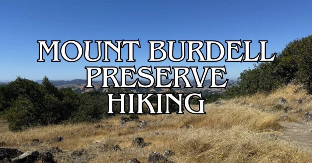
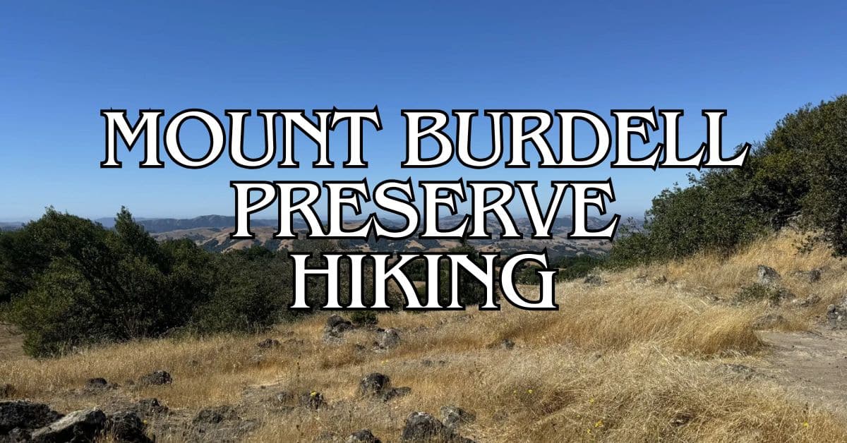
Mount Burdell Open Space Preserve in Marin County offers stunning hiking trails with amazing views. This 1,600-acre preserve sits just north of Novato and provides a perfect escape into nature.
The Deer Camp Fire Road, Old Quarry and Michako Loop is the top-rated trail in Mount Burdell, covering 5.3 miles with 1,190 feet of elevation gain. You’ll enjoy oak-studded hills and sweeping vistas of the bay and surrounding peaks.
Get a discount of 15% to 70% on accommodation in Marin County! Look for deals here:
Marin County Hotels, Apartments, B&Bs
Other great options include the Michako Trail loop and the challenging Burdell Mountain Loop.
Mount Burdell has trails for all skill levels, with a mix of fire roads and single-track paths. Spring brings wildflowers, while fall offers crisp air and clear skies for the best views.
1. Deer Camp Fire Road, Old Quarry And Michako Loop
The Deer Camp Fire Road, Old Quarry and Michako Loop offers a diverse hiking experience in Mount Burdell Preserve. This trail combines scenic views, historical sites, and varied terrain, making it a popular choice for hikers of different skill levels.
Difficulty
This trail is rated as moderate. It has some steep sections and uneven terrain.
You’ll encounter a mix of wide fire roads and narrower single-track paths. The elevation gain is about 1,190 feet, which provides a good workout without being too strenuous.
Beginners might find some parts challenging, but with proper preparation, it’s doable. Experienced hikers will enjoy the varied landscape and elevation changes.
Length And Estimated Time
The loop is 5.3 miles long. Most hikers complete it in 2 to 3 hours.
Your pace may vary based on fitness level and how often you stop to enjoy the views or take photos.
If you’re a fast hiker, you might finish in under 2 hours. For a more leisurely experience with breaks, plan for up to 4 hours.
Key Features
The trail offers stunning views of the San Francisco Bay, Mount Tamalpais, and surrounding hills. You’ll pass through open grasslands, oak woodlands, and chaparral.
The old quarry adds historical interest. It’s a reminder of the area’s mining past.
The Pierre Joske Grove, with its beautiful oak trees, is another highlight.
Wildlife sightings are common. You might see deer, wild turkeys, or various bird species. In spring, wildflowers carpet the meadows, creating a colorful display.
Best Times To Visit
Spring (March to May) is ideal for wildflower viewing and mild temperatures. The hills are green, and creeks are flowing.
Fall (September to November) offers pleasant hiking weather and clear skies for distant views.
Winter can be muddy but provides a lush green landscape. Summer hikes are possible but can be hot.
Start early to avoid midday heat. Bring plenty of water, as the trail has little shade in some sections.
Parking
Parking is available at the San Andreas Drive trailhead. The lot is small and can fill up on weekends.
Arrive early to secure a spot, especially on holidays or sunny weekends. If the main lot is full, limited street parking is available nearby.
Be respectful of residential areas and follow all posted signs. There’s no parking fee, making this an affordable outdoor option.
Safety Tips
- Carry plenty of water, especially in warmer months.
- Wear sturdy hiking shoes with good traction.
- Use sunscreen and wear a hat, as parts of the trail have little shade.
- Watch for poison oak along narrow sections of the trail.
- Be aware of your surroundings and watch for mountain bikers on shared trail sections.
- Check the weather forecast before your hike and dress in layers.
- Inform someone of your hiking plans, especially if going alone.
Historical Notes
The old quarry on this trail is a remnant of Mount Burdell’s mining history. In the early 20th century, the area was used for basalt extraction.
Pierre Joske Grove is named after a former Marin County Parks director. It’s a testament to local conservation efforts.
The fire roads on this trail were originally built for wildfire management. They now serve as popular hiking and biking routes.
Amenities
There are no restrooms or water fountains on the trail. The nearest facilities are at nearby parks in Novato.
You’ll find benches at some viewpoints, perfect for rest stops or picnics.
There are informational signs along the trail providing details about local flora, fauna, and history.
Usage Information
The trail is open to hikers, mountain bikers, and equestrians. Be prepared to share the path and follow proper trail etiquette.
Dogs are allowed on leash. Remember to clean up after your pet and keep them under control.
The trail can get busy on weekends. For a quieter experience, try visiting on weekdays or early mornings.
Trail Connections
From the Deer Camp Fire Road, you can connect to other trails in Mount Burdell Preserve. The Middle Burdell Fire Road offers an alternative loop option.
For a longer hike, you can link up with the Bay Area Ridge Trail section that runs through the preserve.
The Michako Trail connects to San Carlos Fire Road, allowing for various loop combinations.
2. Michako Trail, San Carlos Fire Road, And Middle Burdell Fire Road Loop
This loop trail offers a diverse hiking experience with stunning views of the bay and surrounding peaks. You’ll traverse rolling oak-studded hills and enjoy the natural beauty of Mount Burdell Open Space Preserve.
Difficulty
The Michako Trail, San Carlos Fire Road, and Middle Burdell Fire Road Loop is rated as moderate. You’ll encounter some elevation gain and uneven terrain. The trail is suitable for hikers with some experience and good fitness levels.
Length And Estimated Time
The loop is approximately 5.7 miles long. You can expect to complete the hike in about 2-3 hours, depending on your pace and how often you stop to enjoy the views or take breaks.
Key Features
- Oak-studded hills
- Panoramic views of San Pablo Bay
- Diverse plant life, including coastal chaparral
- Wildlife viewing opportunities
- Scenic ridgelines
You’ll experience a mix of open grasslands and shaded forest areas as you make your way along the trail.
Best Times To Visit
The trail is accessible year-round, but each season offers a unique experience:
- Spring: Wildflowers in bloom, comfortable temperatures
- Summer: Warm and dry, early morning hikes recommended
- Fall: Pleasant temperatures, golden grass landscapes
- Winter: Green hills, potential for muddy trails after rain
For the best weather conditions, plan your hike between October and April.
Parking
A parking area is available at the trailhead off San Andreas Drive. The lot can fill up on weekends, so arrive early to secure a spot. There’s no fee for parking.
Safety Tips
- Bring plenty of water, especially in warmer months
- Wear sturdy hiking shoes with good traction
- Use sun protection (hat, sunscreen, sunglasses)
- Watch for poison oak along the trail edges
- Be aware of your surroundings and wildlife
Stay on designated trails to protect the environment and avoid getting lost.
Historical Notes
Mount Burdell Open Space Preserve was established in the 1970s to protect the area’s natural beauty and provide recreational opportunities. The land was once part of ranches and dairy farms in the 19th and early 20th centuries.
Amenities
- Trailhead information kiosk
- Portable toilets at the parking area
- Benches along the trail for resting
- No water fountains available, bring your own water
There are no visitor centers directly on the trail, but you can find information at nearby park offices.
Usage Information
- Dogs are allowed on leash
- Shared use trail with mountain bikers and equestrians
- No motorized vehicles permitted
- Trail is open from sunrise to sunset
Be courteous to other trail users and yield to horses when encountered.
Trail Connections
The Michako Trail connects to several other trails in the preserve:
- Deer Camp Fire Road
- San Carlos Fire Road
- Middle Burdell Fire Road
You can extend your hike by exploring these connecting trails or create shorter loops for a quicker outing.
3. Middle Burdell Fire Road And Deer Camp Fire Road Loop
The Middle Burdell Fire Road and Deer Camp Fire Road Loop offers a challenging hike with great views and diverse terrain. This trail in Mount Burdell Open Space Preserve gives you a mix of wide fire roads and narrow paths.
Difficulty
This loop is rated as moderate to hard. You’ll face a steady climb with rocky areas and exposed sections. The trail has some steep parts that can be tiring.
Be ready for a good workout. Wear sturdy shoes with good traction. Bring plenty of water and snacks to keep your energy up during the hike.
Length And Estimated Time
The loop is about 5 miles long. Most hikers take 2-3 hours to finish it.
Your speed may vary based on how often you stop for breaks or to enjoy the views. Plan for extra time if you want to take lots of photos or have a picnic along the way.
Key Features
You’ll see beautiful oak trees and grasslands. The trail offers great views of San Pablo Bay and the surrounding hills.
Look out for:
- Rocky outcrops
- Wildflowers in spring
- Wide-open vistas at higher points
The mix of fire roads and narrow paths adds variety to your hike. You might spot local wildlife like deer or birds of prey.
Best Times To Visit
Spring is ideal for this hike. You’ll see green hills and colorful wildflowers.
Fall offers mild weather and clear skies for the best views.
Avoid hot summer days, as there’s little shade on much of the trail. If you go in summer, start early in the morning to beat the heat.
Winter can be muddy after rain, but it’s a peaceful time with fewer hikers.
Parking
Park at the end of San Andreas Drive. There’s free roadside parking available here.
The parking area is small, so arrive early on weekends or holidays to get a spot.
There’s no official parking lot, just street parking.
Safety Tips
- Bring more water than you think you’ll need. There are no water sources on the trail.
- Use sunscreen and wear a hat. Much of the trail is exposed with little shade.
- Watch your footing on rocky and uneven sections.
- Be aware of poison oak along narrow parts of the trail.
- Check for ticks after your hike, especially if you go off-trail.
Historical Notes
Mount Burdell was named after Galen Burdell, a dentist who owned much of the land in the late 1800s.
The fire roads you’ll hike on were built for wildfire management.
The area has been used for grazing cattle for over 100 years. You might see cows on parts of the trail.
Amenities
There are no bathrooms or water fountains on this trail. The nearest facilities are in Novato, about 10 minutes away by car.
Pack out all your trash. There are no garbage cans along the route.
Usage Information
The trail is open to hikers, mountain bikers, and horseback riders. Be ready to share the path and yield when needed.
Dogs are allowed but must be on a leash. Pick up after your pet and carry out waste bags.
The trail can get busy on weekends. Go on a weekday for a quieter experience.
Trail Connections
From this loop, you can connect to other trails in Mount Burdell Open Space Preserve. The Michako Trail joins up with Middle Burdell Fire Road.
For a longer hike, you can link up with the Bay Area Ridge Trail. This connects Mount Burdell to a larger network of regional trails.
4. Burdell Mountain Loop
The Burdell Mountain Loop offers a challenging hike with stunning views of the North Bay. This trail takes you through diverse landscapes and provides a great workout.
Difficulty
The Burdell Mountain Loop is rated as moderate to difficult. It has steep sections and uneven terrain.
You’ll need good fitness and hiking experience to tackle this trail comfortably.
The trail gains significant elevation, especially on the climb to the summit. Wear sturdy hiking boots for ankle support on rocky sections.
Length And Estimated Time
The loop is about 5.7 miles long. Most hikers complete it in 2.5 to 3.5 hours.
Your pace may vary based on fitness level and how often you stop for breaks or photos.
Plan for extra time if you want to enjoy the views or explore side trails.
Key Features
The trail offers panoramic views of the San Francisco Bay Area. On clear days, you can see Mount Tamalpais, San Pablo Bay, and even San Francisco.
You’ll pass through oak woodlands and open grasslands. In spring, wildflowers dot the landscape.
The summit of Mount Burdell, at 1,558 feet, is a highlight. It provides 360-degree views of Marin County and beyond.
Best Times To Visit
Spring (March to May) is ideal for wildflowers and green hillsides. Fall (September to November) offers pleasant temperatures and clear skies.
Summer can be hot, so start early and bring plenty of water. Winter can be muddy after rains, but offers lush green scenery.
Weekdays are less crowded than weekends. Early mornings provide the best chance for wildlife sightings.
Parking
The main parking area is at the end of San Andreas Drive in Novato. It’s free but can fill up on weekends.
Arrive early to secure a spot, especially on holidays and sunny weekends. There’s no overnight parking allowed.
Safety Tips
Bring plenty of water, especially in summer. There are no water sources on the trail.
Watch for poison oak along the trail edges. Wear long pants if you’re sensitive.
Rattlesnakes are present in the area. Stay on the trail and watch where you step.
Cell phone coverage can be spotty. Let someone know your hiking plans before you start.
Historical Notes
Mount Burdell was named after Galen Burdell, a dentist who owned the land in the 1800s.
The area was once used for cattle grazing. You might still see old fences or gates along the trail.
In the late 1880s, a quarry on the west slope supplied cobblestones for San Francisco streets.
Amenities
There are no restrooms or water fountains on the trail. Use facilities in Novato before starting your hike.
A few benches along the trail provide resting spots with scenic views.
There’s no visitor center at the trailhead. Check the Marin County Parks website for current conditions.
Usage Information
Dogs are allowed on leash. Bring waste bags and pack out all pet waste.
The trail is shared with mountain bikers. Stay alert and yield to bikes when necessary.
Horseback riding is also permitted. Give horses plenty of space when passing.
Trail Connections
The Burdell Mountain Loop connects with several other trails in the preserve.
You can extend your hike by taking the Upper Mount Burdell Trail for more challenging terrain.
The Bay Area Ridge Trail passes through Mount Burdell, offering options for longer hikes.
5. Bay Area Ridge Trail: Mount Burdell Open Space Via Novato Blvd
The Bay Area Ridge Trail: Mount Burdell Open Space via Novato Blvd offers stunning views and diverse landscapes. This trail takes you through grasslands and oak-dotted hills to reach panoramic vistas of the North Bay.
Difficulty
The trail is rated as moderate. It has some steep sections and uneven terrain.
Be ready for a good workout, especially on the uphill portions.
The climb to the summit can be challenging for some hikers. Bring plenty of water and take breaks as needed.
Length And Estimated Time
The trail is about 5.5 miles round trip. It typically takes 2-3 hours to complete.
Plan for extra time if you want to enjoy the views or take photos. The pace can vary based on your fitness level and how often you stop.
Key Features
- Panoramic views of the North Bay
- Ancient oak trees
- Diverse wildlife
- Part of the larger Bay Area Ridge Trail system
- Cobblestone Fire Road
The trail passes through oak savanna and grasslands. You’ll see a mix of open areas and dense woodlands.
Look out for wildflowers in spring. The summit offers views of Mount Tam, San Francisco Bay, and Mount Diablo on clear days.
Best Times To Visit
Spring and fall are ideal for this hike. Wildflowers bloom in spring, while fall brings cooler temperatures.
Summer can be hot and dry. If hiking in summer, start early to avoid the midday heat.
Winter can be muddy after rains. Check trail conditions before you go.
Parking
Parking is available at the trailhead on Novato Boulevard. The lot is small and can fill up on weekends.
Arrive early to secure a spot, especially on holidays or nice weekends. There’s no fee for parking.
Safety Tips
- Bring plenty of water, especially in warm weather
- Wear sturdy shoes with good traction
- Watch for poison oak along the trail edges
- Be aware of wildlife, including rattlesnakes in summer
- Check the weather forecast before you go
Stay on marked trails to protect the sensitive wildlife areas. Let someone know your hiking plans before you start.
Historical Notes
Mount Burdell has been used for grazing cattle since the 1800s. You might still see cattle on parts of the preserve today.
The area was once home to Coast Miwok people. Some of the oak trees along the trail are hundreds of years old.
Amenities
There are no restrooms or water fountains on the trail. Plan accordingly and bring all the water you’ll need.
A small informational kiosk is located at the trailhead. It provides a map and basic trail information.
Usage Information
The trail is open to hikers, mountain bikers, and equestrians. Be aware of other users and yield as needed.
Dogs are allowed on leash. Remember to clean up after your pet and carry out waste.
The trail can get busy on weekends. For a quieter experience, try visiting on weekdays.
Trail Connections
This trail is part of the larger Bay Area Ridge Trail system. It connects to other trails in Mount Burdell Open Space Preserve.
From the summit, you can continue on to other trails like the Deer Camp Fire Road or Michako Trail.
Consider combining this hike with other nearby trails for a longer adventure. Always check trail maps for current conditions and connections.
Mount Burdell Preserve Local Regulations And Trail Etiquette
When hiking at Mount Burdell Preserve, you need to follow some important rules and etiquette.
These help keep the area safe and enjoyable for everyone.
Trail hours are from sunrise to sunset. Plan your hike to finish before dark.
Dogs are welcome but must be on a leash no longer than 6 feet.
Respect private property boundaries.
Stay on marked trails to avoid trespassing and protect sensitive habitats.
Here are some key rules to remember:
- No smoking or fires
- Pack out all trash
- No picking plants or disturbing wildlife
- Yield to horses and uphill hikers
- Bikes allowed on fire roads only
When you encounter others on the trail, be polite and give them space.
Step aside to let faster hikers pass. If hiking in a group, walk single file when others approach.
Keep noise levels down to preserve the peaceful atmosphere.
Leave your music at home and enjoy the sounds of nature instead.
Be prepared for your hike.
Bring water, snacks, and sun protection.
Wear sturdy shoes and dress in layers. The weather can change quickly on the mountain.
Getting To Mount Burdell Preserve
Mount Burdell Preserve offers easy access for hikers and nature lovers. You can reach this beautiful area through different modes of transportation, making it a convenient destination for outdoor enthusiasts.
By Car
Driving is the most straightforward way to reach Mount Burdell Preserve.
From San Francisco, take Highway 101 north for about 30 miles.
Exit at San Marin Drive in Novato.
Head west on San Marin Drive for about 2.5 miles until you reach San Andreas Drive.
Turn right and continue for a short distance to find the preserve entrance.
The drive takes roughly 45 minutes to an hour, depending on traffic.
Make sure to bring a map or use a GPS, as some parts of the route may have limited cell service.
Public Transportation
While less convenient than driving, public transportation options are available.
Take the Golden Gate Transit bus from San Francisco to Novato.
From there, you’ll need to use a ride-sharing service or local taxi to reach the preserve.
This option takes longer but can be more eco-friendly.
Plan for about 1.5 to 2 hours of travel time.
Check the Golden Gate Transit website for current schedules and fares.
Parking Information
Mount Burdell Preserve offers free parking for visitors.
The main parking area is located at the end of San Andreas Drive. This lot can accommodate about 20-25 vehicles.
During busy times, especially on weekends and holidays, the lot may fill up quickly.
Arrive early to secure a spot.
If the main lot is full, limited street parking is available along San Andreas Drive.
Remember to lock your vehicle and don’t leave valuables in sight.
The parking area is unattended, so take necessary precautions to protect your belongings.
Preparing For Your Hike
Getting ready for a hike in Mount Burdell Preserve requires careful planning. Proper gear, weather awareness, and fitness considerations are key to a safe and enjoyable experience.
Essential Gear
Packing the right items is crucial for your Mount Burdell hike. Here’s what you should bring:
- Sturdy hiking boots with good traction
- Plenty of water (at least 2 liters per person)
- Snacks and light meals
- Sun protection (hat, sunscreen, sunglasses)
- First aid kit
- Map and compass (or GPS device)
- Hiking poles (optional, but helpful on steeper trails)
Don’t forget a small backpack to carry everything comfortably.
For longer hikes like the Burdell Mountain Loop, pack extra supplies.
Weather Considerations
Mount Burdell’s weather can change quickly. Be prepared for various conditions:
- Check the forecast before you go
- Dress in layers to adjust to temperature changes
- Bring a light waterproof jacket, even on sunny days
- Avoid hiking during extreme heat or after heavy rains
Spring offers pleasant temperatures and wildflower displays.
Summer can be hot, so start early.
Fall and winter provide cooler hiking conditions, but watch for muddy trails after rain.
Fitness Levels
Mount Burdell trails cater to different fitness levels. Choose a trail that matches your abilities:
- Beginners: Start with shorter, flatter routes like parts of the Deer Camp Fire Road
- Intermediate: Try the Michako Trail Loop for a moderate challenge
- Advanced: Take on the full Bay Area Ridge Trail to Mount Burdell Summit for a strenuous hike
Build up your endurance with shorter hikes before attempting longer trails.
Always listen to your body and turn back if you feel overwhelmed.
Wildlife And Plant Life In Mount Burdell Preserve
Mount Burdell Preserve is home to a rich variety of plants and animals. The preserve’s diverse habitats support many species.
You’ll find oak woodlands and grasslands as you hike the trails. These areas provide food and shelter for wildlife.
Common animals you might see include:
- Deer
- Coyotes
- Rabbits
- Ground squirrels
- Wild turkeys
The preserve is also a great spot for birdwatching. Keep an eye out for hawks soaring overhead.
Plant life in Mount Burdell changes with the seasons.
In spring, wildflowers bloom across the grasslands. You’ll see poppies, lupines, and other colorful flowers.
Oak trees are a key part of the preserve’s ecosystem. They provide food and homes for many animals. Look for acorns on the ground in fall.
As you hike, you might notice changes in plant life at different elevations. The mix of plants shifts as you climb higher on the trails.
Remember to respect the wildlife and plants during your visit.
Stay on marked trails and don’t disturb animals or pick flowers. This helps protect the preserve’s natural beauty for future visitors.
Photography Tips For Mount Burdell Preserve
Mount Burdell Preserve offers stunning photo opportunities. Here are some tips to capture its beauty:
Golden hour is your friend.
Visit early morning or late afternoon for soft, warm light on the landscape. This works well for shots of open grasslands and oak forests.
Pack a wide-angle lens.
It’s perfect for sweeping vistas from the summit. You’ll want to capture those gorgeous views of San Pablo Bay.
Don’t forget your macro lens. Spring brings wildflowers, ideal for close-up shots.
Use a tripod for sharper images, especially in low light. It’s also great for capturing movement in grasses or leaves.
Include hikers or wildlife for scale. This helps show the vastness of the preserve.
Try different perspectives:
- Get low to the ground for unique wildflower shots
- Climb high for panoramic views
- Use trees or rocks to frame your subject
Be patient with wildlife.
Keep a respectful distance and use a zoom lens.
Protect your gear.
Bring a rain cover for unexpected weather changes.
Remember to enjoy the moment too. Don’t spend all your time behind the lens!
Family-Friendly Options For Hiking Mount Burdell Preserve
Mount Burdell Preserve offers great hiking options for families. You’ll find trails that are easy for kids to handle and exciting for all ages.
The Deer Camp Fire Road, Old Quarry and Michako Loop is a good choice for families.
It’s 3.7 miles long and takes about 2 hours to finish. The trail is wide and mostly flat, making it easy for little legs.
Another family-friendly option is the Michako Trail, San Carlos Fire Road, and Middle Burdell Fire Road Loop.
This 3.1-mile loop offers nice views and isn’t too hard for kids.
For a shorter walk, try the start of the Middle Burdell Fire Road.
You can go as far as you like and turn back when the kids get tired.
Remember to bring water, snacks, and sun protection.
The trails can get hot in summer, so early morning or late afternoon is best for hiking with kids.
You might see cows grazing in the fields. This can be fun for kids, but keep a safe distance.
Wildflowers bloom in spring, adding color to your family hike.
Accessibility Information
Mount Burdell Preserve offers trails with varying levels of accessibility. Some paths are easier to navigate than others.
The Deer Camp Fire Road, Old Quarry and Michako Loop is relatively flat and wide. This makes it more accessible for those with mobility challenges.
Fire roads in the preserve are generally wider and have a more even surface. These include:
- Middle Burdell Fire Road
- San Carlos Fire Road
- Deer Camp Fire Road
The Bay Area Ridge Trail section in Mount Burdell can be steep in parts. It may not be suitable for all visitors.
Parking is available at trailheads, but spaces are limited.
You’ll find a small lot at the end of San Andreas Drive.
Trail Conditions:
- Mostly unpaved
- Some rocky and uneven terrain
- Can be muddy after rain
Amenities:
- No restrooms on trails
- Limited benches for resting
It’s best to check current trail conditions before your visit.
Weather can affect accessibility. Trails may become slippery or muddy after rain.
Remember to bring water and sun protection.
The preserve has limited shade in some areas.
Local Resources
Mount Burdell Preserve offers helpful resources for hikers. You can find information, assistance, and safety support to make your hiking experience enjoyable and worry-free.
Visitor Centers
The Marin County Parks headquarters serves as the main information point for Mount Burdell Preserve.
It’s located in San Rafael, about 10 miles south of the preserve.
The staff can provide maps, trail conditions, and local insights.
You can also visit the Olompali State Historic Park visitor center.
It’s close to Mount Burdell and offers exhibits on local history and nature.
The center is open weekends and provides useful area information.
For up-to-date trail info, check the bulletin boards at main trailheads.
They often post recent wildlife sightings and seasonal alerts.
Emergency Contacts
Safety is key when hiking. Program these numbers into your phone before your trip:
- Marin County Sheriff: 911 for emergencies
- Non-emergency dispatch: (415) 479-2311
- Marin County Parks: (415) 473-6387
Park rangers patrol the preserve regularly.
If you need help, stay put and call for assistance.
Cell service can be spotty in some areas, so it’s wise to plan your trip carefully.
Useful Websites And Apps
Several online resources can enhance your Mount Burdell experience:
- Marin County Parks website: Check for closure alerts and preserve rules.
- AllTrails app: Find detailed trail info and user reviews.
- Popular routes include the Michako Trail loop and Burdell Mountain Loop.
- Weather apps: Check local forecasts to dress appropriately.
- iNaturalist: Identify plants and animals you spot on the trails.
- Hiking Project app: Access offline trail maps and elevation profiles.
These tools can help you navigate the preserve safely and learn about its natural features.
Get a discount of 15% to 70% on accommodation in Marin County! Look for deals here:
Marin County Hotels, Apartments, B&Bs
5 Best Hiking Trails in Angel Island State Park – Terrain, Difficulty, Accessibility, and Trail Features
5 Best Hiking Trails in Baltimore Canyon Preserve – Terrain, Difficulty, Accessibility, and Trail Features
5 Best Hiking Trails in Belvedere and Tiburon – Terrain, Difficulty, Accessibility, and Trail Features
5 Best Hiking Trails in Blithedale Summit Preserve – Terrain, Difficulty, Accessibility, and Trail Features
5 Best Hiking Trails in Cascade Canyon Preserve – Terrain, Difficulty, Accessibility, and Trail Features
5 Best Hiking Trails in China Camp State Park – Terrain, Difficulty, Accessibility, and Trail Features
5 Best Hiking Trails in Fairfax – Terrain, Difficulty, Accessibility, and Trail Features
5 Best Hiking Trails in Golden Gate National Recreation Area – Terrain, Difficulty, Accessibility, and Trail Features
5 Best Hiking Trails in Indian Tree Open Space Preserve – Terrain, Difficulty, Accessibility, and Trail Features
5 Best Hiking Trails in Kentfield, Greenbrae, and Ross – Terrain, Difficulty, Accessibility, and Trail Features
5 Best Hiking Trails in Larkspur and Corte Madera – Terrain, Difficulty, Accessibility, and Trail Features
5 Best Hiking Trails in Loma Alta Preserve – Terrain, Difficulty, Accessibility, and Trail Features
5 Best Hiking Trails in Marin Headlands – Terrain, Difficulty, Accessibility, and Trail Features
5 Best Hiking Trails in Mill Valley – Terrain, Difficulty, Accessibility, and Trail Features
5 Best Hiking Trails in Mount Burdell Preserve – Terrain, Difficulty, Accessibility, and Trail Features
5 Best Hiking Trails in Mount Tamalpais State Park – Terrain, Difficulty, Accessibility, and Trail Features
5 Best Hiking Trails in Muir Woods National Monument – Terrain, Difficulty, Accessibility, and Trail Features
5 Best Hiking Trails in Novato – Terrain, Difficulty, Accessibility, and Trail Features
5 Best Hiking Trails in Olompali State Historical Park – Terrain, Difficulty, Accessibility, and Trail Features
5 Best Hiking Trails in Point Reyes National Seashore – Terrain, Difficulty, Accessibility, and Trail Features
5 Best Hiking Trails in Samuel P. Taylor State Park – Terrain, Difficulty, Accessibility, and Trail Features
5 Best Hiking Trails in San Anselmo – Terrain, Difficulty, Accessibility, and Trail Features
5 Best Hiking Trails in San Rafael – Terrain, Difficulty, Accessibility, and Trail Features
5 Best Hiking Trails in Sausalito and Marin City – Terrain, Difficulty, Accessibility, and Trail Features
5 Best Hiking Trails in West Marin – Terrain, Difficulty, Accessibility, and Trail Features


