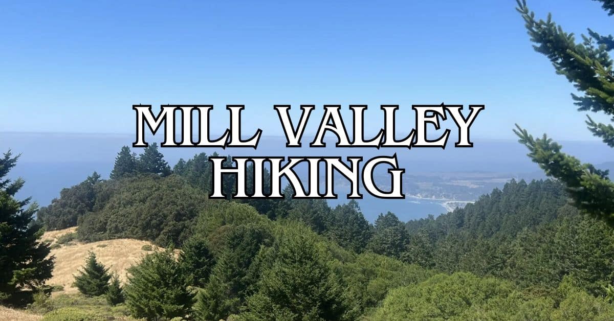
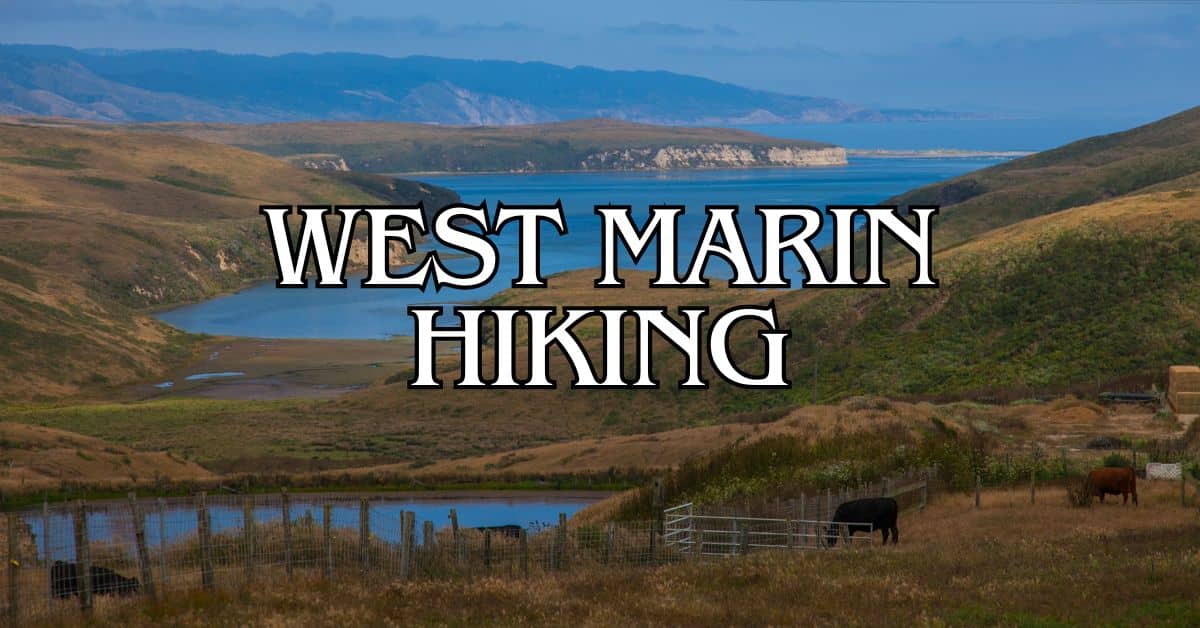
Mill Valley, nestled in Marin County, California, offers some of the best hiking trails in the Bay Area.
With its stunning natural beauty and diverse landscapes, this charming town is a paradise for outdoor enthusiasts and trail runners.
Get a discount of 15% to 70% on accommodation in Marin County! Look for deals here:
Marin County Hotels, Apartments, B&Bs
Mill Valley has over 139 scenic trails that cater to hikers of all skill levels, from easy family-friendly walks to challenging mountain climbs.
You’ll find breathtaking views of the Pacific Ocean, lush redwood forests, and rolling hills as you explore these paths.
The area’s mild climate makes hiking enjoyable year-round, though each season brings its own unique charm to the trails.
Whether you’re a local looking for new adventures or a visitor seeking to experience the natural wonders of Northern California, Mill Valley’s hiking trails offer something for everyone.
From the iconic Dipsea Trail to the serene Fern Creek Loop, you’re sure to find a hike that suits your preferences and fitness level.
1. Dipsea Trail, Steep Ravine Trail, and Matt Davis Loop
The Dipsea Trail, Steep Ravine Trail, and Matt Davis Loop is a stunning hike that showcases the best of Mill Valley’s natural beauty.
This loop takes you through diverse landscapes, from redwood forests to coastal views.
Difficulty
This trail is rated as moderate to challenging.
The elevation gain and diverse terrain make it suitable for experienced hikers.
You’ll encounter steep sections, especially on the Steep Ravine Trail.
The loop includes some strenuous climbs and descents.
Prepare for a workout, especially on the uphill portions.
Sturdy hiking boots are recommended for the varied terrain.
Length and Estimated Time
The loop is approximately 7.5 miles long.
Most hikers complete it in 3 to 4 hours.
Your pace may vary depending on fitness level and how often you stop to enjoy the views.
Plan for extra time if you want to take breaks or photos.
The trail’s beauty often encourages leisurely exploration.
Consider starting early to avoid rushing through the experience.
Key Features
- Redwood forests along Steep Ravine Trail
- Coastal views from Dipsea Trail
- Wooden ladders and bridges on Steep Ravine
- Fern-lined canyons
- Waterfalls (seasonal)
- Panoramic ocean vistas
The trail offers a mix of shaded forest and open coastal sections. You’ll cross Webb Creek several times, adding to the scenic beauty.
Best Times to Visit
Spring and fall are ideal for this hike.
Wildflowers bloom in spring, while fall offers mild temperatures.
Summer can be foggy but provides a cool escape from inland heat.
Winter hiking is possible but requires caution due to muddy trails and potential storm damage.
Early mornings often offer clearer skies and fewer crowds year-round.
Parking
Parking is available at Stinson Beach.
Arrive early on weekends and holidays as spaces fill up quickly. The beach parking lot is free and opens at 9 am.
Alternative parking is available at Pantoll Campground for a fee. This option allows you to start the loop from a different point.
Safety Tips
- Carry plenty of water, especially on hot days
- Wear layers for changing temperatures
- Use sunscreen, even on foggy days
- Watch your footing on steep and potentially slippery sections
- Be aware of poison oak along the trail
- Check weather forecasts before your hike
Stay on marked trails to protect yourself and the environment.
Cell phone coverage can be spotty, so consider hiking with a partner.
Historical Notes
The Dipsea Trail is home to the famous Dipsea Race, the oldest trail race in America.
It started in 1905 and continues annually. The race covers part of this loop, connecting Mill Valley to Stinson Beach.
Steep Ravine was once a private retreat. In the 1960s, it became part of Mount Tamalpais State Park, allowing public access to its natural wonders.
Amenities
- Restrooms at Stinson Beach and Pantoll Campground
- Water fountains at trail intersections (not always reliable)
- Picnic areas at Stinson Beach
- No amenities along the trail itself
Pack snacks and extra water for the hike.
The nearby town of Stinson Beach offers restaurants and shops for post-hike refreshments.
Usage Information
- The trail is popular among hikers and runners
- Mountain biking is not allowed on most sections
- Dogs are permitted on leash on some parts of the trail, but check local regulations before bringing your pet
Expect to encounter other hikers, especially on weekends.
The trail can get crowded during peak times, so consider a weekday visit for a quieter experience.
Trail Connections
This loop connects to several other trails in Mount Tamalpais State Park. You can extend your hike by linking to:
- Bootjack Trail
- Troop 80 Trail
- Pantoll Trail
These connections allow for longer adventures or alternative routes. Study a trail map to plan your extended hike if desired.
2. Dipsea to Steep Ravine Loop from Pantoll Campground
The Dipsea to Steep Ravine Loop offers a diverse hiking experience with stunning views and varied terrain.
This trail takes you through redwood forests, along coastal vistas, and past cascading waterfalls.
Difficulty
The trail is rated as moderate to challenging.
You’ll encounter steep sections and stairs, especially in Steep Ravine.
The elevation gain is significant, with some portions requiring careful footing.
Proper hiking shoes are a must.
Trekking poles can be helpful for balance on steeper parts.
Be prepared for a workout, especially if you’re not used to hills.
Length and Estimated Time
The loop is about 4.6 miles long.
Most hikers complete it in 2-3 hours.
Your pace may vary based on fitness level and how often you stop for photos or rest.
Plan for extra time if you want to enjoy the views or explore side trails.
It’s better to allow more time than to rush through this beautiful hike.
Key Features
- Panoramic views of the Bay Area and Pacific Ocean
- Lush redwood forests
- Seasonal waterfalls in Steep Ravine
- Diverse plant life and ecosystems
You’ll start at Pantoll Campground and follow the Dipsea Trail.
The path winds through sun-dappled forests before opening up to coastal vistas.
In Steep Ravine, you’ll find yourself in a cool, shaded canyon with a creek and waterfalls.
Best Times to Visit
Spring and fall offer the most pleasant hiking conditions.
Wildflowers bloom in spring, while fall brings crisp air and clear skies.
Summer can be foggy, especially in the mornings.
Winter brings rain, making trails muddy and streams fuller.
Each season has its charm, but be prepared for changing weather.
Parking
Parking is available at Pantoll Campground for an $8 fee.
The lot can fill up quickly on weekends and holidays. Arrive early to secure a spot.
If the lot is full, limited roadside parking may be available.
Always park legally and be mindful of no-parking zones.
Safety Tips
- Carry plenty of water
- Wear layers for changing microclimates
- Watch your step on steep and potentially slippery sections
- Be aware of poison oak along the trail
- Check weather forecasts before you go
Tell someone your hiking plans before you set out.
Cell phone reception can be spotty in some areas of the trail.
Historical Notes
The Dipsea Trail is home to the annual Dipsea Race, America’s oldest trail running event.
It started in 1905 and continues to challenge runners today.
Native American tribes, including the Coast Miwok, lived in this area for thousands of years before European settlers arrived.
Amenities
- Restrooms available at Pantoll Campground
- Water fountain near the trailhead
- Picnic tables at Pantoll
There are no facilities along the trail itself. Pack out all trash and use restrooms before starting your hike.
Usage Information
- Dogs are not allowed on the Steep Ravine portion of the trail
- Mountain bikes are prohibited
- The trail is popular, expect to see other hikers
Practice good trail etiquette. Yield to uphill hikers and stay on marked paths to protect vegetation.
Trail Connections
From this loop, you can connect to other trails in Mount Tamalpais State Park. The Matt Davis Trail offers an option to extend your hike.
The Dipsea Trail continues all the way to Stinson Beach if you’re up for a longer adventure.
Always check trail maps and your energy levels before extending your hike.
3. Fern Creek, Lost, and Canopy Trail Loop
The Fern Creek, Lost, and Canopy Trail Loop offers a beautiful journey through Mill Valley’s lush forests.
This trail showcases the area’s natural beauty and provides a moderate challenge for hikers.
Difficulty
This loop is rated as moderately challenging.
You’ll encounter some steep sections and uneven terrain.
The trail includes uphill climbs and descents, making it suitable for hikers with some experience.
Sturdy shoes are a must for navigating the varied terrain.
Length and Estimated Time
The loop spans 3.4 miles.
Most hikers complete it in about 1 hour and 45 minutes to 2 hours.
Your pace may vary based on fitness level and how often you stop to enjoy the views.
Key Features
The trail offers stunning features:
- Towering redwood groves
- Lush fern-covered hillsides
- Babbling creeks and small waterfalls
- Scenic viewpoints of Mt. Tamalpais
You’ll experience diverse ecosystems as you move through different elevations.
The canopy section provides breathtaking views of the forest from above.
Best Times to Visit
Spring and fall are ideal for this hike. In spring, you’ll see wildflowers and lush greenery.
Fall brings cooler temperatures and beautiful foliage.
Summer can be pleasant, but prepare for warmer weather.
Winter hikes are possible, but trails may be muddy and slippery after rain.
Weekday mornings offer the most solitude.
Weekends can be busy, especially in peak seasons.
Parking
Parking is available at the Muir Woods National Monument visitor center.
Arrive early on weekends and holidays, as spaces fill up quickly.
You can also use the shuttle service from nearby parking areas during peak seasons.
A parking reservation system is in place. Book your spot in advance to ensure availability.
Safety Tips
- Carry plenty of water, especially on warm days.
- Wear layers, as temperatures can vary in the forest.
- Watch your footing on steep and uneven sections.
- Stay on marked trails to protect the ecosystem.
- Check for trail updates before your hike, as conditions can change.
Be aware of poison oak along the trail edges. Long pants can help protect you.
Historical Notes
This area has been protected since 1908 when President Theodore Roosevelt declared it a National Monument.
The trails showcase the rich history of conservation efforts in the region.
Native American tribes, including the Coast Miwok, lived in this area for thousands of years before European settlement.
Their connection to the land is an important part of the area’s heritage.
Amenities
At the trailhead near Muir Woods, you’ll find:
- Restrooms
- Water fountains
- A visitor center with exhibits
- A small café
There are no facilities along the trail itself, so plan accordingly.
Usage Information
This trail is for hikers only. Bikes and horses are not allowed.
Dogs are not permitted on the trail to protect the sensitive ecosystem.
The trail can be busy, especially on weekends.
Practice good trail etiquette by yielding to uphill hikers and stepping aside to let others pass when needed.
Trail Connections
The Fern Creek, Lost, and Canopy Trail Loop connects to several other trails in Mt. Tamalpais State Park. You can extend your hike by linking to:
- The Bootjack Trail
- The Ben Johnson Trail
- The Dipsea Trail
These connections allow for longer, more challenging hikes if you’re up for an adventure.
Always check trail maps and your fitness level before attempting longer routes.
4. Tennessee Valley Golden Gate Loop
The Tennessee Valley Golden Gate Loop offers a mix of coastal views, challenging climbs, and diverse landscapes. This popular trail combines scenic beauty with a good workout.
Difficulty
The trail is moderately challenging. It has many ups and downs that will test your fitness.
The path varies from paved to packed dirt, with some steep sections.
You’ll face a few tough climbs, including parts of the Mt. Tam hill climb.
These steep parts will get your heart pumping. The technical downhill sections need care, especially after rain when they can be slippery.
Length and Estimated Time
The loop is 5.7 miles long. Most hikers take about 3 hours to finish it.
This time can change based on your pace and how often you stop for breaks or photos.
If you’re a fast hiker, you might finish in 2.5 hours.
Slower hikers or those who like to take lots of pictures might need 3.5 to 4 hours.
Plan extra time if you want to spend a while at the beach.
Key Features
The trail offers stunning coastal views. You’ll see the Pacific Ocean, rolling hills, and on clear days, the Golden Gate Bridge.
The path goes through varied landscapes, from open grasslands to wooded areas.
A highlight is reaching Tennessee Beach. This small, secluded cove is perfect for a rest stop.
The beach has interesting rock formations and is good for watching waves.
As you climb, you’ll get panoramic views of the Marin Headlands.
The trail also passes through parts of old military installations, adding historical interest.
Best Times to Visit
Spring and fall are ideal for this hike. In spring, wildflowers bloom along the trail.
Fall brings clear skies and mild temps.
Summer can be foggy, especially in the mornings.
Early mornings are great for avoiding crowds and heat.
Weekdays are less busy than weekends.
For the best views, pick a clear day, especially if you want to see the Golden Gate Bridge.
Avoid rainy days as the trail can get muddy and slippery. Winter hikes can be beautiful but check the weather first.
Parking
Park at the Tennessee Valley Staging Area. It’s free and has space for about 90 cars.
The lot fills up fast on weekends and holidays, so arrive early.
There’s overflow parking along Tennessee Valley Road. But be careful not to block traffic or driveways. Carpooling is a good idea on busy days.
The parking area has restrooms and water fountains. It’s also where you’ll find trail maps and info boards.
Safety Tips
- Bring plenty of water. There are few water sources on the trail.
- Wear sturdy hiking shoes with good traction for the steep and sometimes slippery parts.
- Use sunscreen and wear a hat. Many parts of the trail have no shade.
- Be ready for sudden weather changes. Fog can roll in quickly, so bring layers.
- Watch for poison oak along narrow parts of the trail.
- Stay on marked paths to avoid erosion and protect plant life.
- Be aware of wildlife, including coyotes and sometimes mountain lions.
Cell phone coverage can be spotty. Let someone know your hiking plans before you start.
Historical Notes
The Tennessee Valley area has a rich history.
Native Americans lived here for thousands of years before European settlers arrived.
The valley got its name from a shipwreck in 1853 – the SS Tennessee.
During World War II, the area was part of coastal defenses. You can still see old bunkers and gun emplacements along parts of the trail.
These structures were built to protect San Francisco Bay from possible attack.
In the 1960s, the land was saved from development. It became part of the Golden Gate National Recreation Area in 1972.
Amenities
The trailhead has basic amenities. You’ll find restrooms, water fountains, and picnic tables at the parking area.
There are no facilities along the trail or at Tennessee Beach.
Bring your own food and water for the hike.
The nearest stores are in Mill Valley, about 10 minutes away by car.
There’s a visitor center at Muir Beach, but it’s not directly on this trail.
Trail maps are available at the parking lot info board. Trash cans are at the trailhead, but not along the trail. Pack out all your trash.
Usage Information
The trail is popular with hikers and runners.
Mountain bikes are allowed on some parts but not the whole loop. Check signs for allowed uses on each section.
Dogs are not allowed on this trail.
This rule helps protect local wildlife and plant life. Horses are permitted on some sections. Yield to horses if you encounter them.
The trail can get crowded on weekends and holidays.
For a quieter experience, try hiking on weekdays or early mornings.
Trail Connections
The Tennessee Valley Golden Gate Loop connects to several other trails. You can extend your hike by linking to these paths:
- Miwok Trail: This connects to the north, offering views of the Bay.
- Coastal Trail: Heading south, this trail goes towards Muir Beach.
- Fox Trail: This steep trail leads up to the Coyote Ridge.
These connections let you create longer hikes or plan multi-day treks.
The East Peak of Mount Tamalpais is reachable via connected trails, offering a challenging full-day hike option.
5. Fern Creek and Hillside Loop
The Fern Creek and Hillside Loop is a scenic trail in Mill Valley. It offers beautiful redwood groves and lush fern-covered slopes. This loop combines natural beauty with moderate exercise.
Difficulty
The trail is rated as moderate. It has some steep sections and uneven terrain.
Sturdy shoes are recommended. The path is well-maintained but can be slippery when wet.
You’ll encounter some elevation gain. Be prepared for a bit of a workout.
Take breaks if needed, especially on uphill portions.
Length and Estimated Time
The loop is 1.9 miles long. Most hikers complete it in about 1-1.5 hours.
Your pace may vary based on fitness level and how often you stop.
Allow extra time if you want to take photos or enjoy the scenery.
Key Features
Towering redwoods line much of the trail. You’ll walk through cool, shaded groves. Ferns carpet the forest floor, creating a lush green landscape.
The loop offers some nice viewpoints. Look for glimpses of the surrounding hills through the trees.
Wooden bridges cross babbling creeks. These spots are perfect for a quick rest or photo op.
Best Times to Visit
Spring and fall are ideal. Temperatures are mild, and wildflowers bloom in spring.
Summer can be foggy but still pleasant. Winter brings more rain, making trails muddy.
Weekdays are less crowded. If visiting on weekends, arrive early to beat the rush.
Parking
Parking is limited near the trailhead. Arrive early on weekends to secure a spot.
Consider using the Muir Woods Shuttle on busy days. It drops you off near the trail start.
Parking fees may apply. Check current rates before your visit.
Safety Tips
- Stay on marked trails to protect the environment and avoid getting lost.
- Bring water and snacks. There are no facilities on the trail.
- Watch for exposed roots and rocks. They can be tripping hazards.
- Cell service is spotty. Download a trail map before you start.
- Tell someone your hiking plans before you go.
Historical Notes
The trail is part of Muir Woods National Monument. It was established in 1908 to protect the old-growth coastal redwood ecosystem.
John Muir, the famous naturalist, visited these woods. His advocacy helped preserve the area for future generations.
The Civilian Conservation Corps built many of the trails in the 1930s.
Amenities
There are restrooms and a visitor center at the Muir Woods entrance. No facilities are on the actual loop.
Water fountains are available near the trailhead. Fill up before you start.
A small gift shop sells snacks and souvenirs at the park entrance.
Usage Information
The trail is popular for hiking and nature walks. It’s not suitable for biking.
Dogs are not allowed on this trail to protect the fragile ecosystem.
The path is too narrow for strollers or wheelchairs in most sections.
Trail Connections
The Fern Creek and Hillside Loop connects to other trails in Muir Woods.
You can extend your hike by linking to the Canopy View Trail.
For a longer adventure, connect to the Dipsea Trail. This famous path runs from Mill Valley to Stinson Beach.
Mill Valley Local Regulations and Trail Etiquette
When hiking in Mill Valley, it’s important to follow local rules and be respectful of nature and other trail users. Here are some key points to keep in mind:
• Leash laws: You must keep your dogs on leash at all times on most trails. Some areas allow off-leash dogs under voice control.
• Trail hours: Most trails are open from sunrise to sunset. Check posted signs for specific hours.
• Stay on marked trails: Protect plants and prevent erosion by staying on designated paths.
• Yield to others: Hikers should yield to horses. Bikers should yield to both hikers and horses.
• No smoking: Smoking is prohibited on all trails due to fire risk.
• Pack it in, pack it out: Take all trash with you, including food scraps and pet waste.
• Respect wildlife: Do not feed or approach animals. Keep a safe distance and use binoculars to observe.
• No drones: Flying drones is not allowed in most areas to protect wildlife and visitor privacy.
• Group size limits: Some trails have limits on group sizes. Check regulations before planning large outings.
• Parking: Use designated parking areas only. Do not block gates or park on neighborhood streets.
Getting to Mill Valley
Mill Valley is easily accessible by car and public transportation. Parking options are available, but can be limited during peak times.
By Car
Mill Valley is located about 14 miles north of San Francisco. Take Highway 101 north and exit at CA-1/Shoreline Highway. Follow Shoreline Highway for about 2 miles, then turn right onto Almonte Boulevard. This will lead you into downtown Mill Valley.
From the East Bay, cross the Richmond-San Rafael Bridge and take Highway 101 south. Exit at CA-1/Shoreline Highway and follow the same directions as above.
If coming from the north, take Highway 101 south and exit at East Blithedale Avenue. Follow East Blithedale into downtown Mill Valley.
Public Transportation
Golden Gate Transit offers bus service to Mill Valley from San Francisco and other parts of Marin County. Take Route 4 from San Francisco to reach downtown Mill Valley.
From the East Bay, take BART to El Cerrito del Norte station. Then transfer to Golden Gate Transit Route 40 to Marin City. At Marin City, switch to Route 17 to Mill Valley.
Marin Transit provides local bus service within Mill Valley and to nearby towns. Route 219 connects Mill Valley to Tiburon and Strawberry.
Parking Information
Downtown Mill Valley has metered street parking and several public lots. The Lytton Square lot offers 2-hour free parking. For longer stays, use the Miller Avenue lot or Sunnyside lot.
When hiking, trailhead parking can fill up quickly on weekends and holidays. Arrive early to secure a spot. Some popular trailheads like Muir Woods require advance parking reservations.
Street parking is available near many trailheads, but check signs for restrictions. Some neighborhoods have resident-only parking zones.
Consider carpooling or using ride-sharing services to reduce parking demand. This helps preserve the natural beauty of Mill Valley’s trails and parks.
Preparing for Your Hike
Before hitting the trails in Mill Valley, it’s crucial to get ready. Good preparation ensures a safe and fun hike. Let’s look at what you need to know.
Essential Gear
Pack smart for your Mill Valley hike. Bring these items:
- Sturdy hiking boots or shoes
- Water bottle or hydration pack
- Snacks and energy bars
- First aid kit
- Map and compass (or GPS device)
- Sun protection (hat, sunscreen, sunglasses)
- Layers of clothing (temperatures can change)
- Hiking poles (helpful on steep trails)
Don’t forget a backpack to carry everything. Choose one that fits well and has enough space for your gear.
Weather Considerations
Mill Valley’s weather can change quickly. Check the forecast before you go. Here’s what to expect:
- Summer: Warm days, cool nights. Fog is common.
- Fall: Mild temperatures, less fog. Great hiking weather.
- Winter: Cool and rainy. Trails can be muddy.
- Spring: Mild temps, wildflowers bloom. Watch for rain.
Dress in layers to adapt to changing conditions. Bring a light rain jacket, even on sunny days. Fog can roll in fast on trails like the Dipsea Trail, Steep Ravine Trail, and Matt Davis Loop.
Fitness Levels
Mill Valley trails vary in difficulty. Some need good fitness. Others are easier. Here’s a quick guide:
- Easy: Tennessee Valley Golden Gate Loop – Flat, good for beginners.
- Moderate: Fern Creek and Hillside Loop – Some hills, steady pace needed.
- Challenging: Dipsea to Steep Ravine Loop – Steep sections, good fitness required.
Start with easier trails if you’re new to hiking. Build up to harder ones. Always listen to your body and take breaks when needed.
Wildlife and Plant Life in Mill Valley
Mill Valley’s diverse ecosystems support a rich variety of flora and fauna. You’ll find many native species thriving in the area’s forests, meadows, and wetlands.
Muir Woods National Monument is home to ancient coastal redwoods. These towering trees create a unique habitat for many creatures. Look out for:
• Spotted owls
• Black-tailed deer
• Banana slugs
• Salmon in Redwood Creek
The nature around Mill Valley is teeming with life. Keep your eyes peeled for:
• Raccoons
• Coyotes
• Red-tailed hawks
• California quail
Plant life in the area is equally diverse. You’ll encounter:
• Douglas fir
• California bay laurel
• Sword ferns
• Wild strawberries
Spring brings vibrant wildflowers to Mill Valley’s trails. Look for:
• California poppies
• Lupines
• Trilliums
• Irises
Remember to observe wildlife from a safe distance. Don’t feed or approach animals. Stay on marked trails to protect delicate plant life.
Bring binoculars for better wildlife viewing. A field guide can help you identify local species. Early morning or late afternoon are ideal times for spotting animals.
Photography Tips for Mill Valley
Mill Valley’s scenic landscapes offer great chances for photos. Here are some tips to help you capture the beauty:
- Bring the right gear:
- Wide-angle lens for landscapes
- Macro lens for wildflowers and small details
- Tripod for low-light shots
- Polarizing filter to reduce glare
Pack light. A heavy camera bag can make hiking tough.
Time your shots well. The best light for photos is often early morning or late afternoon. This “golden hour” creates warm, soft light.
Look for unique views. Try different angles and perspectives. Get low to the ground or climb to a high point for a fresh take.
Capture the details. Mill Valley trails have lots of small wonders:
- Dewdrops on leaves
- Interesting tree bark textures
- Colorful wildflowers
- Small wildlife like birds or insects
Use leading lines in your shots. Trails, streams, or fallen trees can guide the eye through your photo.
Don’t forget to enjoy the moment. Sometimes it’s best to put the camera down and take in the view with your own eyes.
Be respectful of nature and other hikers. Don’t damage plants or disturb wildlife for a photo. Give other trail users space and right of way.
Family-Friendly Options for Hiking Mill Valley
Mill Valley offers great hiking trails for families with kids. These paths are easy to walk and have cool things to see.
The Fern Creek, Lost, and Canopy Trail Loop is perfect for families. It’s 3 miles long and not too hard.
You’ll see big redwood trees and a pretty creek.
Another good choice is the Fern Creek and Hillside Loop. This trail is shorter at 2 miles. It has nice views and is easy for kids to walk.
For a longer hike, try the Tennessee Valley Golden Gate Loop. It’s 4.7 miles but mostly flat.
You can see the ocean and maybe some wildlife.
Tips for hiking with kids in Mill Valley:
- Bring lots of water and snacks
- Wear good shoes
- Start early to avoid crowds
- Take breaks and go at your child’s pace
- Look for fun things like big trees or cool rocks
Remember to stay on the trails and pick up any trash. This helps keep the trails nice for everyone.
Accessibility Information
Mill Valley offers easily-accessible paths for hikers of all abilities. Some trails are suitable for all skill levels, making them perfect for families and beginners.
The Bay Trail: Strawberry Drive to Golden Gate Bridge is wheelchair-friendly. It has an elevation gain of 862 feet, providing a challenge while still being accessible.
Another option for those seeking an easier route is the Fern Creek to Camp Eastwood to Lost to Canopy Loop. This trail has an elevation gain of 823 feet and is also wheelchair-friendly.
For walkers, the Matt Davis Trail to Bootjack Trail Loop offers a more challenging hike. It has the highest elevation gain at 1,512 feet.
Remember to check trail conditions before you go. Weather can affect accessibility, especially after rain. Always choose a trail that matches your fitness level and abilities.
Local Resources
Mill Valley offers helpful resources for hikers exploring its trails. You’ll find visitor centers, emergency contacts, and useful websites to enhance your hiking experience.
Visitor Centers
The Mill Valley Chamber of Commerce serves as a key information hub. Located downtown, it provides maps, trail guides, and local advice. Staff can answer questions about hiking trails and conditions.
Muir Woods National Monument has a visitor center near the park entrance. It offers exhibits on redwood ecology and trail information. Rangers give talks and lead guided walks.
Mount Tamalpais State Park’s East Peak Visitor Center, while not in Mill Valley, is a valuable resource. It has panoramic views and displays about the mountain’s history and wildlife.
Emergency Contacts
For emergencies on trails, call 911. The Mill Valley Police Department’s non-emergency number is (415) 389-4100. They can assist with minor issues or questions.
The Marin County Sheriff’s Office Search and Rescue team responds to lost or injured hikers. Their dispatch number is (415) 479-2311.
For medical care, Marin General Hospital in nearby Greenbrae is the closest emergency room. Their number is (415) 925-7000.
Useful Websites and Apps
AllTrails is a top resource for detailed trail maps and user reviews.
It covers popular routes like the Dipsea Trail.
The Marin County Parks website lists trail conditions and closures.
It’s crucial to check before heading out.
The iNaturalist app lets you identify plants and animals on your hike.
It’s great for learning about local ecosystems.
Weather Underground provides accurate local forecasts.
Check it for up-to-date conditions on Mount Tamalpais and surrounding areas.
The Marin Transit app helps you find bus routes to trailheads if you’re not driving.
Get a discount of 15% to 70% on accommodation in Marin County! Look for deals here:
Marin County Hotels, Apartments, B&Bs
5 Best Hiking Trails in Angel Island State Park – Terrain, Difficulty, Accessibility, and Trail Features
5 Best Hiking Trails in Baltimore Canyon Preserve – Terrain, Difficulty, Accessibility, and Trail Features
5 Best Hiking Trails in Belvedere and Tiburon – Terrain, Difficulty, Accessibility, and Trail Features
5 Best Hiking Trails in Blithedale Summit Preserve – Terrain, Difficulty, Accessibility, and Trail Features
5 Best Hiking Trails in Cascade Canyon Preserve – Terrain, Difficulty, Accessibility, and Trail Features
5 Best Hiking Trails in China Camp State Park – Terrain, Difficulty, Accessibility, and Trail Features
5 Best Hiking Trails in Fairfax – Terrain, Difficulty, Accessibility, and Trail Features
5 Best Hiking Trails in Golden Gate National Recreation Area – Terrain, Difficulty, Accessibility, and Trail Features
5 Best Hiking Trails in Indian Tree Open Space Preserve – Terrain, Difficulty, Accessibility, and Trail Features
5 Best Hiking Trails in Kentfield, Greenbrae, and Ross – Terrain, Difficulty, Accessibility, and Trail Features
5 Best Hiking Trails in Larkspur and Corte Madera – Terrain, Difficulty, Accessibility, and Trail Features
5 Best Hiking Trails in Loma Alta Preserve – Terrain, Difficulty, Accessibility, and Trail Features
5 Best Hiking Trails in Marin Headlands – Terrain, Difficulty, Accessibility, and Trail Features
5 Best Hiking Trails in Mill Valley – Terrain, Difficulty, Accessibility, and Trail Features
5 Best Hiking Trails in Mount Burdell Preserve – Terrain, Difficulty, Accessibility, and Trail Features
5 Best Hiking Trails in Mount Tamalpais State Park – Terrain, Difficulty, Accessibility, and Trail Features
5 Best Hiking Trails in Muir Woods National Monument – Terrain, Difficulty, Accessibility, and Trail Features
5 Best Hiking Trails in Novato – Terrain, Difficulty, Accessibility, and Trail Features
5 Best Hiking Trails in Olompali State Historical Park – Terrain, Difficulty, Accessibility, and Trail Features
5 Best Hiking Trails in Point Reyes National Seashore – Terrain, Difficulty, Accessibility, and Trail Features
5 Best Hiking Trails in Samuel P. Taylor State Park – Terrain, Difficulty, Accessibility, and Trail Features
5 Best Hiking Trails in San Anselmo – Terrain, Difficulty, Accessibility, and Trail Features
5 Best Hiking Trails in San Rafael – Terrain, Difficulty, Accessibility, and Trail Features
5 Best Hiking Trails in Sausalito and Marin City – Terrain, Difficulty, Accessibility, and Trail Features
5 Best Hiking Trails in West Marin – Terrain, Difficulty, Accessibility, and Trail Features


