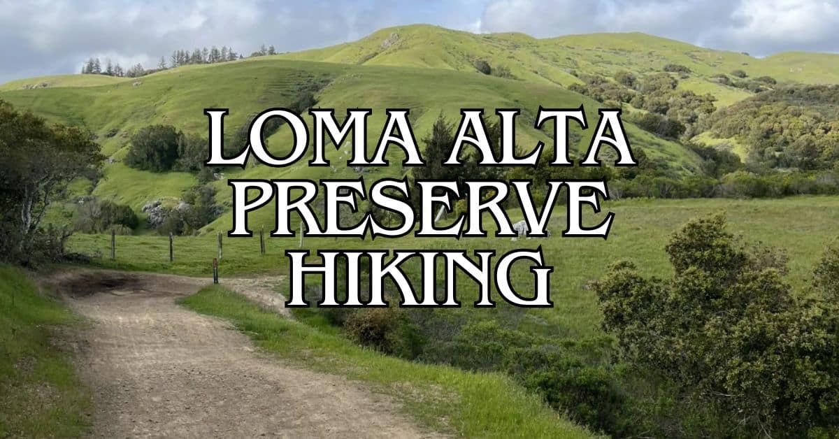
Loma Alta Open Space Preserve offers some of the best hiking trails in Marin County, California. This hidden gem boasts stunning views and diverse landscapes.
Loma Alta’s five top trails give you a mix of challenging climbs and easy walks, perfect for hikers of all skill levels.
Get a discount of 15% to 70% on accommodation in Marin County! Look for deals here:
Marin County Hotels, Apartments, B&Bs
The preserve sits on a high ridge, giving you amazing views of the Bay Area. You’ll see rolling hills, oak woodlands, and grasslands as you hike.
Each trail in Loma Alta has its own unique features to explore.
Whether you want a quick nature walk or a longer adventure, Loma Alta has a trail for you.
The Oak Manor, Smith Ridge, Sunrise and Old Railroad Grade Loop offers a good mix of terrain and views.
For a more challenging hike, try the White Hill Fire Road. Both trails showcase the beauty of this special place.
1. Oak Manor, Smith Ridge, Sunrise and Old Railroad Grade Loop
The Oak Manor, Smith Ridge, Sunrise and Old Railroad Grade Loop offers a diverse hiking experience with stunning views and varied terrain.
This trail combines scenic vistas, shaded woodlands, and historical elements.
Difficulty
This loop trail is rated as moderate. You’ll encounter some steep sections and uneven terrain.
The trail includes both fire roads and single-track paths. Proper footwear is essential for navigating rocky areas and potential muddy spots after rain.
Length and Estimated Time
The loop is 5.1 miles long. Most hikers complete it in 2-3 hours.
Your pace may vary based on fitness level and how often you stop to enjoy the views or take photos. Plan for extra time if you want to have a picnic or explore side trails.
Key Features
- Panoramic views of San Francisco Bay
- Old-growth oak and bay laurel forests
- Historical railroad grade sections
- Wildflower displays in spring
- Wildlife viewing opportunities
You’ll experience 360-degree views from several points along Smith Ridge.
The trail passes through diverse ecosystems, from grasslands to dense forests.
Keep an eye out for deer, birds, and other local wildlife.
Best Times to Visit
Spring and fall offer the most pleasant hiking conditions.
Wildflowers bloom in spring, while fall brings cooler temperatures and clear skies.
Summer can be hot on exposed sections, so start early. Winter hikes can be muddy but offer lush green landscapes.
Weekday mornings are ideal for a quieter experience. Weekends can be busier, especially on sunny days.
Parking
A small parking area is available at the Oak Manor trailhead. It can fill up quickly on weekends.
Arrive early to secure a spot. Street parking is limited in the nearby residential area. Be respectful of local residents and obey all parking signs.
Safety Tips
- Carry plenty of water, especially on hot days
- Wear sun protection – parts of the trail are exposed
- Check for ticks after your hike
- Be aware of poison oak along narrow sections
- Watch for mountain bikers on shared trail segments
- Tell someone your hiking plans before you go
Stay on marked trails to avoid getting lost and to protect sensitive habitats.
Historical Notes
The Old Railroad Grade section follows the path of a former narrow-gauge railroad.
This railway once transported lumber from Mount Tamalpais to Mill Valley in the early 1900s. You can still see remnants of this history along the trail.
Amenities
There are no restrooms or water fountains on the trail. The nearest facilities are in nearby parks or towns.
Pack out all trash as there are no garbage bins along the route. Bring all necessary supplies with you, including water and snacks.
Usage Information
The trail is open to hikers, runners, and mountain bikers. Dogs are allowed on leash.
Be prepared to share the trail, especially on weekends. Yield to uphill traffic and step aside for faster users.
The trail can be muddy after rain, so check conditions before you go.
Trail Connections
This loop connects to several other trails in Loma Alta Open Space Preserve.
You can extend your hike by linking to the Bay Area Ridge Trail or exploring nearby fire roads.
The Smith Ridge Fire Road offers options for longer hikes or connecting to adjacent preserves.
2. White Hill Fire Road
White Hill Fire Road offers a challenging hike with stunning views of Marin County. This trail provides a mix of steep climbs and scenic vistas, making it popular among hikers and mountain bikers alike.
Difficulty
The White Hill Fire Road is considered moderately challenging.
You’ll encounter some steep sections and uneven terrain. The trail can be rocky in places, so good hiking shoes are essential.
Elevation gain is significant, which adds to the difficulty. Be prepared for a workout, especially if you’re not used to hilly terrain.
Length and Estimated Time
The trail is 6.5 miles out-and-back. You can expect to spend about 3 hours and 11 minutes completing the full route.
This time estimate can vary based on your fitness level and how often you stop to rest or take in the views. Plan for extra time if you want to enjoy a leisurely pace.
Key Features
White Hill Fire Road boasts panoramic views of the surrounding landscape. On clear days, you can see for miles across Marin County.
The trail passes through diverse habitats, including:
- Open grasslands
- Oak woodlands
- Chaparral
Wildlife spotting opportunities are plentiful. Keep an eye out for deer, birds, and smaller critters along the way.
Best Times to Visit
Spring and fall offer the most pleasant hiking conditions.
Wildflowers bloom in spring, adding color to the landscape.
Summer can be hot, so start early to avoid the midday heat. Winter hikes can be muddy after rain, but offer lush green views.
Weekday mornings tend to be less crowded if you prefer a quieter experience.
Parking
Parking is available at the trailhead off Sir Francis Drake Boulevard. The lot is small, so arrive early on weekends to secure a spot.
Overflow parking can sometimes be found along the road, but be careful not to block traffic or private driveways.
Safety Tips
- Bring plenty of water, especially on hot days
- Wear sunscreen and a hat – much of the trail is exposed
- Watch for poison oak along the sides of the trail
- Be aware of mountain bikers sharing the trail
- Check the weather forecast before you go
- Tell someone your hiking plans
Historical Notes
White Hill Fire Road was originally an old ranch road used to access grazing lands.
It’s now part of the larger network of trails in the Marin County Open Space District.
The area has a rich history of ranching and agriculture dating back to the 1800s.
Amenities
Amenities are limited on this trail.
There are no restrooms or water fountains along the route.
The nearest facilities are in nearby Fairfax. Plan accordingly and bring everything you need for your hike.
Usage Information
- Dogs are allowed on leash
- Be respectful of other trail users and follow proper trail etiquette
The trail can get busy on weekends, especially with mountain bikers. Stay alert and yield when necessary.
Trail Connections
White Hill Fire Road connects to several other trails in the area:
- Fox Hollow Trail offers a shaded alternative route
- You can link up with trails in the nearby Loma Alta Open Space Preserve
- For a longer hike, connect to the Bay Area Ridge Trail system
3. Old Railroad Grade and Sunrise Fire Road
The Old Railroad Grade and Sunrise Fire Road offers a scenic hike with panoramic views of Marin County. This trail combines historical charm with natural beauty, making it a popular choice for hikers and nature enthusiasts.
Difficulty
This trail is rated as moderately challenging. It has some steep sections and uneven terrain.
The path is well-maintained, but you’ll need good hiking shoes and a moderate fitness level.
Length and Estimated Time
The trail is 2.8 miles long as an out-and-back route. Most hikers complete it in about 1 hour and 45 minutes.
Your pace may vary based on stops for rest or taking in the views.
Key Features
The trail offers stunning vistas of the surrounding hills and valleys. You’ll find:
- Scenic overlooks of Marin County
- Dense oak woodlands
- Wildflower meadows in spring
- Glimpses of San Francisco Bay on clear days
The mix of open fire roads and shaded forest paths adds variety to your hike.
Best Times to Visit
Spring and fall are ideal for this hike.
Spring brings wildflowers and green hillsides. Fall offers mild temperatures and clear skies.
Early mornings are great for avoiding crowds and heat. Winter can be muddy, while summer may be hot on exposed sections.
Parking
Parking is available at the trailhead off Sir Francis Drake Boulevard. The lot is small, so arrive early on weekends.
Overflow parking is along the road, but be careful not to block traffic.
Safety Tips
- Bring plenty of water, especially on hot days
- Wear sturdy hiking boots for uneven terrain
- Use sunscreen and a hat on exposed sections
- Watch for poison oak along the trail edges
- Be aware of your surroundings, as mountain bikers also use this trail
Historical Notes
The Old Railroad Grade follows the path of a former narrow-gauge railway.
This railway once connected Mill Valley to the summit of Mount Tamalpais in the early 1900s.
The trail preserves this piece of local history while offering a unique hiking experience.
Amenities
- No restrooms at the trailhead
- Bring your own water as there are no fountains
- A few benches along the trail provide resting spots
- No trash cans, so pack out what you bring in
Usage Information
- Dogs are allowed on leash
- The trail is shared with mountain bikers, so stay alert
- Horses are not permitted on this trail
- The wide fire road sections are great for group hikes
Trail Connections
This trail connects to several others in Loma Alta Open Space Preserve:
- Oak Manor, Smith Ridge, Sunrise and Old Railroad Grade Loop for a longer hike
- Sunrise Fire Road leads to higher elevations and more views
- Glen Fire Road offers additional exploration options
You can extend your hike by combining these trails for a full day of adventure.
4. White Hill to 680 Trail
The White Hill to 680 Trail offers a challenging hike with stunning views of Marin County. This trail provides a mix of shaded forest and open ridgelines, making it a great choice for experienced hikers looking for a workout.
Difficulty
The White Hill to 680 Trail is rated as moderately challenging. It has steep sections and uneven terrain.
You’ll need good physical fitness and hiking experience to enjoy this trail. Wear sturdy hiking boots and bring trekking poles for extra stability.
Length and Estimated Time
The trail is a 10.4-mile loop. Most hikers complete it in about 5 to 6 hours.
Plan for a full day on the trail, including breaks for rest and taking in the views. Start early to give yourself plenty of time to finish before dark.
Key Features
The trail offers panoramic views of the Bay Area. You’ll see rolling hills, dense forests, and on clear days, the San Francisco skyline. Wildlife sightings are common, including deer and various bird species.
The trail passes through diverse ecosystems. You’ll hike through oak woodlands, grasslands, and chaparral. Wildflowers bloom in spring, adding splashes of color to the landscape.
Best Times to Visit
Spring and fall are ideal for hiking this trail. In spring, you’ll enjoy mild temperatures and wildflower displays.
Fall brings crisp air and clear skies, perfect for long-distance views.
Summer can be hot on exposed sections of the trail. If hiking in summer, start early to beat the heat. Winter can be muddy and slippery, so use caution if hiking during the rainy season.
Parking
Parking is available at the White Hill Open Space Preserve trailhead. The lot is small and fills up quickly on weekends.
Arrive early to secure a spot. There’s no fee for parking.
If the main lot is full, limited street parking is available nearby. Be respectful of local residents and don’t block driveways.
Safety Tips
Bring plenty of water, at least 2-3 liters per person. There are no water sources on the trail.
Wear sun protection, including sunscreen, a hat, and sunglasses. Many sections of the trail are exposed with little shade.
Check the weather forecast before you go. Fog can roll in quickly, reducing visibility.
Tell someone your hiking plans and expected return time. Cell phone coverage can be spotty in some areas.
Historical Notes
The trail follows old fire roads and ranch paths. It offers glimpses into Marin County’s ranching history. Look for remnants of old fences and the occasional rusted farm equipment along the way.
Native American tribes, including the Coast Miwok, once inhabited this area. Respect any archaeological sites you may encounter.
Amenities
There are no restrooms or water fountains on the trail. Use facilities at nearby parks before starting your hike.
A small information kiosk at the trailhead provides a map and basic trail information. Take a photo of the map on your phone for reference.
Usage Information
The trail is open to hikers, mountain bikers, and equestrians. Be alert and share the trail.
Hikers should yield to horses, and bikers should yield to both hikers and horses.
Dogs are allowed on leash. Bring waste bags and pack out all pet waste.
The trail can get busy on weekends. For a quieter experience, try hiking on weekdays.
Trail Connections
The White Hill to 680 Trail connects to several other trails in the area. You can extend your hike by linking up with the Bay Area Ridge Trail or the Old Railroad Grade Trail.
For a shorter option, you can turn back at any point to create an out-and-back hike. The trail is well-marked with signage at major junctions.
5. Tamarancho via Glen Fire Road
Tamarancho via Glen Fire Road offers a challenging and exciting hiking experience. This trail combines scenic views, technical sections, and a taste of mountain biking history.
Difficulty
The Tamarancho via Glen Fire Road trail is rated as moderately challenging. It features steep climbs, rocky terrain, and some technical sections.
Hikers should be in good physical condition and have some experience with more difficult trails.
This route is not recommended for beginners or those with limited mobility. Sturdy hiking boots with good ankle support are essential for navigating the uneven ground and loose rocks.
Length and Estimated Time
The trail is a 7.5-mile loop. Most hikers take about 3 hours and 22 minutes to complete the full route.
This time can vary based on your fitness level and how often you stop to rest or enjoy the views.
Plan to spend at least half a day on this hike. Bring plenty of water and snacks to keep your energy up throughout the journey.
Key Features
Tamarancho via Glen Fire Road offers a mix of challenging terrain and beautiful scenery. You’ll encounter:
- Rock gardens that test your footing
- Tight switchbacks winding through the landscape
- Groves of majestic redwood trees
- Panoramic views of the surrounding hills
- Technical sections that add excitement to your hike
The trail passes through Camp Tamarancho, operated by the Marin Council and Boy Scouts of America. This adds an interesting historical element to your hike.
Best Times to Visit
Spring and fall are ideal for hiking Tamarancho via Glen Fire Road. The weather is mild, and wildflowers bloom in spring.
Summer can be hot, so start early if hiking then. Avoid rainy days, as the trail can become slippery and dangerous. Winter hikes are possible but be prepared for muddy conditions and check trail status before going.
Parking
Parking for Tamarancho via Glen Fire Road is limited. Arrive early to secure a spot, especially on weekends and holidays.
Respect local residents by not blocking driveways or parking in unauthorized areas.
Consider carpooling or using a ride-sharing service to reduce parking pressure. Always lock your vehicle and don’t leave valuables visible.
Safety Tips
- Carry plenty of water, at least 2 liters per person
- Wear sturdy hiking boots with good traction
- Bring a map or download a trail app for navigation
- Tell someone your hiking plans before you go
- Watch for poison oak along the trail
- Be aware of mountain bikers sharing the trail
- Stay on designated paths to avoid erosion and protect plant life
Historical Notes
Tamarancho is located in the birthplace of mountain biking. The area played a key role in developing this sport in the 1970s.
As you hike, you’re walking through a piece of cycling history.
Camp Tamarancho, which the trail passes through, has been a Boy Scout camp since 1945. It offers a glimpse into outdoor education and scouting traditions in Marin County.
Amenities
Amenities on Tamarancho via Glen Fire Road are limited. There are no restrooms or water sources along the trail. Plan accordingly and bring all necessary supplies with you.
The nearby town of Fairfax offers restaurants, shops, and public restrooms. Consider stopping there before or after your hike for any last-minute needs.
Usage Information
Tamarancho via Glen Fire Road is popular with both hikers and mountain bikers. Be prepared to share the trail and follow proper etiquette:
- Yield to uphill traffic
- Step aside when you hear or see bikers approaching
- Keep dogs on leash and clean up after them
- Stay on designated trails to protect the environment
The trail is open year-round, but conditions can vary with the seasons. Check recent trail reports for current information before your hike.
Trail Connections
Tamarancho via Glen Fire Road connects to other trails in the area, allowing for longer hikes or different route options. Some connecting trails include:
- Serpentine Trail
- B-17 Trail
- Endor Flow Trail
These connections offer opportunities to extend your hike or create loop options. Always check trail maps and your fitness level before attempting longer routes.
Loma Alta Preserve Local Regulations and Trail Etiquette
When you visit Loma Alta Open Space Preserve, it’s important to follow the rules and be a good trail user. Here are some key guidelines to keep in mind:
• Hours: The preserve is open from sunrise to sunset. Plan your hikes accordingly.
• Pets: Dogs are allowed on leash. Remember to clean up after your pet.
• Bikes: Mountain biking is permitted on fire roads only. Yield to hikers and horses.
• Stay on trail: Stick to marked paths to protect plants and prevent erosion.
• Wildlife: Don’t feed or disturb animals. Keep a safe distance from all wildlife.
• Fire safety: No smoking or fires allowed in the preserve.
Trail etiquette helps everyone enjoy the outdoors:
• Yield to horses and uphill hikers.
• Use headphones if listening to music.
• Don’t block the trail when stopping.
• Pack out all trash, including food scraps.
Be prepared for your hike on the White Hill Fire Road or other trails:
• Bring water and snacks.
• Wear proper footwear and sun protection.
• Check the weather forecast before you go.
• Tell someone your plans.
Getting to Loma Alta Preserve
Loma Alta Open Space Preserve is easily accessible from several nearby towns in Marin County. You have multiple options for reaching this beautiful hiking destination, whether you prefer driving or using public transportation.
By Car
Driving to Loma Alta Preserve is straightforward. From Fairfax, take Sir Francis Drake Boulevard west for about 2 miles.
Turn right onto Glen Drive and continue for approximately 1 mile until you reach the preserve entrance.
If you’re coming from San Rafael, head west on Sir Francis Drake Boulevard for about 5 miles before turning right onto Glen Drive.
From Lucas Valley, take Lucas Valley Road west, then turn left onto Nicasio Valley Road.
Continue south until you reach Sir Francis Drake Boulevard, then follow the directions from Fairfax.
Public Transportation
Marin Transit offers bus services that can get you close to Loma Alta Preserve.
Take Route 68 from San Rafael Transit Center to Fairfax. Get off at the stop near Sir Francis Drake Boulevard and Glen Drive.
From there, you’ll need to walk about 1 mile up Glen Drive to reach the preserve entrance.
This option requires some extra hiking, but it’s a great way to warm up before hitting the trails.
Parking Information
Loma Alta Preserve has limited parking available at the main entrance off Glen Drive. The lot is small, so arrive early on weekends and holidays to secure a spot.
If the main lot is full, you can find additional parking along Glen Drive.
Be sure to park safely off the road and avoid blocking driveways or fire lanes.
For longer hikes, consider carpooling or using a ride-sharing service to reduce parking congestion.
This helps preserve the natural beauty of the area and ensures everyone can enjoy the Oak Manor, Smith Ridge trails.
Remember to lock your vehicle and don’t leave valuables in sight. The preserve is generally safe, but it’s always better to take precautions.
Preparing for Your Hike
Before hitting the trails in Loma Alta Open Space Preserve, it’s crucial to get ready.
Proper gear, weather awareness, and fitness preparation are key to a safe and fun hike.
Essential Gear
Packing the right gear is vital for your Loma Alta hike. Here’s what you need:
- Sturdy hiking boots with good traction
- Comfortable, moisture-wicking clothes
- A backpack to carry supplies
- Plenty of water (at least 2 liters per person)
- Snacks and energy bars
- Sun protection (hat, sunscreen, sunglasses)
- First-aid kit
- Map and compass (or GPS device)
- Flashlight or headlamp with extra batteries
Don’t forget a fully charged phone for emergencies. Consider trekking poles for steep sections on trails like the Oak Manor, Smith Ridge, Sunrise and Old Railroad Grade Loop.
Weather Considerations
Loma Alta’s weather can change quickly, affecting your hiking experience. Keep these points in mind:
- Check the forecast before you go
- Dress in layers to adjust to temperature changes
- Bring a light rain jacket, even on sunny days
- Be prepared for fog, especially in the mornings
Summer can be hot and dry. Carry extra water and start early to avoid the midday heat. Winter brings cooler temperatures and occasional rain. Trails may be muddy, so waterproof boots are a good idea.
Fitness Levels
Loma Alta trails vary in difficulty, so consider your fitness level when choosing a route.
- Beginners: Start with shorter, flatter trails like parts of the White Hill Fire Road
- Intermediate: Try the Old Railroad Grade and Sunrise Fire Road for a moderate challenge
- Advanced: Take on the full Oak Manor, Smith Ridge, Sunrise and Old Railroad Grade Loop for a more strenuous hike
Build up your endurance before tackling longer trails. Start with shorter hikes and gradually increase distance and elevation gain. Always listen to your body and turn back if you feel overwhelmed.
Wildlife and Plant Life in Loma Alta Preserve
Loma Alta Preserve is home to a diverse array of wildlife and plant species. You’ll find a mix of open grasslands and wooded areas that provide habitat for many animals.
Keep an eye out for deer, coyotes, and rabbits as you hike the trails. Birdwatchers can spot hawks, turkey vultures, and various songbirds.
The preserve’s plant life is equally varied. In spring, wildflowers bloom across the grasslands. Oak trees dot the landscape, offering shade and acorns for wildlife.
Loma Alta’s ecosystems are part of important local watersheds. These areas help filter rainwater and support the health of nearby creeks.
As you explore, you might catch glimpses of Nicasio Creek, which flows near the preserve. This waterway is vital for local wildlife and plants.
The preserve includes one of Marin County’s highest peaks. From here, you can see how the different plant communities blend together across the landscape.
Remember to stay on marked trails to protect the delicate ecosystems. By doing so, you help preserve Loma Alta’s natural beauty for future visitors to enjoy.
Photography Tips for Loma Alta Preserve
Loma Alta Preserve offers great photo opportunities. Here are some tips to help you capture its beauty:
Best times for photos:
- Early morning: Soft light and less crowds
- Late afternoon: Golden hour lighting
- Foggy days: Moody, atmospheric shots
Gear to bring:
- Wide-angle lens: For sweeping views
- Macro lens: For wildflower close-ups
- Tripod: For steady shots in low light
- Polarizing filter: To reduce glare and enhance colors
When hiking the Oak Manor, Smith Ridge, Sunrise and Old Railroad Grade Loop, look for panoramic views at the summit. This spot is perfect for landscape shots.
The White Hill Fire Road offers open grasslands. Try using leading lines in your compositions here.
For wildlife photos, move slowly and quietly. Use a zoom lens to avoid disturbing animals. Spring is great for wildflower shots on many trails.
Remember to protect the environment:
- Stay on marked trails
- Don’t pick flowers or move natural objects
- Keep a safe distance from wildlife
Bring extra batteries and memory cards. The preserve’s beauty might inspire more photos than you expect!
Family-Friendly Options for Hiking Loma Alta Preserve
Loma Alta Preserve offers great trails for families with kids. You’ll find paths that are fun and safe for little hikers.
The Oak Manor, Smith Ridge, Sunrise and Old Railroad Grade Loop is a top pick for families. It’s 5.1 miles long with nice views. The trail is rated as moderate, so it’s good for older kids and active families.
For an easier hike, try the Old Railroad Grade and Sunrise Fire Road. This trail is shorter and has a gentler slope. Kids can learn about old trains while enjoying nature.
Here are some tips for hiking with kids in Loma Alta:
- Bring plenty of water and snacks
- Wear sunscreen and hats
- Start early to avoid hot afternoon sun
- Take frequent breaks
- Point out plants and wildlife to keep kids engaged
Remember to stay on marked trails and respect nature. Teach your kids about Leave No Trace principles as you hike.
Loma Alta trails can be rocky in spots. Make sure everyone wears sturdy shoes with good grip. Watch your step and help younger children on uneven ground.
Before you go, check the trail conditions online. This helps you pick the best trail for your family’s skill level.
Accessibility Information
Loma Alta Preserve offers trails with varying levels of accessibility. Here’s what you need to know:
• Terrain: Most trails in the preserve are fire roads. These wide, unpaved paths are generally flat but can have some uneven sections.
• Difficulty: Trail difficulty ranges from easy to moderate. The Oak Manor, Smith Ridge, Sunrise and Old Railroad Grade Loop is considered intermediate.
• Parking: Limited accessible parking is available at trailheads. Arrive early to secure a spot, especially on weekends.
• Facilities: Restrooms at trailheads may not be fully accessible. Plan accordingly before starting your hike.
• Trail surfaces: Most trails are dirt or gravel. They can become muddy and slippery after rain.
• Signage: Trail markers and informational signs are present but may be limited in some areas.
• Assistance: The preserve does not offer guided tours or mobility equipment rentals.
• Weather: Trails can be hot and exposed in summer. Bring sun protection and water.
• Elevation changes: Some trails have steep sections. Check trail profiles before deciding which path to take.
Local Resources
Loma Alta Open Space Preserve offers various resources to help you make the most of your visit. From visitor centers to emergency contacts and useful digital tools, you’ll find everything you need for a safe and enjoyable hiking experience.
Visitor Centers
The Marin County Parks office serves as the main information hub for Loma Alta Open Space Preserve. It’s located in San Rafael and provides maps, trail guides, and up-to-date information on trail conditions.
Staff members can answer your questions about the preserve and offer tips for your hike.
The office is open on weekdays from 9 AM to 5 PM.
There’s also a small information kiosk at the main trailhead. It displays a map of the preserve and important notices about trail closures or wildlife sightings.
Emergency Contacts
In case of emergencies while hiking in Loma Alta Open Space Preserve, it’s crucial to have the right contacts on hand.
For immediate assistance, dial 911. The local emergency services are familiar with the preserve and can respond quickly.
For non-emergency issues, contact the Marin County Sheriff’s Office at (415) 473-7250.
They can help with lost items, minor injuries, or reporting suspicious activity.
Park rangers are available during daylight hours. Their number is (415) 473-2816. They can assist with trail information and minor emergencies.
Useful Websites and Apps
Several digital resources can enhance your hiking experience in Loma Alta Open Space Preserve.
The Marin County Parks website provides up-to-date information on trail conditions, closures, and events.
It’s a must-check before your visit.
AllTrails is an essential app for hikers.
It offers detailed trail information for popular routes like the Oak Manor, Smith Ridge, Sunrise and Old Railroad Grade Loop and the White Hill Fire Road.
The Marin Transit app can help you plan your journey if you’re using public transportation to reach the preserve.
Weather apps like Weather Underground or AccuWeather provide accurate local forecasts, which are crucial for planning your hike safely.
Get a discount of 15% to 70% on accommodation in Marin County! Look for deals here:
Marin County Hotels, Apartments, B&Bs
5 Best Hiking Trails in Angel Island State Park – Terrain, Difficulty, Accessibility, and Trail Features
5 Best Hiking Trails in Baltimore Canyon Preserve – Terrain, Difficulty, Accessibility, and Trail Features
5 Best Hiking Trails in Belvedere and Tiburon – Terrain, Difficulty, Accessibility, and Trail Features
5 Best Hiking Trails in Blithedale Summit Preserve – Terrain, Difficulty, Accessibility, and Trail Features
5 Best Hiking Trails in Cascade Canyon Preserve – Terrain, Difficulty, Accessibility, and Trail Features
5 Best Hiking Trails in China Camp State Park – Terrain, Difficulty, Accessibility, and Trail Features
5 Best Hiking Trails in Fairfax – Terrain, Difficulty, Accessibility, and Trail Features
5 Best Hiking Trails in Golden Gate National Recreation Area – Terrain, Difficulty, Accessibility, and Trail Features
5 Best Hiking Trails in Indian Tree Open Space Preserve – Terrain, Difficulty, Accessibility, and Trail Features
5 Best Hiking Trails in Kentfield, Greenbrae, and Ross – Terrain, Difficulty, Accessibility, and Trail Features
5 Best Hiking Trails in Larkspur and Corte Madera – Terrain, Difficulty, Accessibility, and Trail Features
5 Best Hiking Trails in Loma Alta Preserve – Terrain, Difficulty, Accessibility, and Trail Features
5 Best Hiking Trails in Marin Headlands – Terrain, Difficulty, Accessibility, and Trail Features
5 Best Hiking Trails in Mill Valley – Terrain, Difficulty, Accessibility, and Trail Features
5 Best Hiking Trails in Mount Burdell Preserve – Terrain, Difficulty, Accessibility, and Trail Features
5 Best Hiking Trails in Mount Tamalpais State Park – Terrain, Difficulty, Accessibility, and Trail Features
5 Best Hiking Trails in Muir Woods National Monument – Terrain, Difficulty, Accessibility, and Trail Features
5 Best Hiking Trails in Novato – Terrain, Difficulty, Accessibility, and Trail Features
5 Best Hiking Trails in Olompali State Historical Park – Terrain, Difficulty, Accessibility, and Trail Features
5 Best Hiking Trails in Point Reyes National Seashore – Terrain, Difficulty, Accessibility, and Trail Features
5 Best Hiking Trails in Samuel P. Taylor State Park – Terrain, Difficulty, Accessibility, and Trail Features
5 Best Hiking Trails in San Anselmo – Terrain, Difficulty, Accessibility, and Trail Features
5 Best Hiking Trails in San Rafael – Terrain, Difficulty, Accessibility, and Trail Features
5 Best Hiking Trails in Sausalito and Marin City – Terrain, Difficulty, Accessibility, and Trail Features
5 Best Hiking Trails in West Marin – Terrain, Difficulty, Accessibility, and Trail Features


