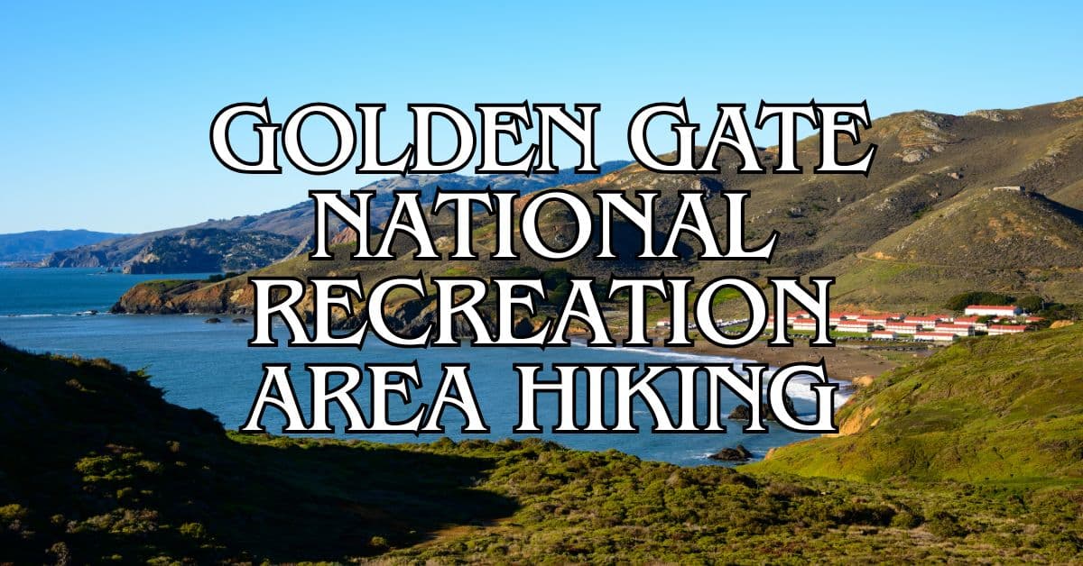
Belvedere and Tiburon offer some of the most scenic hiking trails in California. These coastal towns boast stunning views of the San Francisco Bay and surrounding hills.
The top 5 hiking trails in Belvedere Tiburon range from easy waterfront walks to challenging island loops.
Get a discount of 15% to 70% on accommodation in Marin County! Look for deals here:
Marin County Hotels, Apartments, B&Bs
You’ll find options for all skill levels here.
The trails wind through diverse landscapes, from eucalyptus groves to open grasslands.
Many routes offer panoramic vistas of the Golden Gate Bridge, Angel Island, and San Francisco skyline.
Before you hit the trails, make sure to bring plenty of water and sun protection. The weather can change quickly, so dress in layers.
Now let’s explore some of the best hikes this beautiful area has to offer.
1. North Ridge And Sunset Loop
The North Ridge and Sunset Loop offers stunning views of San Francisco Bay and a mix of terrains. This popular trail on Angel Island combines scenic vistas with historical sites.
Difficulty
This trail is rated as moderately challenging. It has some steep sections and uneven terrain.
The elevation gain is about 740 feet. Hikers should be in good physical condition and wear sturdy shoes.
Length And Estimated Time
The loop is 5.1 miles long. Most hikers complete it in 2 to 3 hours.
Your pace may vary based on fitness level and how often you stop to enjoy the views or take photos.
Key Features
- Panoramic views of San Francisco Bay
- Eucalyptus groves
- Historic military buildings
- Beach access
- Wildlife viewing opportunities
You’ll see landmarks like Alcatraz, the Golden Gate Bridge, and the San Francisco skyline. The trail passes through diverse habitats including grasslands and forests.
Best Times To Visit
Spring and fall offer mild temperatures and clear skies. Wildflowers bloom in spring. Fall brings golden grasses and crisp air.
Summer can be foggy but usually clears by midday. Winter has fewer crowds but can be rainy.
Weekdays are less crowded than weekends. Early mornings provide the best chance for clear views before fog rolls in.
Parking
There’s no parking on Angel Island. You must take a ferry from Tiburon or San Francisco.
The Tiburon ferry is closer and runs more frequently. Arrive at the ferry terminal early to secure a spot, especially on weekends.
Safety Tips
- Bring plenty of water and snacks
- Wear layers for changing weather
- Use sunscreen and a hat
- Stay on marked trails
- Be aware of poison oak along the trail
- Watch for bikes on shared sections
Cell phone coverage can be spotty. Let someone know your hiking plans before you go.
Historical Notes
Angel Island has a rich history. It served as an immigration station from 1910 to 1940. During World War II, it was a POW processing center.
You’ll pass old military buildings and gun emplacements on your hike.
The island was also home to Coast Miwok people for thousands of years before European contact.
Amenities
- Restrooms at the ferry landing and Ayala Cove
- Picnic areas with tables
- Water fountains at main visitor areas
- A small cafe at Ayala Cove (seasonal hours)
There are no trash cans on the trails. Pack out all your garbage.
Usage Information
- Dogs are not allowed on Angel Island
- Bikes can use the perimeter road but not single-track trails
- The trail is popular for hiking and running
- Swimming is allowed at designated beaches
Trail Connections
The North Ridge and Sunset Loop connects to other trails on Angel Island. You can extend your hike to include:
- Mount Livermore Trail for a higher viewpoint
- Perimeter Road for a longer, flatter option
- Sunset Trail for more coastal views
You can create various loop combinations based on your preferences and time constraints.
2. Angel Island Perimeter Loop
The Angel Island Perimeter Loop offers stunning views of San Francisco Bay. This popular trail circles Angel Island State Park, providing a mix of natural beauty and historical sites.
Difficulty
The trail is rated as moderately challenging. It has some elevation changes but is mostly flat. Most hikers with average fitness can complete this loop.
The path is well-maintained and clearly marked. Some sections have steep drop-offs, so watch your step.
Length And Estimated Time
The loop is about 6 miles long. Most hikers finish in 2 to 3 hours.
Your pace may vary based on how often you stop for views or to explore historical sites. Plan for extra time if you want to take lots of photos or have a picnic.
Key Features
Angel Island Perimeter Loop showcases the best of the bay. You’ll see panoramic views of:
- San Francisco skyline
- Golden Gate Bridge
- Bay Bridge
- Alcatraz Island
- Marin County hills
The trail passes through diverse landscapes. You’ll walk through:
- Eucalyptus groves
- Sandy beaches
- Rocky shores
- Grasslands
Historical sites dot the path. Look for old military buildings and immigration station ruins.
Best Times To Visit
Spring and fall offer the best weather for hiking. Wildflowers bloom in spring, adding color to the landscape.
Summer can be foggy, especially in the mornings. The fog often clears by afternoon, revealing spectacular views.
Winter brings clearer skies but can be chilly and rainy. Dress in layers and check the weather before you go.
Weekdays are less crowded than weekends. Early mornings or late afternoons provide great lighting for photos.
Parking
There’s no parking on Angel Island. You must take a ferry to reach the island.
Ferries depart from:
- Tiburon
- San Francisco
- Oakland/Alameda (seasonal)
Check ferry schedules in advance. Arrive early to ensure you get a spot, especially on weekends.
Safety Tips
Stay on marked trails to protect the environment and avoid hazards.
Bring plenty of water. There are few water sources on the trail.
Wear sunscreen and a hat. Many sections of the trail have little shade.
Watch for poison oak along the trail edges.
Be aware of your surroundings. Some trail sections have steep drop-offs.
Check the weather forecast. Fog can roll in quickly, reducing visibility.
Historical Notes
Angel Island has a rich history. It served as:
- A fishing and hunting site for Coast Miwok people
- An immigration station from 1910 to 1940
- A military base during several wars
Look for informational plaques along the trail. They provide details about the island’s past.
The Immigration Station museum is worth a visit. It tells the stories of immigrants who passed through Angel Island.
Amenities
Restrooms are available at several points along the trail.
There’s a visitor center near the ferry dock. It offers exhibits and trail maps.
A small café near the dock sells snacks and drinks.
Picnic areas with tables are scattered around the island.
Usage Information
The trail is open to hikers and cyclists.
Dogs are not allowed on Angel Island to protect wildlife.
Bikes can be rented on the island or brought on the ferry for an extra fee.
The trail can get busy on weekends and holidays. Start early for a quieter experience.
Trail Connections
The Perimeter Loop connects to several other trails on Angel Island:
- North Ridge Trail leads to Mount Livermore, the island’s highest point
- Fire Road offers a more direct route across the island
- Sunset Trail provides an alternate route with different views
You can combine these trails for a longer hike or to explore more of the island.
3. Mount Caroline Livermore Via North Ridge Trail
The Mount Caroline Livermore via North Ridge Trail offers a rewarding hike with stunning views of San Francisco Bay. This popular trail takes you to the highest point on Angel Island, providing a unique hiking experience.
Difficulty
The trail is rated as moderately challenging. It has some steep sections and uneven terrain.
The elevation gain is about 790 feet. This climb can be tiring, especially on hot days. Make sure to pace yourself and take breaks as needed.
Length And Estimated Time
The trail is approximately 4 miles out and back. Most hikers complete the round trip in about 2 hours.
Your hiking speed may vary based on fitness level and how often you stop for breaks or photos. Allow extra time if you want to enjoy the views from the summit.
Key Features
The North Ridge Trail offers panoramic views of San Francisco Bay. As you climb, you’ll see the Golden Gate Bridge, Alcatraz, and the city skyline.
The trail passes through diverse landscapes. You’ll walk through grassy meadows, wooded areas, and rocky outcrops.
At the summit, you’ll find a small monument marking the highest point. This spot provides 360-degree views of the surrounding bay and islands.
Best Times To Visit
Spring and fall are ideal for this hike. Temperatures are mild, and wildflowers often bloom in spring.
Summer can be hot, so start early if hiking then. Winter can be chilly and rainy, but offers clear views on sunny days.
Weekdays are less crowded than weekends. Early mornings or late afternoons provide good lighting for photos.
Parking
There’s no parking on Angel Island. You must take a ferry to reach the island.
Ferries depart from San Francisco, Tiburon, and Alameda/Oakland. Check ferry schedules in advance.
Once on the island, follow signs to the North Ridge Trail. It starts near Ayala Cove, where ferries dock.
Safety Tips
- Bring plenty of water. There are no water sources along the trail.
- Wear sturdy hiking shoes. The trail can be rocky and uneven in places.
- Use sunscreen and wear a hat. Many sections of the trail are exposed.
- Check the weather forecast. Fog can roll in quickly, reducing visibility.
- Stay on marked trails to protect the natural environment.
- Be aware of poison oak, which grows in some areas along the trail.
Historical Notes
Mount Caroline Livermore is named after Caroline Sealy Livermore, a conservationist. She played a key role in preserving Angel Island as a state park in the 1950s.
The island has a rich history. It served as an immigration station, military base, and quarantine station. You might spot old military buildings along your hike.
Amenities
There are restrooms and a visitor center at Ayala Cove, where ferries arrive. No facilities are available along the trail itself.
A small cafe at Ayala Cove offers food and drinks. It’s a good spot to grab refreshments before or after your hike.
Picnic areas are available near the cove. Consider packing a lunch to enjoy with bay views.
Usage Information
The trail is open to hikers only. No bikes or motorized vehicles are allowed.
Dogs are not permitted on Angel Island to protect the natural habitat.
The trail can get busy on weekends and holidays. Start early for a quieter experience.
Trail Connections
The North Ridge Trail connects with other paths on Angel Island. You can extend your hike by linking to the Sunset Trail or Perimeter Road.
For a longer adventure, consider the North Ridge and Sunset Loop. This 5.9-mile loop offers varied terrain and views.
If you have time, the Angel Island Perimeter Loop is a great way to see the whole island. It’s 5.5 miles and circles the entire coastline.
4. Old Saint Hilarys And Uplands Preserve
The Old Saint Hilarys and Uplands Preserve offers a short but rewarding hike with stunning bay views and seasonal wildflowers. This loop trail combines natural beauty with historical significance in Tiburon.
Difficulty
This trail is rated as moderately challenging. The terrain includes some steep and uneven sections that require careful footing. Sturdy hiking shoes are recommended.
The elevation gain is about 200 feet, providing a good workout without being too strenuous for most hikers. Beginners in good shape can handle it, while experienced hikers will enjoy the quick climb.
Length And Estimated Time
The loop trail is approximately 1 mile long. Most hikers complete it in about 44 minutes.
This makes it a perfect option for a quick nature escape or as part of a longer day exploring Tiburon. You can easily extend your hike by combining it with nearby trails.
Key Features
Old Saint Hilarys Preserve boasts diverse flora and fauna. In spring, the hillsides burst with colorful wildflowers, including rare species.
The trail offers panoramic views of San Francisco Bay, Angel Island, and the Golden Gate Bridge. On clear days, you can see the San Francisco skyline.
A historic chapel, built in 1888, sits at the preserve’s entrance. This landmark adds cultural interest to your hike.
The Oakwood Trail section winds through a shaded woodland, providing a contrast to the open grasslands.
Best Times To Visit
Spring (March to May) is ideal for wildflower viewing. The hills come alive with vibrant colors and diverse plant species.
Fall offers pleasant temperatures and clear skies, perfect for enjoying the bay views.
Winter can be muddy after rains but provides a lush green landscape.
Summer tends to be dry and warm, so bring plenty of water and sun protection.
Parking
A small parking area is available at the trailhead on Vistazo Street West. It can fill up quickly on weekends and holidays.
Street parking is available nearby if the lot is full. Be respectful of residential areas and obey all posted signs.
Consider carpooling or using public transportation to reduce parking congestion, especially during peak times.
Safety Tips
- Stay on designated trails to protect sensitive plant species and prevent erosion.
- Watch your footing on steep and uneven sections, especially after rain when trails can be slippery.
- Bring water, even for this short hike. There are no water sources on the trail.
- Wear sun protection. Many sections of the trail are exposed with little shade.
- Be aware of poison oak along the trail edges. Learn to identify and avoid it.
- Check for ticks after your hike, especially if you venture off-trail.
Historical Notes
The preserve is named after Saint Hilary, a 4th-century bishop of Poitiers, France.
The chapel at the preserve entrance was built in 1888 and served Tiburon’s railroad workers.
The land was once slated for development but was preserved through community efforts in the 1970s.
Native American tribes, including the Coast Miwok, inhabited this area for thousands of years before European settlement.
Amenities
There are no restrooms or water fountains on the trail. Plan accordingly before starting your hike.
Benches along the trail provide resting spots and viewpoints.
Interpretive signs offer information about local flora, fauna, and history.
The nearby town of Tiburon offers restaurants and shops for post-hike refreshments.
Usage Information
- Dogs are welcome but must be kept on a leash at all times.
- The trail is popular for bird watching. Bring binoculars to spot local and migratory species.
- Mountain biking is not allowed on this trail to protect the sensitive ecosystem.
- The preserve can get busy on weekends. Visit early in the day or on weekdays for a quieter experience.
Trail Connections
The Old Saint Hilarys trail connects to the Tiburon Uplands Nature Preserve, offering additional hiking options.
You can extend your hike by linking to the Spanish Trail for a longer loop.
The nearby Ring Mountain Preserve provides more challenging hiking opportunities with even more expansive views.
Consider combining this hike with a walk along the Tiburon waterfront for a full day of exploration.
5. Tiburon Waterfront
The Tiburon Waterfront trail offers stunning views of San Francisco Bay and Angel Island. This easy walk takes you along the scenic shoreline, past charming shops and restaurants in downtown Tiburon.
Difficulty
The Tiburon Waterfront trail is rated as easy. It’s a flat, paved path with no steep sections or challenging terrain. This makes it perfect for hikers of all skill levels, including families with young children and those with mobility issues.
Length And Estimated Time
The trail is 5.7 miles out and back. Most hikers complete it in about 1 hour and 45 minutes. You can easily adjust the length by turning around at any point. The flat terrain allows for a comfortable, steady pace throughout the walk.
Key Features
- Panoramic views of San Francisco Bay
- Angel Island State Park visible across the water
- Charming downtown Tiburon with shops and restaurants
- Historic Railroad & Ferry Depot Museum
- Shoreline Park with benches and picnic areas
- Views of sailboats and ferries crossing the bay
The trail’s main draw is its constant waterfront views. You’ll see the San Francisco skyline, Golden Gate Bridge, and Alcatraz Island on clear days.
Best Times To Visit
Spring and fall offer mild temperatures and clear skies. Summer can be foggy in the mornings but often clears by afternoon. Winter brings lush green hills but occasional rain.
Weekdays are less crowded. For the best experience, try an early morning walk to watch the sunrise over the bay. Sunset walks are also popular for the golden light on the water.
Parking
Several parking options are available:
- Main Street: Limited free street parking
- Point Tiburon Plaza: Paid lot near the ferry terminal
- Ark Row: Free lot behind Main Street shops
- Donohue Street: Free parking near Shoreline Park
Arrive early on weekends and holidays, as parking can fill up quickly.
Safety Tips
- Wear sunscreen and a hat, as there’s limited shade on the trail
- Bring water, especially on warm days
- Watch for cyclists sharing the path
- Be cautious of slippery surfaces near the water’s edge after rain
- Stay on designated paths to protect sensitive coastal habitats
Historical Notes
Tiburon was once the southern terminus of the Northwestern Pacific Railroad. The historic Railroad & Ferry Depot Museum showcases this heritage. The waterfront area has been transformed from an industrial zone to a scenic recreational space over the past century.
Amenities
- Public restrooms at Shoreline Park and near the ferry terminal
- Water fountains along the trail
- Benches and picnic tables at regular intervals
- Restaurants and cafes in downtown Tiburon
- Bike racks near major access points
- Information kiosks with trail maps and local history
Usage Information
The trail is popular with walkers, joggers, and cyclists. Leashed dogs are welcome. The wide, paved path allows for easy sharing between different user groups. Be mindful of others and keep to the right when passing.
Trail Connections
The Tiburon Waterfront trail connects to:
- Blackie’s Pasture: A grassy area popular for picnics
- Richardson Bay Lineal Park: Extends the waterfront walk
- Ferry access to Angel Island State Park and San Francisco
You can create longer routes by combining these connected trails for a full day of exploring Tiburon’s shoreline.
Belvedere And Tiburon Local Regulations And Trail Etiquette
When hiking in Belvedere and Tiburon, it’s important to follow local rules and be respectful of nature. Here are some key points to remember:
- Stay on marked trails: This helps protect plants and prevents erosion.
- No littering: Pack out all trash, including food scraps.
- Pets: Dogs must be on leash on most trails. Always clean up after your pet.
- Wildlife: Do not feed or approach animals. Keep a safe distance.
Fire safety is crucial in this area. Smoking and open flames are not allowed on trails. Be extra careful during dry seasons.
Respect other hikers by yielding to those going uphill. If you’re in a group, hike single file when others pass.
Parking can be limited. Use designated areas only and avoid blocking driveways or fire lanes.
Many trails in Belvedere and Tiburon offer views of the Golden Gate Bridge. Remember to stay behind safety barriers when taking photos.
Some trails connect to longer routes in the Marin Headlands. Check trail maps before embarking on longer hikes.
Getting To Belvedere And Tiburon
Belvedere and Tiburon are easily accessible by car and public transportation. You have several options for reaching these charming towns, including a scenic ferry ride from San Francisco.
By Car
You can drive to Belvedere and Tiburon from San Francisco or other parts of the Bay Area. Take Highway 101 north and exit at Tiburon Boulevard/East Blithedale Avenue.
Follow Tiburon Boulevard for about 4 miles until you reach downtown Tiburon.
For Belvedere, continue on Tiburon Boulevard and turn right onto Beach Road.
The drive from San Francisco takes about 30-40 minutes, depending on traffic.
Keep in mind that traffic can be heavy during rush hours, especially on the Golden Gate Bridge. Plan your trip outside peak times if possible.
Public Transportation
The Blue and Gold Ferry offers a scenic and relaxing way to reach Tiburon from San Francisco.
Ferries depart from Pier 41 at Fisherman’s Wharf and arrive at the Tiburon Ferry Terminal.
The ferry ride takes about 30 minutes and offers stunning views of the Bay, Alcatraz, and the Golden Gate Bridge.
Ferries run several times daily, with more frequent service on weekends.
You can also take a bus from San Francisco. Golden Gate Transit operates Route 8, which runs from the San Francisco Financial District to Tiburon via Sausalito.
Parking Information
Parking in Tiburon and Belvedere can be challenging, especially on weekends and during summer months. In Tiburon, you’ll find metered street parking and several public lots.
The Tiburon Boulevard Parking Lot offers all-day parking for a fee. It’s located near the ferry terminal and downtown shops.
In Belvedere, street parking is limited. Some areas have time restrictions, so check signs carefully.
Consider using public transportation or carpooling to reduce parking hassles. If you’re staying overnight, many hotels offer parking for guests.
Preparing For Your Hike
Getting ready for a hike in Belvedere and Tiburon requires careful planning. Proper gear, weather awareness, and fitness considerations are key to a safe and enjoyable experience.
Essential Gear
Packing the right gear is crucial for your Belvedere and Tiburon hikes. Here’s what you need:
- Footwear: Sturdy hiking boots or trail runners with good traction
- Clothing: Moisture-wicking layers, including a waterproof jacket
- Navigation: Map and compass or GPS device
- Water: At least 2 liters per person for longer trails
- Food: Energy bars, trail mix, and sandwiches
- Sun protection: Sunscreen, hat, and sunglasses
- First aid kit: Include basics like bandages and pain relievers
- Backpack: A comfortable daypack to carry your supplies
Don’t forget a fully charged phone for emergencies. Consider trekking poles for steeper trails like the North Ridge and Sunset Loop.
Weather Considerations
Belvedere and Tiburon’s weather can change quickly. Be prepared for various conditions:
- Check the forecast before you go
- Dress in layers to adjust to temperature changes
- Bring extra warm clothing, even on sunny days
- Watch for fog, especially on coastal trails
- Be aware of wind chill, particularly on exposed ridges
- Avoid hiking during extreme heat or heavy rain
Wildlife And Plant Life In Belvedere And Tiburon
Belvedere and Tiburon are home to a rich variety of plants and animals. You’ll find many native species as you explore the area’s hiking trails.
Common animals you might spot include deer, rabbits, and squirrels.
Birdwatchers can enjoy spotting various species along the trails. Keep an eye out for hawks soaring overhead.
The plant life is diverse and beautiful. You’ll see:
- Oak trees
- Bay laurel
- Manzanita
- California poppies
- Lupines
Ring Mountain is a special spot for nature lovers. It’s home to rare plants like the Tiburon mariposa lily. This flower only grows in a few places in the world.
If you’re into geology, Ring Mountain has interesting rock formations. Some hikers enjoy bouldering here. Be careful and respect the environment if you try this activity.
Spring is a great time to see wildflowers in bloom. Summer and fall offer different plant views. Each season brings its own charm to the trails.
Photography Tips For Belvedere And Tiburon
Belvedere and Tiburon offer stunning landscapes for photographers. Here are some tips to capture the best shots:
Golden Hour: Plan your shoots during sunrise or sunset. The soft light creates magical scenes, especially along the waterfront.
Wide-Angle Lens: Bring a wide-angle lens to capture the expansive bay views and rolling hills.
Tripod: Use a tripod for steady shots, especially in low light conditions or for long exposures.
Composition: Look for leading lines along trails or the shoreline to guide viewers’ eyes through your images.
Weather: Fog can add drama to your photos. Check the forecast and be ready to capture misty mornings.
Local Spots: The Tiburon Waterfront offers picturesque views of boats and the San Francisco skyline.
High Points: Hike to elevated spots like the Old Saint Hilarys for panoramic vistas.
Wildlife: Keep your camera ready for deer, birds, and other local wildlife. A telephoto lens can be helpful.
Seasonal Changes: Visit different seasons to capture varied landscapes. Spring wildflowers and fall colors are particularly photogenic.
Respect Nature: Stay on designated trails and follow local guidelines to protect the environment while photographing.
Family-Friendly Options For Hiking Belvedere And Tiburon
Belvedere and Tiburon offer great hiking spots for families. These trails are easy to walk and have nice views.
The Tiburon Waterfront is perfect for kids. It’s flat and paved, making it easy for strollers. You can see boats and the San Francisco skyline.
Another good choice is the Old Saint Hilarys and Uplands Preserve. This short trail has wildflowers in spring and great bay views.
For a bit more adventure, try the North Ridge and Sunset Loop on Angel Island. You can take a ferry there. The trail is longer but has gentle slopes and amazing views.
Tips for family hikes:
• Bring water and snacks
• Wear sunscreen and hats
• Start early to avoid crowds
• Check trail conditions before you go
Accessibility Information
The hiking trails in Belvedere and Tiburon offer varying levels of accessibility. Here’s what you need to know:
The Tiburon Waterfront trail is the most accessible option. It’s a paved path suitable for wheelchairs and strollers.
The Tiburon Peninsula Historic Trail is another good choice. It’s wide, paved, and mostly level, running 2.5 miles along the water.
Other trails in the area have more challenging terrain.
The North Ridge and Sunset Loop on Angel Island has steep sections and uneven surfaces.
For those with limited mobility, consider these tips:
- Check trail conditions before you go
- Bring a companion if you need assistance
- Use trekking poles for extra stability
- Start with shorter, easier trails and work up to more difficult ones
Local Resources
Belvedere and Tiburon offer helpful resources for hikers. You’ll find visitor centers, emergency contacts, and useful websites to plan your trips.
Visitor Centers
The Tiburon Peninsula Chamber of Commerce serves as a key information hub. It’s located in downtown Tiburon and provides maps, trail guides, and local tips.
Angel Island State Park has a visitor center near the ferry dock. Here you can learn about the island’s history and get trail maps.
Old St. Hilary’s Landmark in Tiburon offers exhibits on local nature and history. It’s a great stop before hiking the nearby Old Saint Hilarys and Uplands Preserve.
Emergency Contacts
For emergencies, always call 911 first.
The Tiburon Police Department can be reached at (415) 789-2800 for non-emergencies.
Marin County Sheriff’s Office: (415) 473-7250
Tiburon Fire Protection District: (415) 435-7200
Useful Websites And Apps
AllTrails is a top resource for hiking trail information. It offers detailed maps, reviews, and trail conditions.
Marin County Parks website provides updates on trail closures and park events.
The Marin Transit app helps you plan bus trips to trailheads.
Weather Underground gives accurate local forecasts for your hike planning.
iNaturalist app lets you identify plants and animals you spot on the trails.
ParkMe helps find parking near popular trailheads like the Tiburon Waterfront.
Get a discount of 15% to 70% on accommodation in Marin County! Look for deals here:
Marin County Hotels, Apartments, B&Bs
5 Best Hiking Trails in Angel Island State Park – Terrain, Difficulty, Accessibility, and Trail Features
5 Best Hiking Trails in Baltimore Canyon Preserve – Terrain, Difficulty, Accessibility, and Trail Features
5 Best Hiking Trails in Belvedere and Tiburon – Terrain, Difficulty, Accessibility, and Trail Features
5 Best Hiking Trails in Blithedale Summit Preserve – Terrain, Difficulty, Accessibility, and Trail Features
5 Best Hiking Trails in Cascade Canyon Preserve – Terrain, Difficulty, Accessibility, and Trail Features
5 Best Hiking Trails in China Camp State Park – Terrain, Difficulty, Accessibility, and Trail Features
5 Best Hiking Trails in Fairfax – Terrain, Difficulty, Accessibility, and Trail Features
5 Best Hiking Trails in Golden Gate National Recreation Area – Terrain, Difficulty, Accessibility, and Trail Features
5 Best Hiking Trails in Indian Tree Open Space Preserve – Terrain, Difficulty, Accessibility, and Trail Features
5 Best Hiking Trails in Kentfield, Greenbrae, and Ross – Terrain, Difficulty, Accessibility, and Trail Features
5 Best Hiking Trails in Larkspur and Corte Madera – Terrain, Difficulty, Accessibility, and Trail Features
5 Best Hiking Trails in Loma Alta Preserve – Terrain, Difficulty, Accessibility, and Trail Features
5 Best Hiking Trails in Marin Headlands – Terrain, Difficulty, Accessibility, and Trail Features
5 Best Hiking Trails in Mill Valley – Terrain, Difficulty, Accessibility, and Trail Features
5 Best Hiking Trails in Mount Burdell Preserve – Terrain, Difficulty, Accessibility, and Trail Features
5 Best Hiking Trails in Mount Tamalpais State Park – Terrain, Difficulty, Accessibility, and Trail Features
5 Best Hiking Trails in Muir Woods National Monument – Terrain, Difficulty, Accessibility, and Trail Features
5 Best Hiking Trails in Novato – Terrain, Difficulty, Accessibility, and Trail Features
5 Best Hiking Trails in Olompali State Historical Park – Terrain, Difficulty, Accessibility, and Trail Features
5 Best Hiking Trails in Point Reyes National Seashore – Terrain, Difficulty, Accessibility, and Trail Features
5 Best Hiking Trails in Samuel P. Taylor State Park – Terrain, Difficulty, Accessibility, and Trail Features
5 Best Hiking Trails in San Anselmo – Terrain, Difficulty, Accessibility, and Trail Features
5 Best Hiking Trails in San Rafael – Terrain, Difficulty, Accessibility, and Trail Features
5 Best Hiking Trails in Sausalito and Marin City – Terrain, Difficulty, Accessibility, and Trail Features
5 Best Hiking Trails in West Marin – Terrain, Difficulty, Accessibility, and Trail Features


